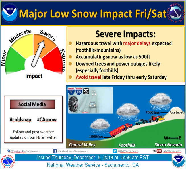
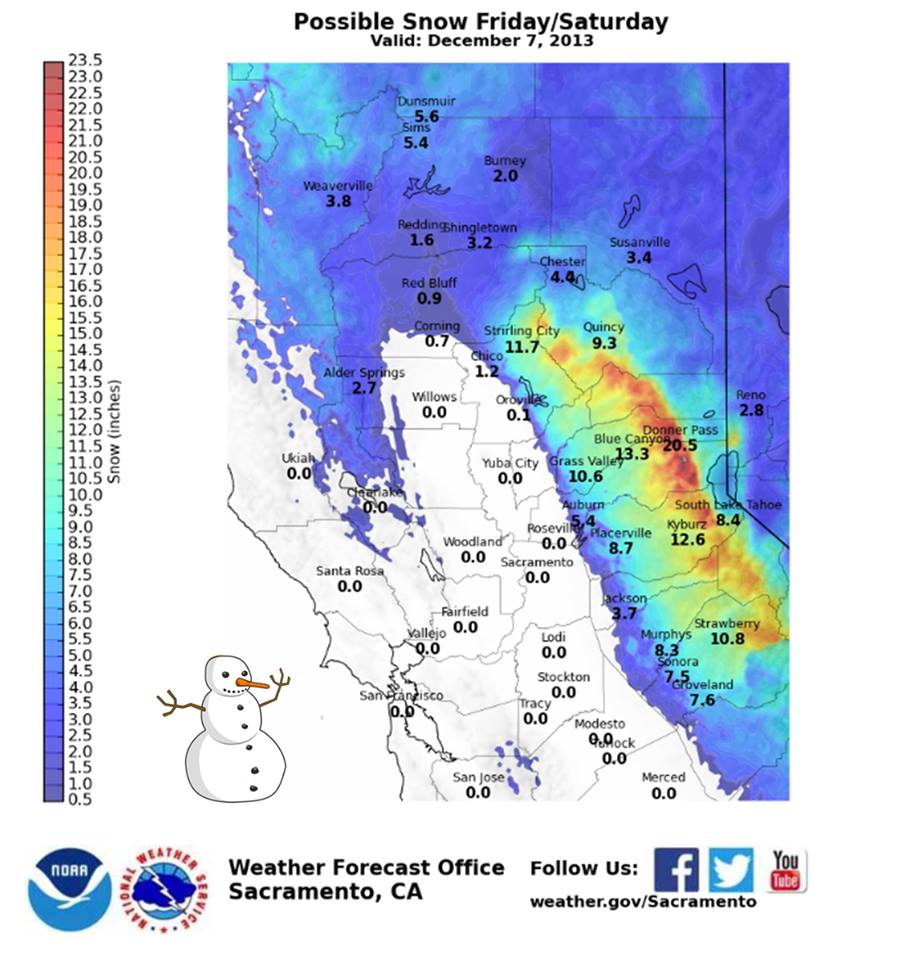
A very cold winter storm will roll into Lake Tahoe tomorrow and tomorrow night. 20:1 snow/water ratios are expected with this storm which will inflate snow totals into the double digit range. NOAA has issued a Winter Storm Watch and is calling for a foot or more of snow down to lake level on the west shore. The high mountains will likely see 18-20″ out of this storm.
“That gives us 7-12 inches in the basin and 12-18 inches along the crest.” – Opensnow.com today at 9am

This storm is just what we need right now. A bit higher density snow would be more ideal for base building, but we aren’t complaining.
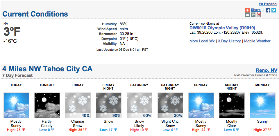
Temperatures associated with this storm will be very cold with a low of 17F in the valleys on Friday night when the bulk of the snow is forecasted to fall.
URGENT - WINTER WEATHER MESSAGE
NATIONAL WEATHER SERVICE RENO NV
237 AM PST THU DEC 5 2013

...VERY COLD WINTER STORM FRIDAY NIGHT...

.LOW PRESSURE WILL DROP SOUTH THE GULF OF ALASKA AND WILL REACH
THE EASTERN SIERRA AND WESTERN NEVADA FRIDAY NIGHT. THIS LOW WILL
BRING VERY COLD AIR...GUSTY WINDS...AND A PERIOD OF MODERATE TO
HEAVY SNOW.

THE COMBINATION OF GUSTY WINDS...AND A POWDERY SNOW MAY LEAD TO
CONSIDERABLE BLOWING AND DRIFTING SNOW WITH WHITEOUT CONDITIONS
OVER MOUNTAIN PASSES.

...WINTER STORM WATCH IN EFFECT FROM FRIDAY AFTERNOON THROUGH
SATURDAY MORNING...

* TIMING: SNOW WILL REACH THE TAHOE BASIN FRIDAY AFTERNOON WITH A
  PERIOD OF HEAVY SNOW LIKELY FRIDAY NIGHT AND EARLY SATURDAY MORNING.

* SNOW ACCUMULATIONS: A FOOT OR MORE ABOVE 7000 FEET AND DOWN TO
  LAKE LEVEL ALONG THE WESTERN SHORE. AT TRUCKEE...SOUTH LAKE AND
  THE EASTERN SHORE...6 TO 10 INCHES OF SNOW IS POSSIBLE.

* WINDS: GUSTS OF 30 MPH OR MORE IN THE LOWER ELEVATIONS AND GUSTS
  OF 60 TO 80 MPH OVER RIDGES MAY PRODUCE CONSIDERABLE BLOWING
  SNOW...LARGE DRIFTS AND WHITEOUT CONDITIONS.

* IMPACTS: HAZARDOUS DRIVING CONDITIONS DUE TO SNOW COVERED ROADS
  AND LOW VISIBILITY. TEMPERATURES BELOW 20 DEGREES AND GUSTY
  WINDS WILL LEAD TO BELOW ZERO WIND CHILL VALUES.
I’m ready! Though at 1300 ft, I just put the snow tires on
only 2 hours ago!