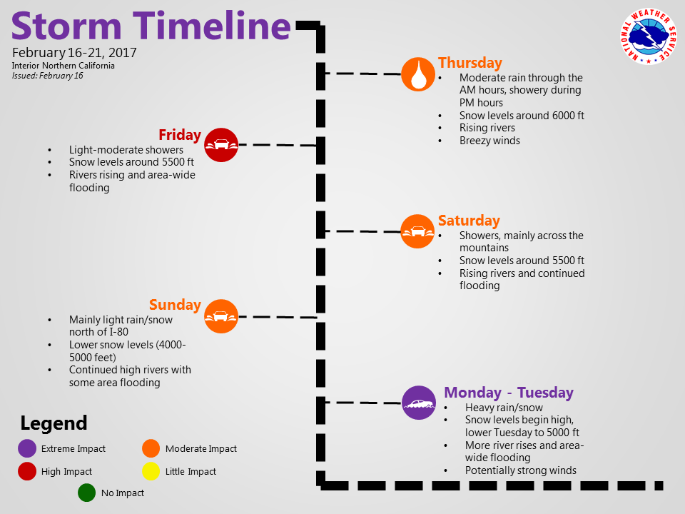
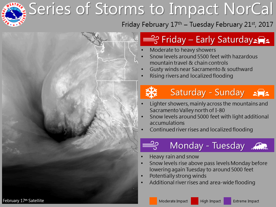
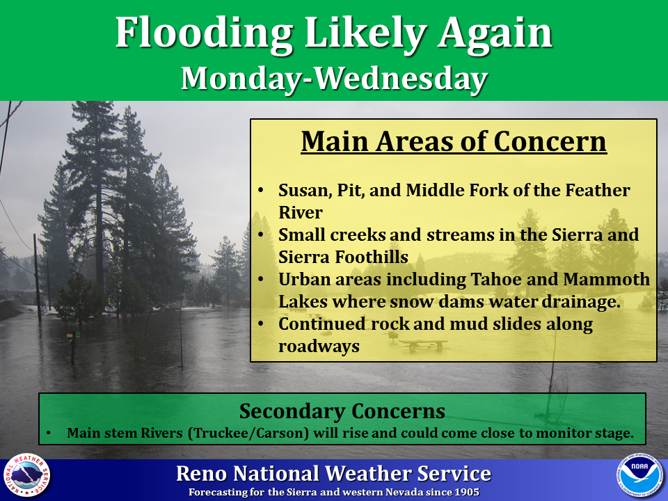
NOAA has issued Winter Storm Warnings & Winter Weather Advisories for much of the Eastern Sierra. Snow will be followed by the possibility of widespread flooding early next week.
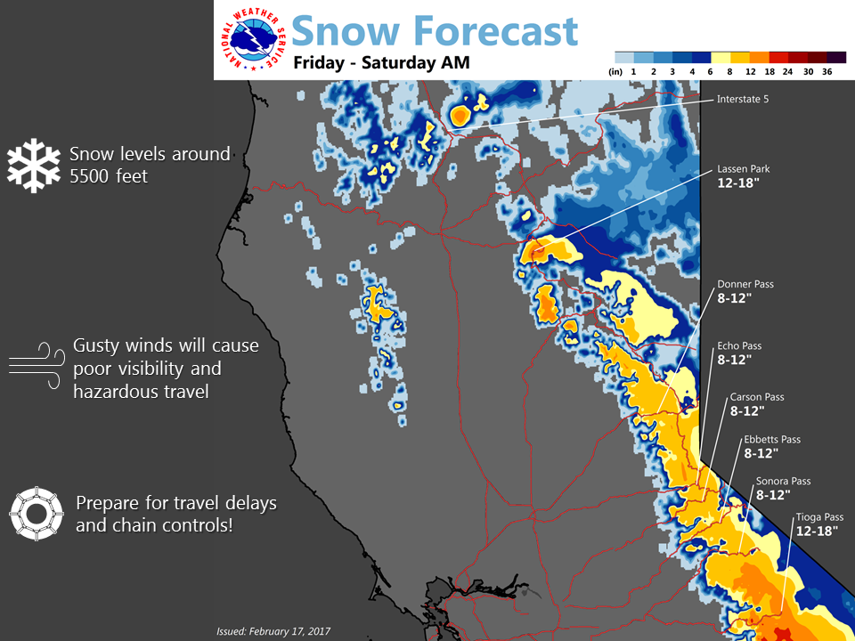
8-14+” of snow is in the forecast Friday-Saturday Morning with snow levels around 5500ft.

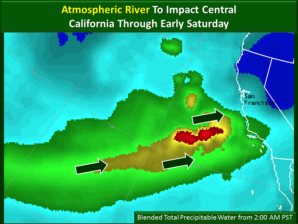
Huge precipitation totals are forecasted for California throughout the next 7 days. Warm weather will accompany this storm, making for higher snow levels.
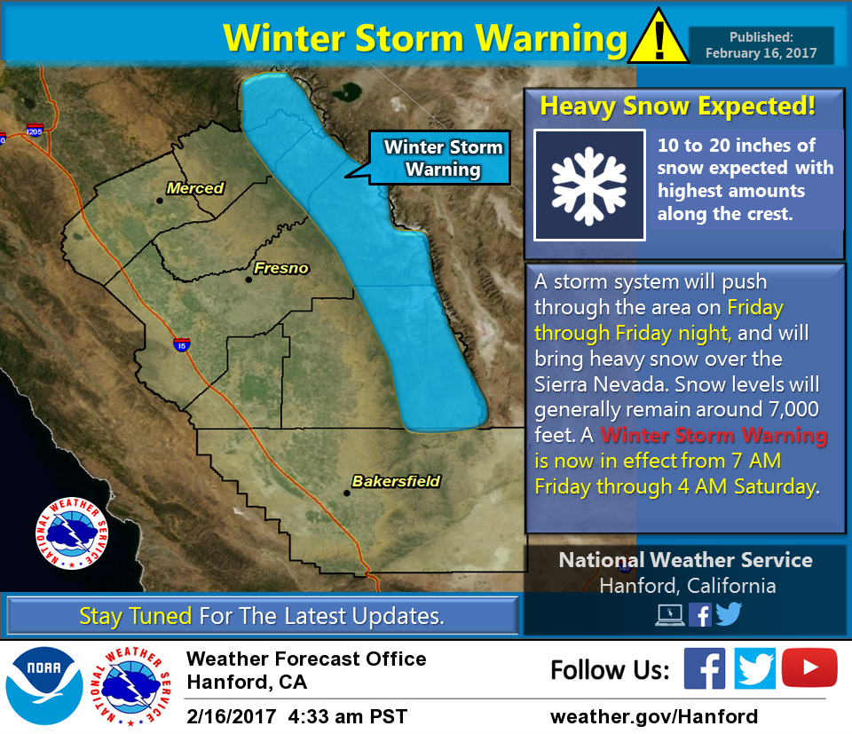
California: 8-14″ of Snow With Up To 18″ Through Saturday Morning
* Snow Accumulations: Below 7000 feet...4 to 8 inches with locally
  up to 1 foot west of Highway 89. Above 7000 feet...8 to 14
  inches with locally up to 18 inches.
- NOAA Reno, NV

Winter Weather Advisory For California:
URGENT - WINTER WEATHER MESSAGE
National Weather Service Reno NV
416 AM PST Fri Feb 17 2017

Greater Lake Tahoe Area-
Including the cities of South Lake Tahoe, Truckee, Stateline,
and Incline Village

...WINTER WEATHER ADVISORY REMAINS IN EFFECT FROM 7 AM THIS
MORNING TO 10 AM PST SATURDAY...

* Timing: Snow will begin this morning and continue through
  Saturday morning. Heaviest snow is expected this afternoon and
  evening.

* Snow Accumulations: Below 7000 feet...4 to 8 inches with locally
  up to 1 foot west of Highway 89. Above 7000 feet...8 to 14
  inches with locally up to 18 inches.

* Snow Levels: Near 5000 feet this morning, then rising to near
  6000 feet tonight.

* Impacts: Expect slick and snow covered roads today and tonight
  with travel delays and chain controls likely on most highways
  around the Tahoe basin.