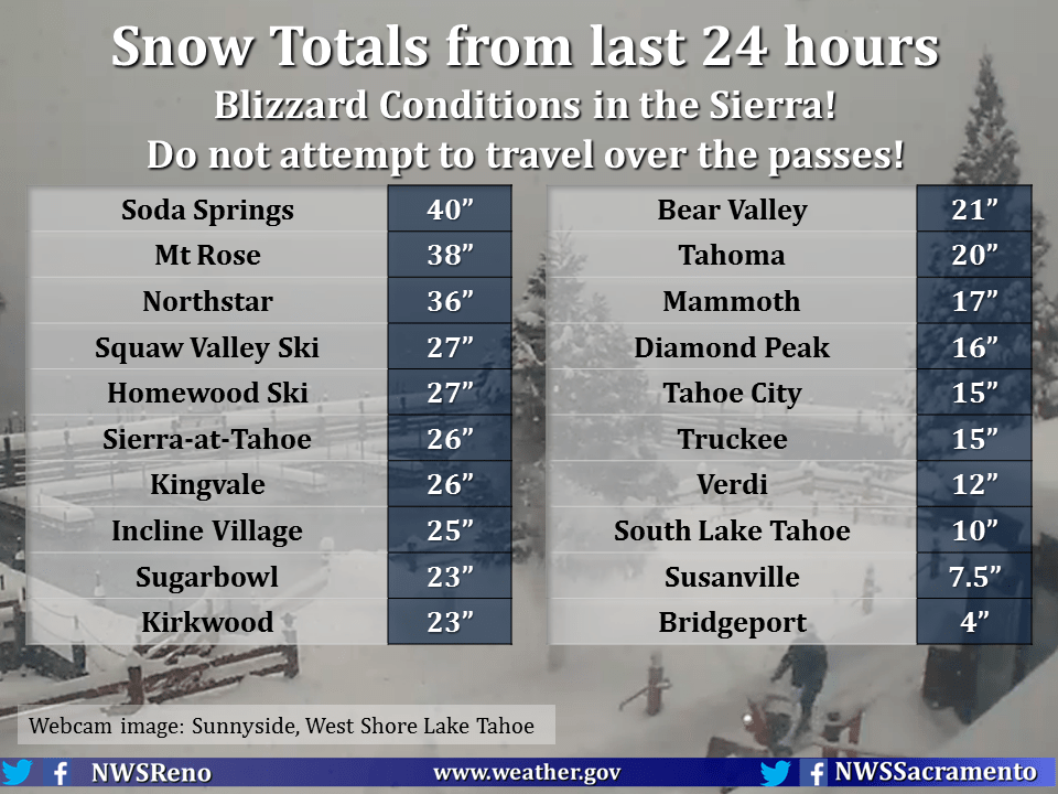
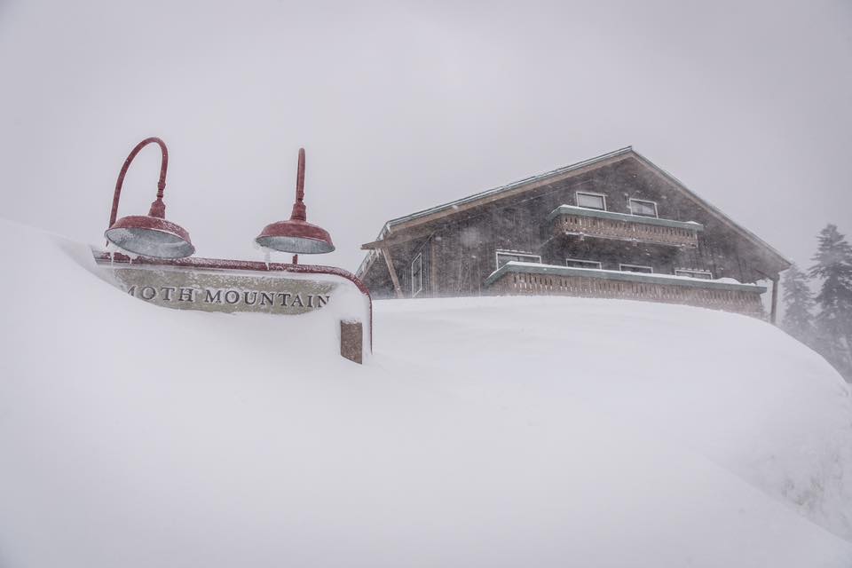
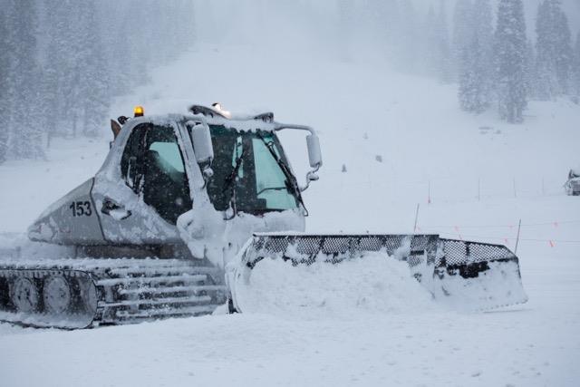
Huge snowfall totals are being reported already and there’s A LOT more on the way. Heavenly Mountain Resort received 48″ of snow overnight and it’s still coming down.
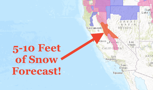
The National Weather Service has issued a Blizzard Warning for the Northern Sierras, along with the Winter Storm Warning. An additional 3-7 FEET is expected to fall at Lake Level and 5-10 FEET at elevations above 7,000 ft by Thursday Morning.
Lake Level Snowfall: 3-7 FEET by Thursday Morning
* TOTAL SNOW ACCUMULATIONS: 3 TO 7 FEET AT LAKE TAHOE LEVEL.
- NOAA Reno, NV Today
Snowfall Above 7,000 ft: 5-10 FEET by Thursday Morning
* TOTAL SNOW ACCUMULATIONS: 5 TO 10 FEET ABOVE 7000 FEET
- NOAA Reno, NV Today
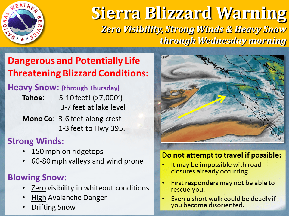
Heavy snowfall, avalanche danger, up to 150 mph winds, and drifting snow is going to make for a hectic time in California.

These conditions are mixing to produce dangerous conditions, so be safe when traveling. Once these conditions improve, get out there and enjoy all of this fresh snow!
Blizzard Warning For Lake Tahoe Area:
...BLIZZARD WARNING REMAINS IN EFFECT UNTIL 10 AM PST WEDNESDAY...

...WINTER STORM WARNING REMAINS IN EFFECT FROM 10 AM WEDNESDAY TO4 AM PST THURSDAY...

* TIMING: DANGEROUS BLIZZARD CONDITIONS UNTIL WEDNESDAY MORNING.HEAVY SNOW WILL
PERSIST WITH LIGHTER WINDS WEDNESDAY ANDWEDNESDAY NIGHT.

* TOTAL SNOW ACCUMULATIONS: 5 TO 10 FEET ABOVE 7000 FEET WITH 3TO 7 FEET AT LAKE
TAHOE LEVEL.

* WINDS: SOUTHWEST 20 TO 30 MPH WITH GUSTS TO 60 MPH. SIERRARIDGE GUSTS OVER 100 MPH

* SNOW LEVELS: MAY BRIEFLY RISE ABOVE 6000 FEET THIS AFTERNOON.

* IMPACTS: DANGEROUS LIFE THREATENING BLIZZARD CONDITIONS FORTRAVEL AND OUTDOOR
ACTIVITIES. STAY HOME AND DO NOT ATTEMPT TOTRAVEL UNTIL THE STORM PASSES. AVALANCHE DANGER IS HIGH.