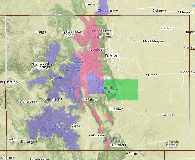
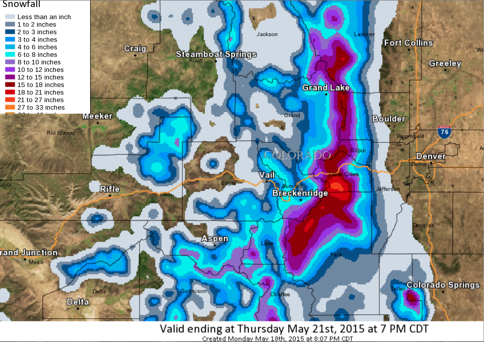
Colorado is still on track to receive 10-20 inches of snow today and they’ve expanded their Winter Storm Warnings and Winter Storm Watches to include more areas and mountains.
Arapahoe Basin, CO got 6″ of snow overnight, 15″ in the past 3 days, and it’s still snowing.
Colorado has been getting it in May and it’s not over yet.
Get out there and have fun, but don’t forget about avalanches. All this new snow, with higher springtime temps is going to certainly cause some unstable conditions in Colorado this week. Be smart, be careful.
WINTER STORM WARNING:
* TIMING…SNOW WILL INCREASE TONIGHT AND CONTINUE INTO TUESDAYBEFORE DECREASING TUESDAY AFTERNOON. THE HEAVIEST SNOW WILLFALL LATE TONIGHT THROUGH TUESDAY MORNING.
* SNOW ACCUMULATIONS…10 TO 20 INCHES…WITH MOST OF THE HEAVYSNOW ABOVE 10 THOUSAND FEET AND ON HIGHEST EAST SLOPES.
* WIND/VISIBILITY…SOUTHEAST WINDS AT 15 TO 30 MPH OVER HIGHERELEVATIONS. VISIBILITIES BELOW A QUARTER MILE AT TIMES IN THEHEAVIER SNOW SHOWERS.
* IMPACTS…ROADS ABOVE 9000 FEET ARE LIKELY SLUSHY OR SNOWPACKEDWITH ROADS ABOVE 10000 FEET SNOWPACKED WITH LOW VISIBILITY DUETO BLOWING SNOW. LOW VISIBILITIES MAY ALSO MAKE TRAVELDIFFICULT IN THE HEAVIER SHOWERS.
One thought on “Colorado Storm Expands | 10-20″ of Snow Forecast”