Jackson Hole and Grand Targhee have been under Winter Storm Warnings throughout the winter and we like it.
Once again, a HUGE winter storm is expected to pound the two resorts. Up to 4 FEET of snow is forecasted through Wednesday Night.


Jackson Hole: 2+’ Through Wednesday Night
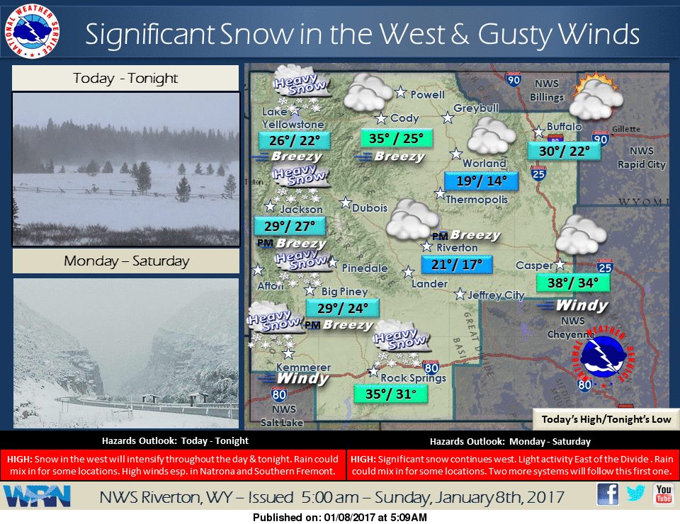
* SNOW TOTALS...1 TO 2 FEET ACROSS THE JACKSON VALLEY WITH THE
  HEAVIER AMOUNTS TOWARDS MOOSE AND MORAN BY LATE WEDNESDAY
  NIGHT.
- NOAA Riverton, WY Today

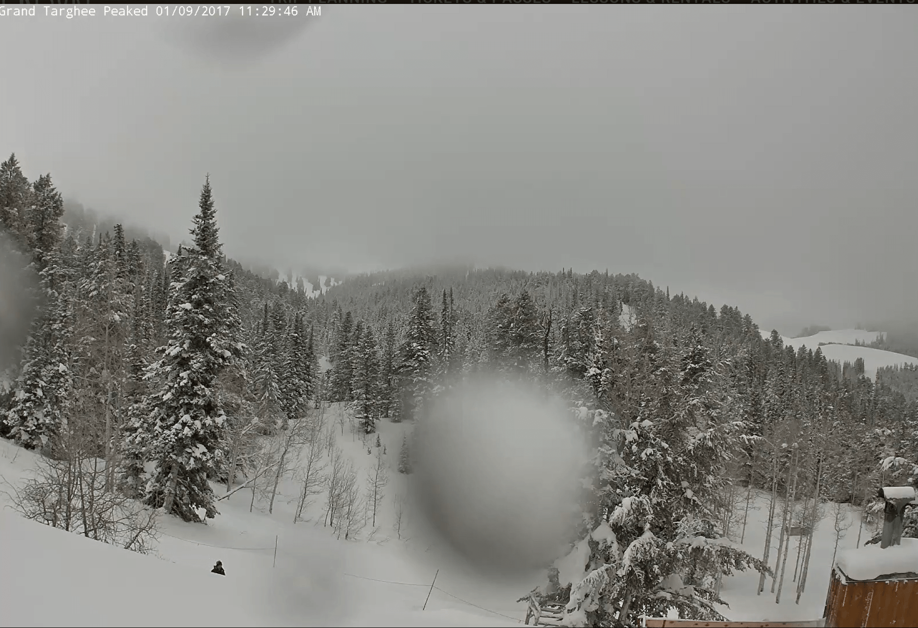
Grand Targhee: Up To 4′ Through Wednesday Night
* SNOW TOTALS...2 TO 4 FEET BY LATE WEDNESDAY NIGHT.
- NOAA Riverton, WY Today
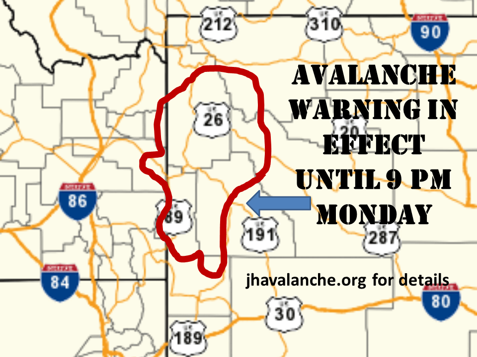
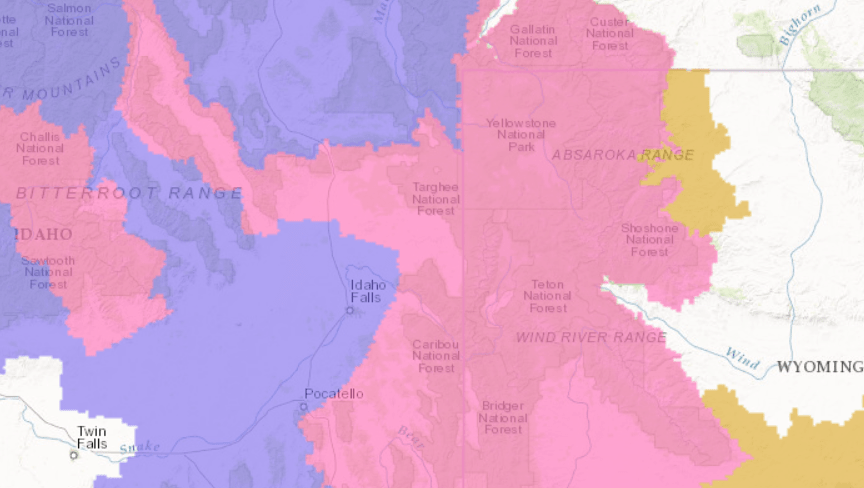
All of this recent snowfall has left the mountains of Eastern Idaho and Western Wyoming prone to avalanches.
Jackson Hole Conditions:
- 24 Hour Snowfall: 10″
- 48 Hour Snowfall: 14″
- Season Snowfall: 282″
Grand Targhee Conditions:
- 24 Hour Snowfall: 7″
- Snowfall Since Lifts Closed: 5″
- Season Snowfall: 249″

Grand Targhee Winter Storm Warning:
URGENT - WINTER WEATHER MESSAGE
NATIONAL WEATHER SERVICE RIVERTON WY
638 AM MST MON JAN 9 2017

...MAJOR LONG DURATION WINTER STORM TO IMPACT THE WEST THROUGH
WEDNESDAY NIGHT...

...WINTER STORM WARNING REMAINS IN EFFECT UNTIL 5 AM MST
THURSDAY...

* TIMING...PERIODS OF MODERATE TO HEAVY SNOW EXPECTED THROUGH
  MUCH OF TODAY. ANOTHER ROUND OF HEAVY SNOW IS EXPECTED
  POSSIBLE TUESDAY MORNING AND AGAIN LATE TUESDAY NIGHT THROUGH
  WEDNESDAY WITH LIGHTER SNOW BETWEEN THESE TIMES.

* SNOWFALL SO FAR...10 TO 20 INCHES WITH 9 TO 18 INCHES
  OVERNIGHT.

* SNOW TOTALS...2 TO 4 FEET BY LATE WEDNESDAY NIGHT.

* WIND AND VISIBILITY...WEST TO SOUTHWEST WIND 25 TO 35 MPH WITH
  GUSTS OVER 50 MPH AT PASS AND PEAK LEVEL. VISIBILITY WILL BE
  REDUCED TO UNDER ONE QUARTER MILE AT TIMES ALONG WITH BLOWING
  AND DRIFTING SNOW.

* MAIN IMPACT...ROADS WILL BE SLICK AND SNOW PACKED AND
  VISIBILITIES WILL BE UNDER ONE QUARTER MILE AT TIMES IN HEAVY
  SNOW. AVALANCHE DANGER WILL ALSO BE INCREASING DURING THIS
  EVENT FOR BACKCOUNTRY TRAVELLERS AND EVEN THOSE OVER TETON
  PASS.