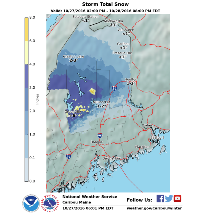
NOAA has issued a Winter Weather Advisory for Maine for today and tomorrow that is calling for 3-9″ of snow.
* SNOW ACCUMULATIONS...3 TO 6 INCHES...WITH LOCALLY 6 TO 9 INCHES
  POSSIBLE FOR TERRAIN ABOVE 2500 FT.
  - NOAA Caribou, ME today
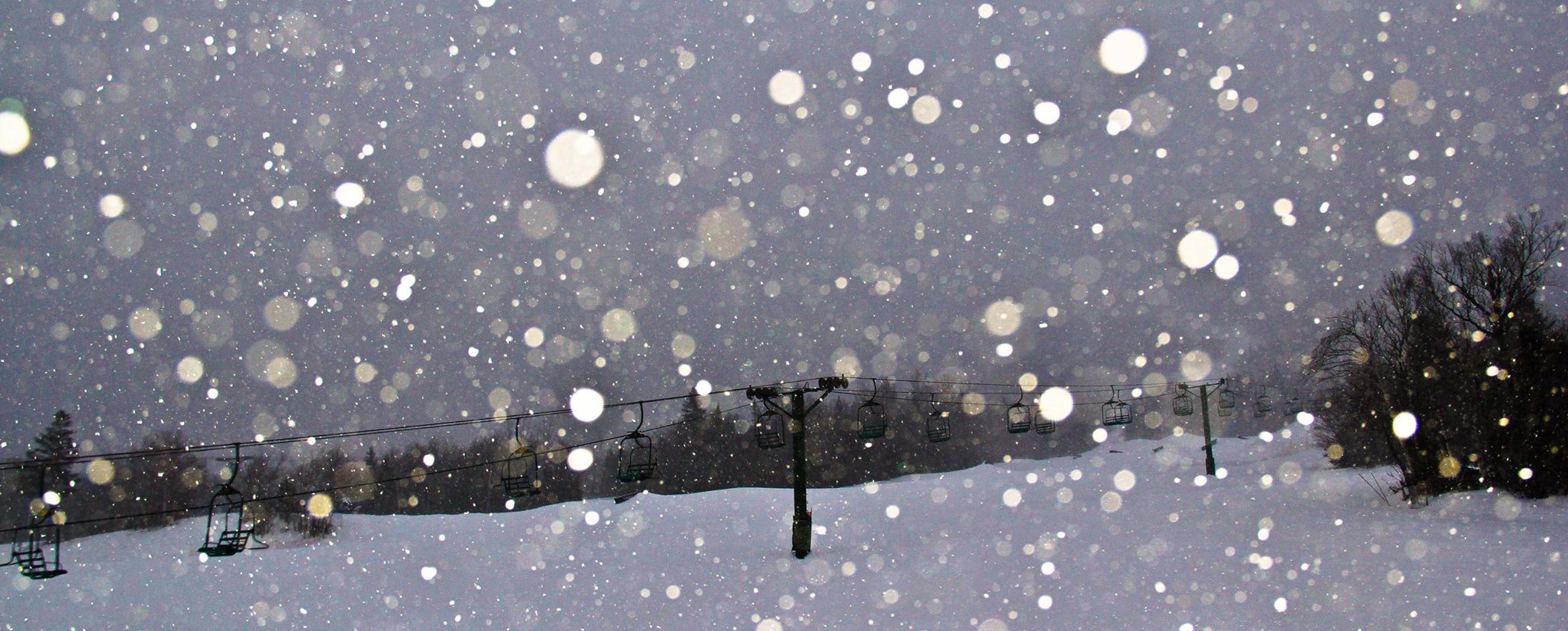
This should help get some Maine ski resorts open this November.
“…Early Season Snow…
Intensifying low pressure will track across the Gulf of Maine later tonight through Friday. The low will bring accumulating snow to northern Maine overnight into Friday morning. The snow will then mix with…or change to…rain Friday afternoon. A Winter Weather Advisory is in effect. This will be a heavy wet snow which will cling to trees and power lines. Lesser snow accumulations are expected across the remainder of northern Maine.” – NOAA Caribou, ME today
WINTER WEATHER ADVISORY for MAINE:
URGENT - WINTER WEATHER MESSAGE
NATIONAL WEATHER SERVICE CARIBOU ME
348 PM EDT THU OCT 27 2016

...FIRST SIGNIFICANT SNOWFALL MAINLY OVER THE HIGHLANDS OF
NORTHWEST AND CENTRAL MAINE LATE TONIGHT INTO FRIDAY AFTERNOON...

NORTHERN SOMERSET-NORTHERN PISCATAQUIS-CENTRAL PISCATAQUIS-
INCLUDING THE CITIES OF...BAKER LAKE...BILLY-JACK DEPOT...
BAXTER ST PARK...CHAMBERLAIN LAKE...CHURCHILL DAM...
MOUNT KATAHDIN...GREENVILLE...MONSON...BLANCHARD

...WINTER WEATHER ADVISORY IN EFFECT FROM 4 AM TO 4 PM EDT
FRIDAY...

THE NATIONAL WEATHER SERVICE IN CARIBOU HAS ISSUED A WINTER
WEATHER ADVISORY FOR SNOW...WHICH IS IN EFFECT FROM 4 AM TO 4 PM
EDT FRIDAY.

* LOCATIONS...NORTHWEST AND CENTRAL MAINE HIGHLANDS.

* HAZARD TYPES...SNOW

* SNOW ACCUMULATIONS...3 TO 6 INCHES...WITH LOCALLY 6 TO 9 INCHES
  POSSIBLE FOR TERRAIN ABOVE 2500 FT.

* TIMING...VERY LATE TONIGHT INTO FRIDAY MORNING.

* IMPACTS...MODERATE. SNOW WILL RESULT IN DIFFICULT DRIVING
  CONDITIONS. HEAVY WET SNOW MAY CAUSE TREE BRANCHES TO SNAP WITH
  ISOLATED TO SCATTERED POWER OUTAGES POSSIBLE.

* WINDS...EAST 10 TO 15 MPH WITH GUSTS UP TO 25 MPH.

* TEMPERATURES...IN THE LOWER 30S.