
NOAA just released their August updated for the current state of ENSO (El Nino/La Nina/Neutral).
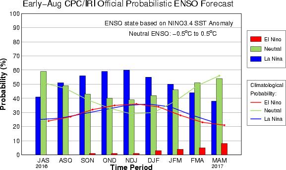
NOAA is saying that there is now a 55-65% chance that La Nina will develop during Fall/Winter 2016/17.
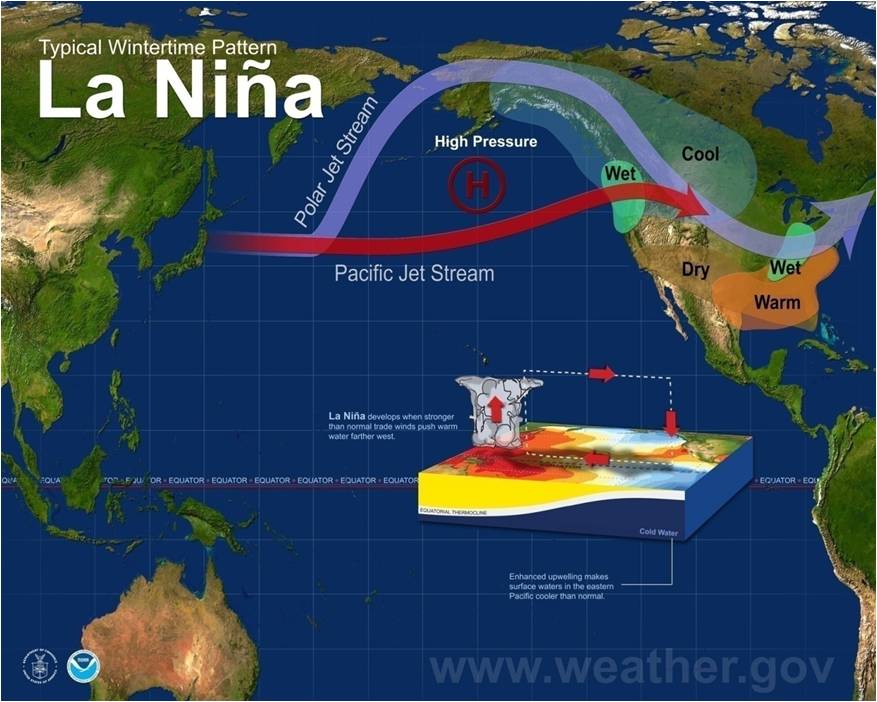
The map above shows what a typical La Nina winter looks like for North America.
NOAA has issued a La Nina Watch.
Below are 4 different 2016/17 winter outlooks from: NOAA, Accuweather, OnTheSnow, & The Old Farmer’s Almanac:
If you’re curious:
“What Is La Niña?”
EL NIÑO/SOUTHERN OSCILLATION (ENSO) DIAGNOSTIC DISCUSSION
issued by
CLIMATE PREDICTION CENTER/NCEP/NWS
and the International Research Institute for Climate and Society 11 August 2016
ENSO Alert System Status: La Niña Watch
Synopsis: La Niña is slightly favored to develop during August – October 2016, with about a 55-60% chance of La Niña during the fall and winter 2016-17.
ENSO-neutral conditions were observed during the past month, featuring slightly below average sea surface temperatures (SSTs) close to the equator across the eastern tropical Pacific Ocean (Fig. 1).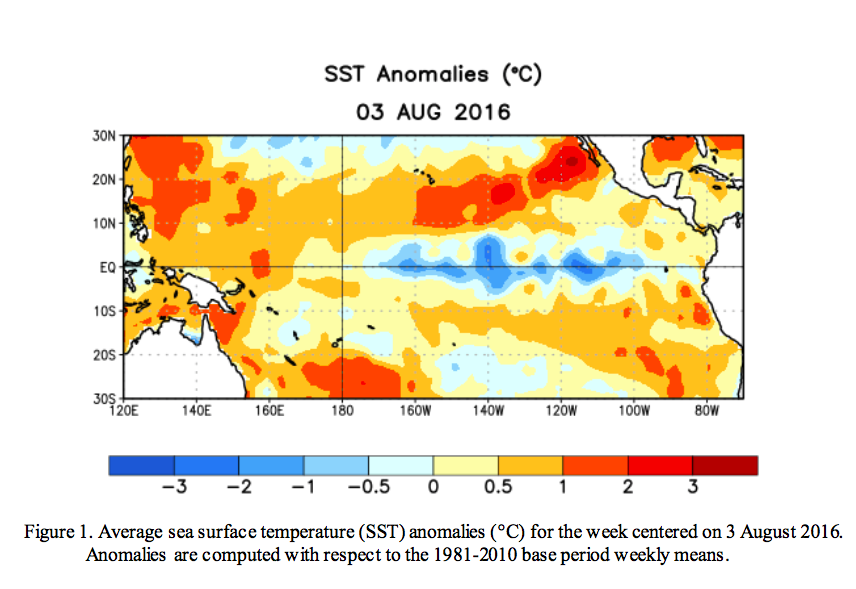
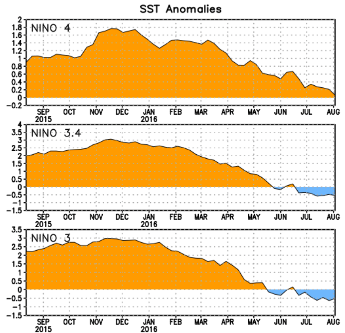
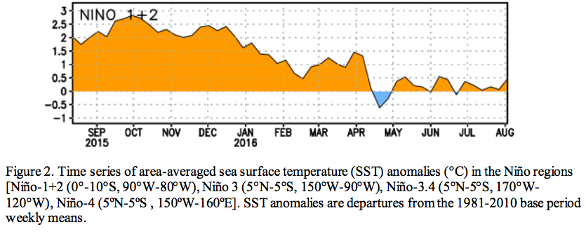
While the weekly Niño-1+2 and Niño-4 regions were near average, the Niño-3 and Niño-3.4 indices were slightly below average (approaching -0.5oC) during July (Fig. 2).
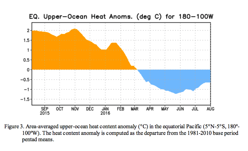
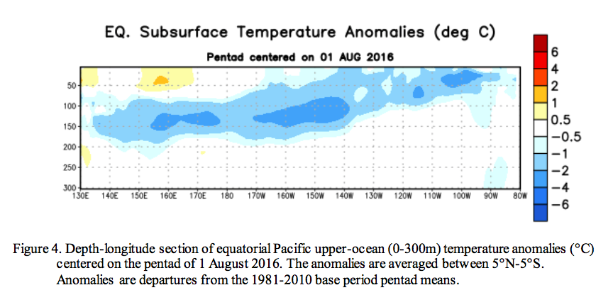
Although below-average subsurface temperatures continued, they weakened during the past month (Fig. 3) but remained near the surface in parts of the central and eastern equatorial Pacific (Fig. 4).
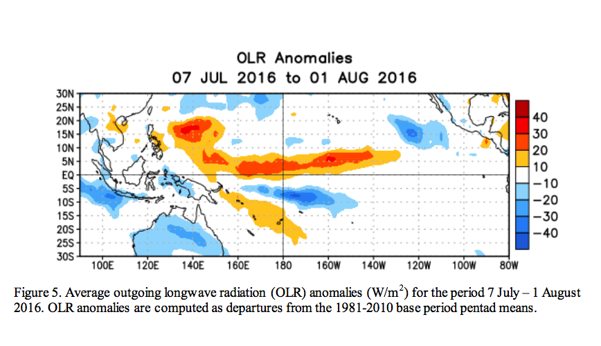
Atmospheric anomalies over the tropical Pacific Ocean also indicated ENSO-neutral conditions. Both the traditional Southern Oscillation index and the equatorial Southern Oscillation index were near average during July, while the upper and lower- level winds also were near average across most of the tropical Pacific. Convection was suppressed over portions of the western and central tropical Pacific and enhanced over part of Indonesia (Fig. 5). Overall, the combined ocean and atmosphere system is reflective of ENSO-neutral.
Many models favor La Niña (3-month average Niño-3.4 index less than or equal to -0.5°C) by the beginning of the Northern Hemisphere fall, continuing into winter (Fig. 6). Statistical models predict a slightly later onset time (i.e., mid- to late fall) than dynamical models, and also predict a slightly weaker event. The forecaster consensus favors La Niña onset during the August-October season, and predicts a weak event (Niño-3.4 index between -0.5°C and -1.0°C) if La Niña forms. Overall, La Niña is slightly favored to develop during August – October 2016, with about a 55-60% chance of La Niña during the fall and winter 2016-17 (click CPC/IRI consensus forecast for the chance of each outcome for each 3-month period).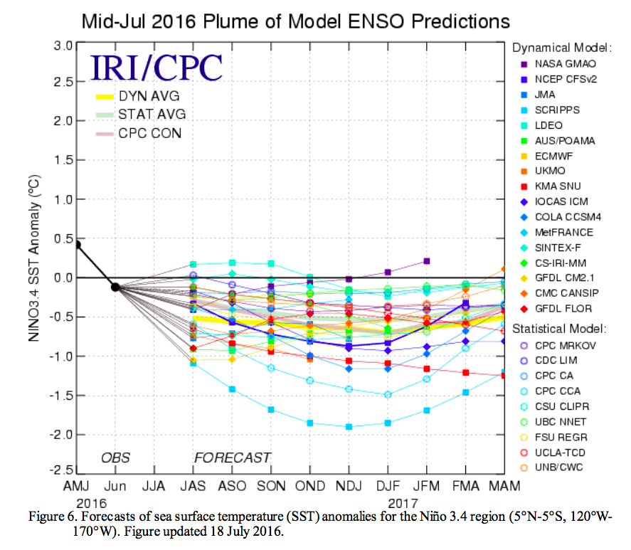
One thought on “Official NOAA La Niña Update: 55-60% Chance of La Nina This Winter”