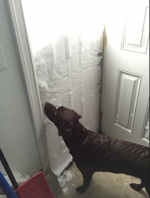
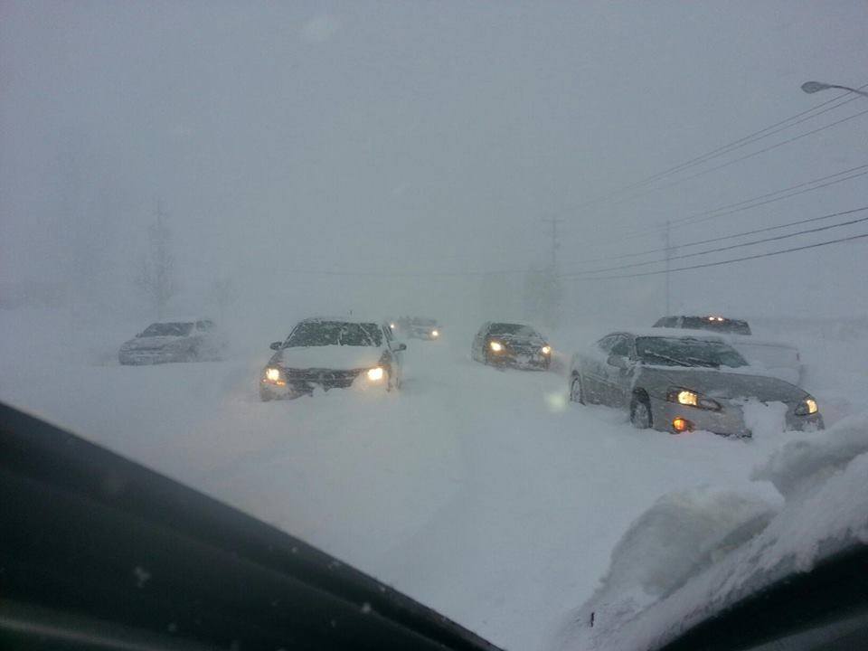
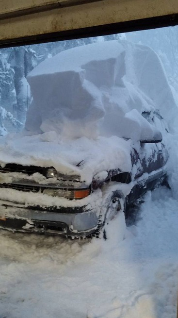
The Great Lakes Region is getting uber nuked on today via a large Lake-Effect snow event. 3 feet of snow has fallen in spots with 5 to 6 foot deep snow drifts. Some areas are forecasts to receive up to 60 inches of snow by Friday morning. Snowfall rates of 3-inches per hour have been observed…
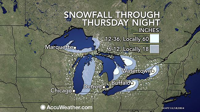
“The coldest air of the season so far will continue to trigger bands of very heavy snow downwind of the Great Lakes into the middle of the week and beyond. The snow will be blinding in some areas, falling at the rate of 3-5 inches per hour, and can be accompanied by gusty winds, thunder and lightning. Travel will be impossible for a time in the heaviest bands of snow.
The bands of snow will shift slowly southward during Tuesday night into early Wednesday, before shifting northward. Lake-effect snow will re-energize on Thursday after a weak storm system with general light snow swings through at midweek.” – accuweather.com
What is Lake-Effect Snow?
Lake-effect snow is produced during cooler atmospheric conditions when cold winds move across long expanses of warmer lake water, providing energy and picking up water vapor, which freezes and is deposited on the leeward shores. The same effect also occurs over bodies of salt water, when it is termed ocean-effect or bay-effect snow. The effect is enhanced when the moving air mass is uplifted by the orographic influence of higher elevations on the downwind shores. This uplifting can produce narrow but very intense bands of precipitation, which deposit at a rate of many inches of snow each hour, often resulting in copious snowfall totals. – wikipedia
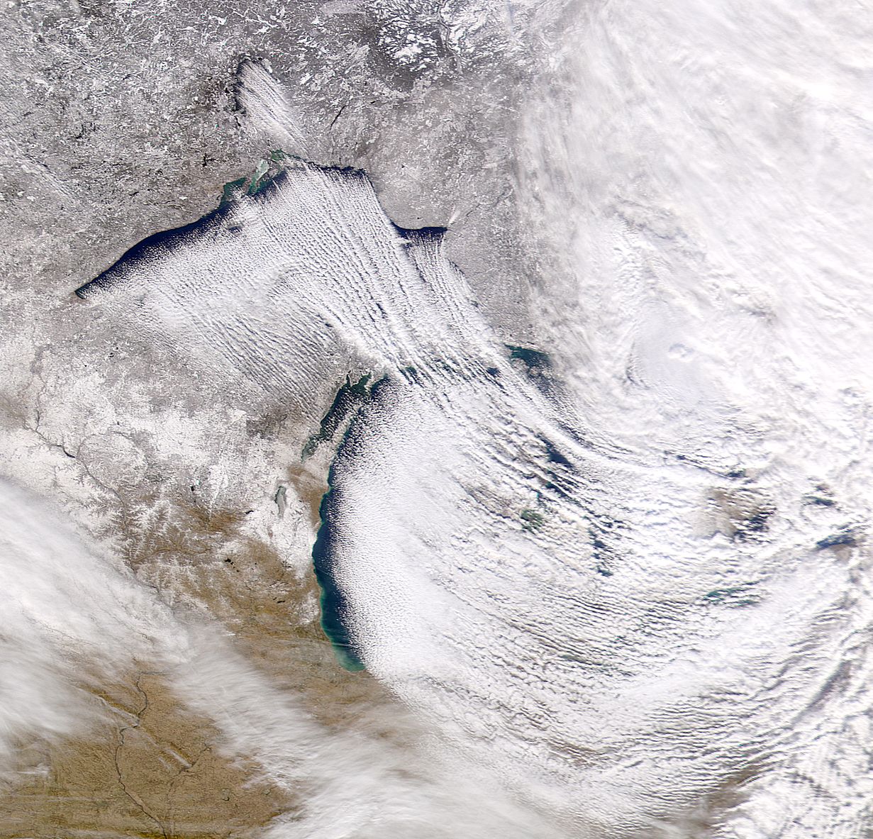
Image Credit: NASA/NOAA GOES Project, Dennis Chesters
PHOTO TOUR:

no
Us