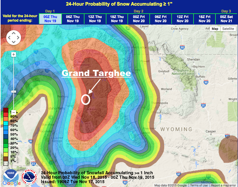
NOAA is forecasting 12-26″ of snow for Grand Targhee ski resort in Wyoming in the next 48 hours.
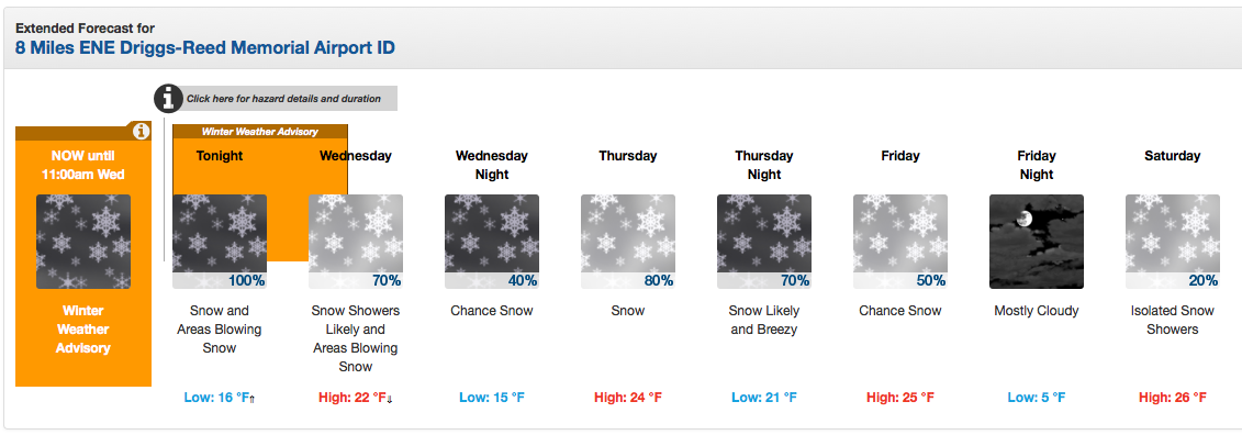
NOAA has issued a Winter Weather advisory that is calling for 5-10 inches of snow in the Targhee area in the next 18 hours.
Grand Targhee will be opening up for the season this Friday, November 20th. Good timing.
NOAA’s Winter Weather Advisory is calling for 5-10″ of new snow and their local forecast for Grand Targhee ski resort is calling for 12-16″ of snow by Thursday night.
* SNOWFALL...5 TO 10 INCHES. - NOAA Riverton, WY today
***
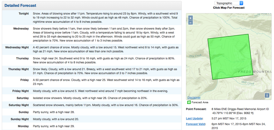
Snow levels will be to valley floors with this system with the warmest daytime temperature forecast to be 26ºF this week.
Grand Targhee will be the first ski resort to open in Wyoming this year when they open up on Friday.
***

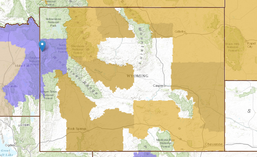
WINTER WEATHER ADVISORY for WYOMING:
URGENT - WINTER WEATHER MESSAGE
NATIONAL WEATHER SERVICE RIVERTON WY
146 PM MST TUE NOV 17 2015

...A QUICK ROUND OF SNOW AND WIND OUT WEST TONIGHT AND WEDNESDAY
MORNING AS A STRONG COLD FRONT APPROACHES...

.A QUICKLY APPROACHING WEATHER DISTURBANCE AND COLD FRONT WILL
COMBINE WITH A STRONG JET STREAM ALOFT TO PRODUCE SNOW AND WIND TO
THE FAR WEST TONIGHT INTO WEDNESDAY MORNING. THE SNOW WILL LESSEN
WEDNESDAY AFTERNOON AND EVENING AND THEN PICK BACK UP AGAIN
THURSDAY.

WYZ012-181115-
/O.NEW.KRIW.WW.Y.0023.151118T0000Z-151118T1800Z/
TETON AND GROS VENTRE MOUNTAINS-
146 PM MST TUE NOV 17 2015

...WINTER WEATHER ADVISORY IN EFFECT FROM 5 PM THIS AFTERNOON TO
11 AM MST WEDNESDAY...

THE NATIONAL WEATHER SERVICE IN RIVERTON HAS ISSUED A WINTER
WEATHER ADVISORY FOR SNOW AND WIND WHICH IS IN EFFECT FROM 5 PM
THIS AFTERNOON TO 11 AM MST WEDNESDAY.

* TIMING...SNOW AND WIND WILL INCREASE AND BECOME WIDESPREAD THIS
  EVENING AND THEN INCREASE THROUGH THE NIGHT ALONG WITH THE WIND.
  THE STORM WILL BEGIN TO WIND DOWN LATER WEDNESDAY MORNING BUT
  SOME LIGHT SNOW AND GUSTY WIND WILL CONTINUE.

* SNOWFALL...5 TO 10 INCHES.

* WIND AND VISIBILITY...SOUTHWEST WIND 15 TO 25 MPH GUSTS TO 35
  MPH THIS EVENING...THEN INCREASE AND SHIFTING TO THE WEST AT 30
  TO 40 MPH WITH GUSTS OF 50 TO 60 MPH OVER THE HIGHER ELEVATIONS
  AND EXPOSED LOCATIONS. VISIBILITY WILL BE REDUCED TO NEAR ZERO
  AT TIMES DURING PERIODS OF HEAVIER SNOW AND STRONG WIND.

* MAIN IMPACT...TRAVEL OVER TETON PASS AND ANY BACKCOUNTRY TRAVEL
  MAY BE SEVERELY IMPACTED BY THE COMBINATION OF SNOW AND STRONG
  WIND. PLEASE BE PREPARED FOR THIS QUICK HITTING STORM SYSTEM.