A Winter Weather Advisory forecasting 6-12″ of snow has been issued for all of Colorado’s mountains today. A small pocket of mountains around Wolf Creek ski area has a Winter Storm Warning issued with 8-12″ of snow forecast.
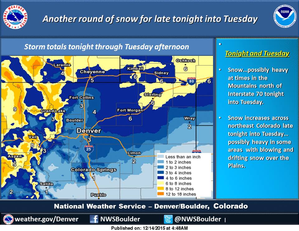
A COLD FRONT WILL MOVE ACROSS THE AREA TODAY BRINGING SNOWFALL TO
MUCH OF THE REGION. MANY WINTER STORM HIGHLIGHTS HAVE BEEN ISSUED
TO ACCOUNT FOR THIS STORM. SNOWFALL WILL SPREAD FROM WEST TO EAST
AS THE DAY PROGRESSES AND CONTINUE OVERNIGHT AND INTO TOMORROW.
- NOAA Denver, CO today
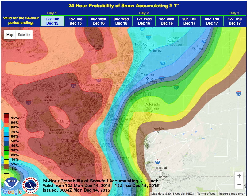
NOAA is forecasting 6-12″ of snow today and tomorrow for nearly every mountain in Colorado.
* SNOW ACCUMULATION...6 TO 12 INCHES WITH LOCALLY HIGHER AMOUNTS.
- NOAA Denver, CO today
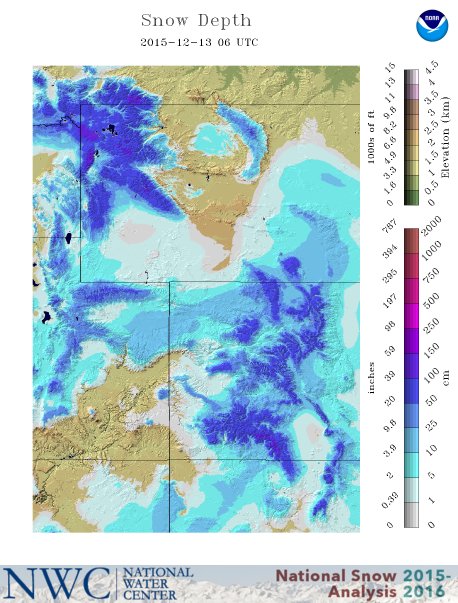
Colorado has been on fire this early season with big season snowfall totals already.
- Wolf Creek = 133″
- Loveland = 113″
- Keystone = 95″
- Winter Park = 91″
WINTER WEATHER ADVISORY:
URGENT - WINTER WEATHER MESSAGE
NATIONAL WEATHER SERVICE GRAND JUNCTION CO
821 AM MST MON DEC 14 2015

GRAND AND BATTLEMENT MESAS-
GORE AND ELK MOUNTAINS/CENTRAL MOUNTAIN VALLEYS-
WEST ELK AND SAWATCH MOUNTAINS-

...WINTER WEATHER ADVISORY REMAINS IN EFFECT FROM NOON TODAY TO
9 PM MST TUESDAY...

* LOCATIONS INCLUDE THE CITIES OF...SKYWAY...ASPEN...VAIL...
  SNOWMASS...CRESTED BUTTE...TAYLOR PARK...MARBLE.

* TIMING...SNOW WILL DEVELOP LATER THIS AFTERNOON BECOMING
  WIDESPREAD EARLY THIS EVENING. PERIODS OF SNOW WILL CONTINUE
  THROUGH TOMORROW EVENING.

* SNOW ACCUMULATION...6 TO 12 INCHES WITH LOCALLY HIGHER AMOUNTS.

* WINDS...SOUTHWEST 10 TO 15 MPH WITH GUSTS UP TO 25 MPH...
  SHIFTING WEST AND DECREASING THIS EVENING.

* IMPACTS...TRAVELLERS CAN EXPECT ICY AND SNOW PACKED ROADS
  ESPECIALLY OVER MOUNTAIN PASSES. GUSTY WINDS WILL CREATE AREAS
  OF BLOWING AND DRIFTING SNOW.