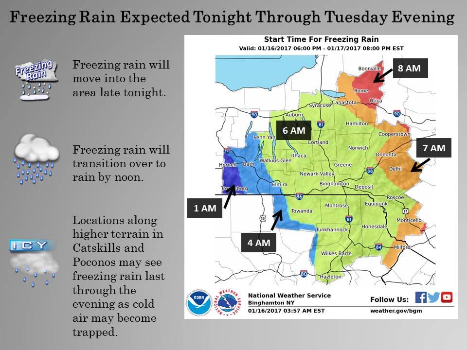
As the week begins, a storm is expected to hit much of the east coast Tuesday-Wednesday delivering snow to higher elevations, along with a mixed precipitation to the valleys.
Up to 8″ of snow is expected to fall, but the snow is expected to be relatively heavy.
Killington, VT is expected to receive 6″ of snow, which may be your best bet for some powder turns with the funky snow levels associated with this system.
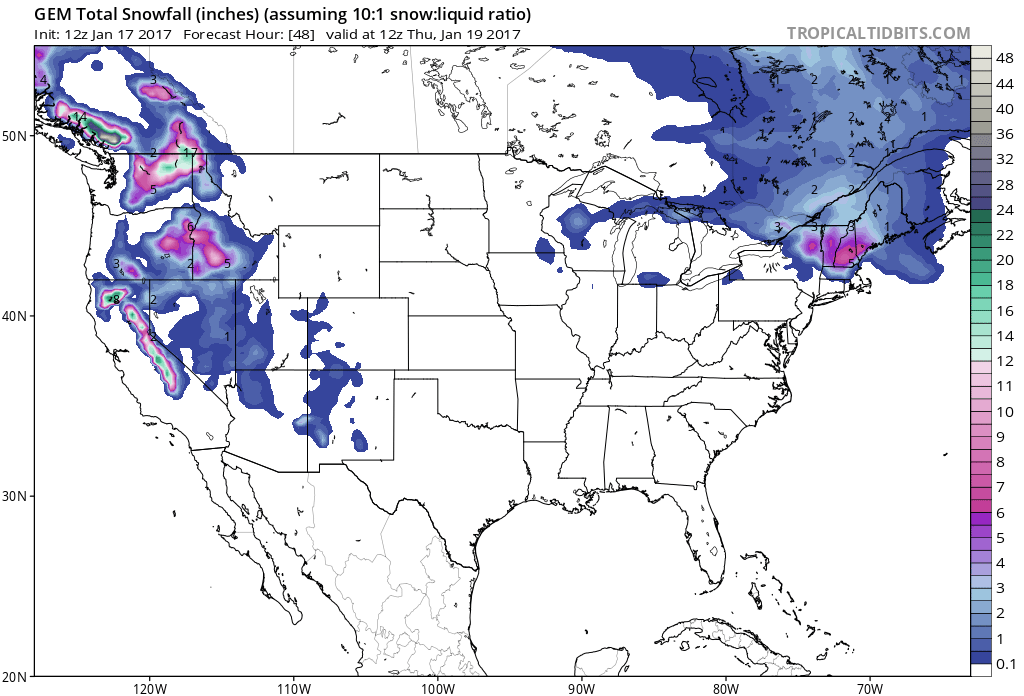
Heavy precipitation is headed to the southern half of the east coast within the next 7 days. The precipitation that arrives early this week is expected to fall in the form of snow at higher elevations, but snow levels are expected to vary throughout the storm.
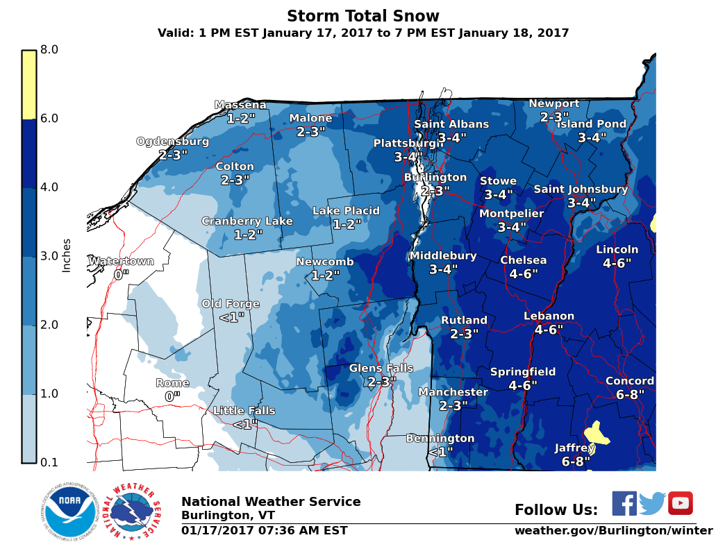
Killington, VT Forecast: 3-6″ through Wednesday
* ACCUMULATIONS... SNOW ACCUMULATION OF 3 TO 6 INCHES OF HEAVY WET
  SNOW... ALONG WITH AROUND A TRACE OF ICE.
- NOAA Burlington, VT Today
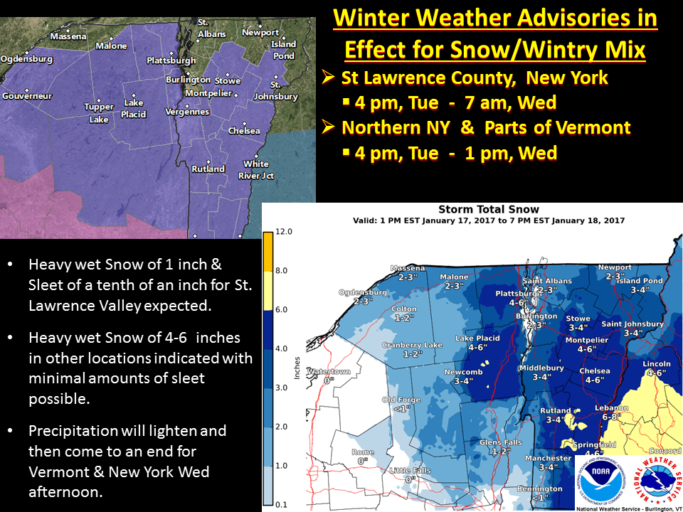
Upper New York Forecast: 3-6″ Through Wednesday
* ACCUMULATIONS...SNOW ACCUMULATION OF 3 TO 6 INCHES OF HEAVY WET SNOW...ALONG WITH AROUND A TRACE OF ICE.
- NOAA New York, NY Today
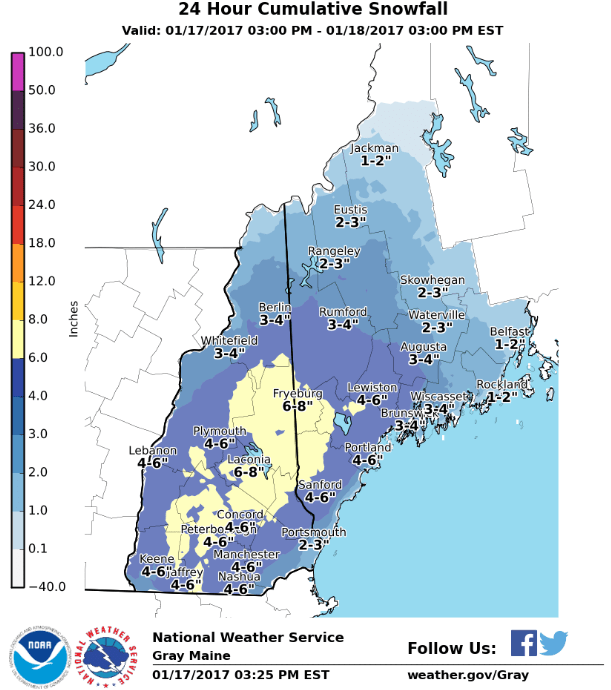
Eastern NH/Western ME Forecast: 4-8″ Through Wednesday
* ACCUMULATIONS...SNOW ACCUMULATION OF 4 TO 8 INCHES...ALONG WITH
  AROUND A TRACE OF ICE.
- NOAA Grey, ME Today


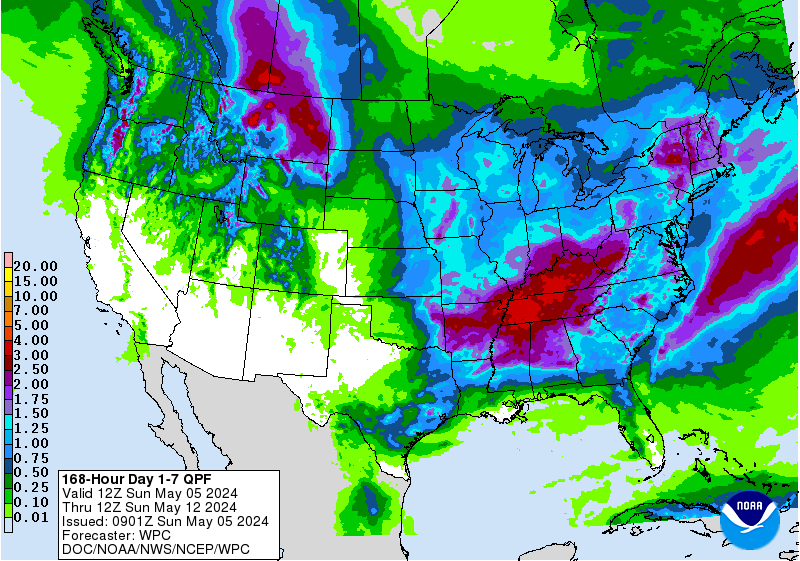
Above average temperature and precipitation is forecasted for the east coast in the next 6-10 days, which should make for some interesting storms coming through the area.

Winter Weather Advisory For Vermont:
URGENT - WINTER WEATHER MESSAGE
NATIONAL WEATHER SERVICE BURLINGTON VT
406 AM EST TUE JAN 17 2017

...WINTER WEATHER ADVISORY REMAINS IN EFFECT FROM 4 PM THIS
AFTERNOON TO 1 PM EST WEDNESDAY...

THE NATIONAL WEATHER SERVICE IN BURLINGTON CONTINUES THE WINTER
WEATHER ADVISORY FOR SNOW AND SLEET...FROM 4 PM THIS AFTERNOON TO
1 PM EST WEDNESDAY.

* LOCATIONS...THE NORTHERN ADIRONDACKS, EASTERN CLINTON AND
  ESSEX COUNTIES IN NEW YORK, MUCH OF CENTRAL, SOUTH-CENTRAL,
  AND EASTERN VERMONT.

* HAZARD TYPES...SNOW AND SLEET.

* ACCUMULATIONS...SNOW ACCUMULATION OF 3 TO 5 INCHES OF HEAVY
  DENSE SNOW...ALONG WITH AROUND A TRACE OF ICE.

* MAXIMUM SNOWFALL RATE...UP TO A HALF INCH PER HOUR...MAINLY
  THIS EVENING THROUGH MIDNIGHT.

* TIMING...SNOW IS EXPECTED TO DEVELOP LATE TUESDAY AFTERNOON
  AROUND SUNSET. SNOW WILL BE MODERATE AT TIMES THROUGH TUESDAY
  NIGHT BEFORE GRADUALLY TAPERING OFF WEDNESDAY MORNING.

* IMPACTS...SNOW WILL MAKE TRAVEL DIFFICULT TUESDAY NIGHT INTO
  WEDNESDAY MORNING, ESPECIALLY ON ANY UNTREATED ROAD SURFACES.

* WINDS...SOUTHEAST 10 TO 15 MPH WITH GUSTS UP TO 25 MPH.

* TEMPERATURES...HIGHS IN THE LOWER 30S. LOWS AROUND 30.

* VISIBILITIES...DOWN TO A HALF MILE AT TIMES TUESDAY NIGHT.