
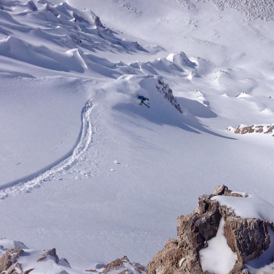
Las Lenas, Argentina is having the season that skiers and riders have dreamed about for years.
It’s been a bit windy and stormy this year (read: Marte closed, there are no trees here, white out, basically staying home and not skiing) but some long time locals are saying it’s the best season since 2011.

It’s been snowing for 3 days or so, then clearing up for a week or so. This is the perfect pattern for Lenas because you need those clear days to settle the avalanche danger and get deep into the incredible backcountry there.
In the next 3 days, Las Lenas is forecast to get 17″ of new snow. Then, it’s gonna clear up and be potentially perfect.
Lenas currently has 25″ of snowpack at the base, 35″ of snowpack at mid-mountain, and 47″ of snowpack on the summit.
September looks like it’ll be a month to remember in Las Lenas, Argentina.
Las Lenas snowfall history shows the peak in July with August snowfall averaging less than 3/4 of July and September snowfall averaging less than half of July. This may be hard for North American skiers to relate because:
1) December-March have similar monthly averages in Utah, and in Colorado March is actually the highest snow month in some places by a modest margin.
2) Even in California January and February have similar averages and March average is 85% of those months.
I believe the “Santa Rosa” legend came into being because late August/early September is the LATEST time that you might see a monster 6+ foot dump. September in the central Andes resorts can be viewed like April in the Sierra (similar snowfall averages vs. midwinter). You might see a huge dump early in the month, but it would be very unusual to see more than 2-3 feet out of one storm after middle of the month.
La Nina is likely bad news for the central Andes reports from Portillo in the north to Las Lenas in the south. There’s not a lot of data, only about 4 La Nina seasons, but none of them are above average and some are barely half normal snowfall.
Surf style. Are you sure thats not 18″.
The Santa Rosa has happened yet. Just wait for it.
Las Lenas is on a sustained run of below average to poor snow years, so this one looks pretty good by comparison. It’s still running only about 70% of normal, yet that’s the best since 2009.
What’s open and skiable is great but not what it can be. The base depth is barely 1 meter and it needs to be 2+ meters for full potential. Only a handful of the steep chutes on the south side of Marte filled in this season. Any time it’s warm the low elevation terrain north of Vulcano and the sidecountry runs to the valley floor start to melt out.
Overall my plan this year worked out. You go down there for 2 weeks, take your lumps with grueling travel, Marte closures and sketchy facilities but you’ll still get a few transcendant ski days that make it all worthwhile.
Tony,
If La Nina follows a strong El Nino, as often happens, what would you expect for Las Lenas next season?