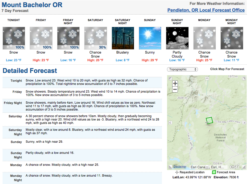
NOAA is forecasting 9-17″ of snow to drop on Mt. Bachelor, OR Thursday through Saturday this week.
As of February 22nd, 2015, Mt. Bachelor had the 4th deepest snowpack in the USA at 88″. This week’s storm should add to that.
Bachelor is the highest elevation ski resort in the Pacific Northwest and it shows. They have the deepest snowpack in the PNW this year by far.
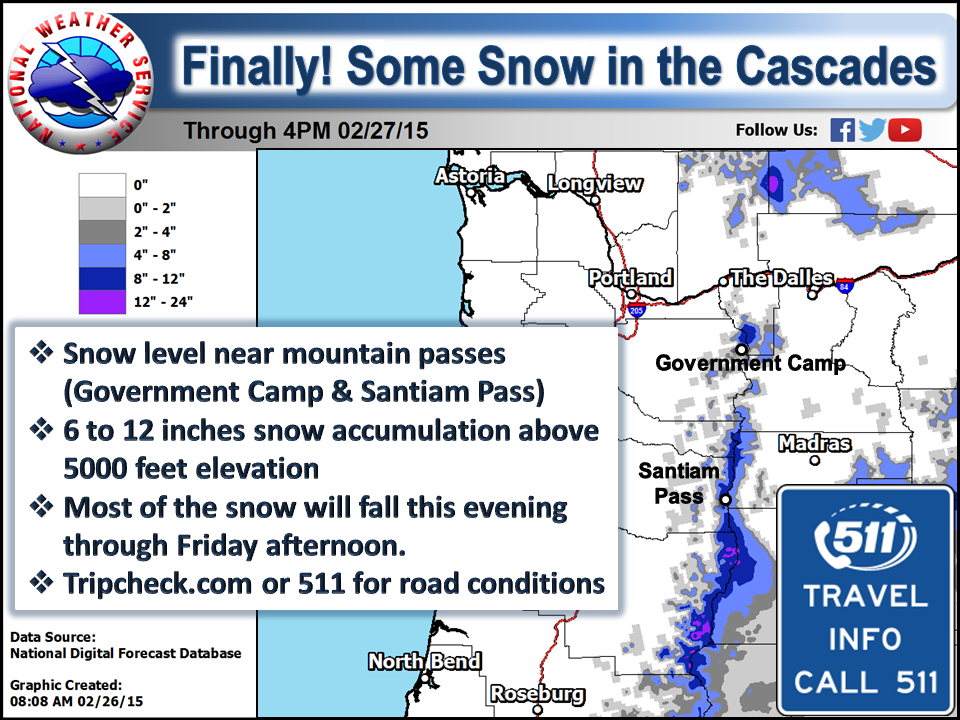
NOAA Winter Weather Advisory:
URGENT - WINTER WEATHER MESSAGE
NATIONAL WEATHER SERVICE PENDLETON OR
257 PM PST THU FEB 26 2015

...MODERATE TO HEAVY SNOW TONIGHT THROUGH FRIDAY NIGHT...

.A LOW PRESSURE SYSTEM WILL TRACK ACROSS THE REGION TONIGHT
THROUGH FRIDAY NIGHT BRINGING MODERATE TO HEAVY PRECIPITATION.
HEAVY SNOW WILL BE POSSIBLE IN THE HIGHER TERRAIN...ESPECIALLY
ACROSS CENTRAL OREGON.

...WINTER WEATHER ADVISORY IN EFFECT FROM 10 PM THIS EVENING TO
4 AM PST SATURDAY...

* SNOW ACCUMULATIONS: 5 TO 7 INCHES.

* ELEVATION: HEAVIEST SNOW ABOVE 4500 FEET TONIGHT...WITH SNOW
  LEVELS FALLING TO AROUND 4000 FEET ON FRIDAY MORNING. SNOW
  LEVELS WILL FALL BELOW 3000 FEET ON SATURDAY NIGHT.

* TIMING: LIGHT SNOW SHOWERS WILL BE POSSIBLE THIS EVENING.
  MODERATE TO HEAVY SNOW IS EXPECTED TONIGHT THROUGH FRIDAY NIGHT.

* LOCATIONS INCLUDE: LA PINE...SUNRIVER

* IMPACTS: SNOW PACKED ROADS WILL MAKE TRAVEL DIFFICULT. THIS
  INCLUDES ALONG HIGHWAYS 20 AND 97.