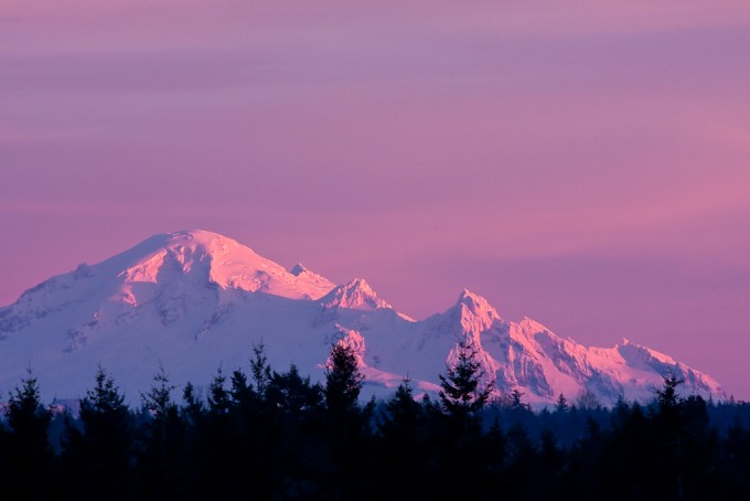
NOAA is currently forecasting up to 75″ of snow for 10,781-foot Mount Baker in Washington by Friday. Snow-forecast.com is forecasting up to 200″ of snow for Mount Baker in the next 5 days (see forecast graphic at bottom of article)…
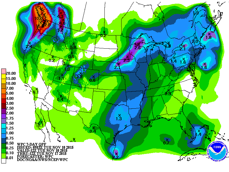
THE LAST THREE RUNS OF THE GFS [forecast model] HAVE BROUGHT HEAVY RAIN TO
THE OLYMPICS AND CASCADES WITH BULLSEYES OF AROUND 10 INCHES OVER
THE 54 HOUR PERIOD 18Z THURSDAY THROUGH 00Z SUNDAY.
- NOAA Seattle, WA today
If the Cascade mountains really see 10-inches of liquid precipitation as NOAA suggests in the quote above, that would translate to about 10 feet of snow in only 54 hours…
This big snow forecast is the result of 2 storms that will be hitting Washington hard the next 4 days with the second being a strong frontal system capable of dropping large amounts of precipitation in the Cascade Mountains.
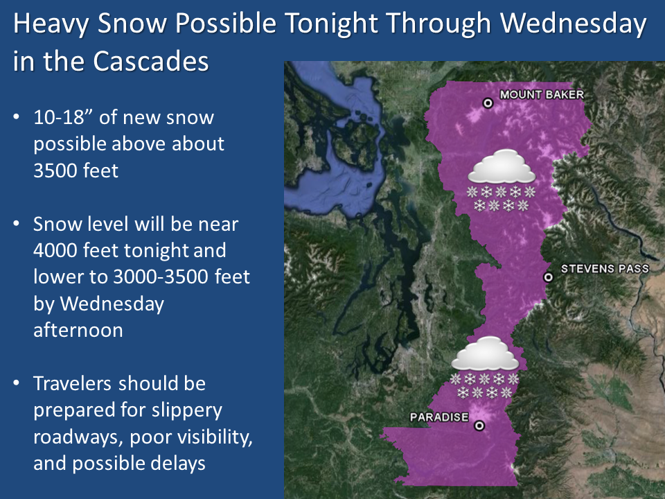
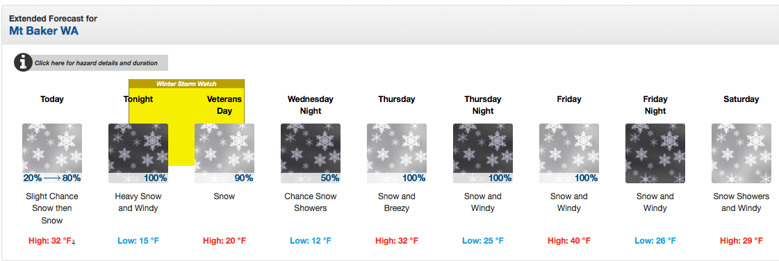
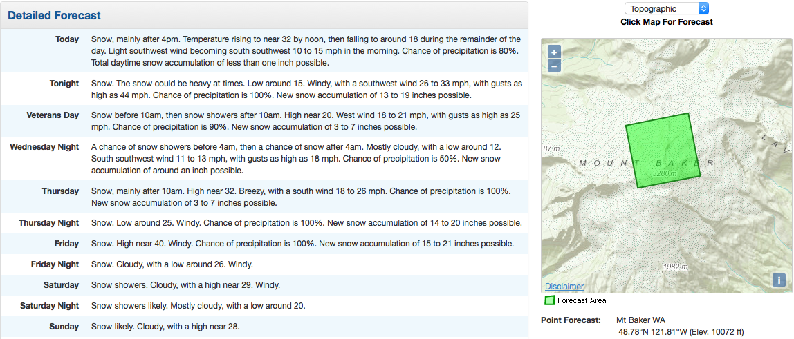
A Winter Storm Watch is in effect for Washington today and tomorrow that predicts 10-18″ of snowfall with snow levels as low as 3,500-feet.
* SNOW ACCUMULATIONS...NEW SNOW ACCUMULATIONS OF 10 TO 18 INCHES
  POSSIBLE ABOVE ABOUT 3500 FEET. - NOAA Seattle, WA today
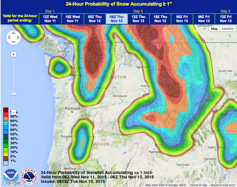
Mt. Baker ski resort (not actually on Mt. Baker – living within the elevations of 3,500′-5,000′) is under the Winter Storm Watch and is forecast to see 10-18″ of snow out of these two systems this week. We’re hoping this snow puts them one step closer to opening up. Baker doesn’t use snowmaking, they rely on Mother Nature to get the snow down she needs to open up.
Regardless of what happens, this is going to be a helluva storm and it’s going to be fun to watch it unveil this week.
WINTER STORM WATCH for WASHINGTON:
URGENT - WINTER WEATHER MESSAGE
NATIONAL WEATHER SERVICE SEATTLE WA
357 AM PST TUE NOV 10 2015

CASCADES OF WHATCOM AND SKAGIT COUNTIES-
CASCADES OF SNOHOMISH AND KING COUNTIES-
CASCADES OF PIERCE AND LEWIS COUNTIES-

...WINTER STORM WATCH REMAINS IN EFFECT FROM THIS EVENING THROUGH
WEDNESDAY AFTERNOON...

* SOME AFFECTED LOCATIONS...MOUNT BAKER...HURRICANE RIDGE...
  PARADISE...STEVENS PASS...WHITE PASS...RAINY PASS...CHINOOK PASS.

* TIMING...TONIGHT AND WEDNESDAY.

* SNOW LEVEL...NEAR 4000 FEET TONIGHT LOWERING TO 3000 TO 3500
  FEET BY WEDNESDAY AFTERNOON.

* SNOW ACCUMULATIONS...NEW SNOW ACCUMULATIONS OF 10 TO 18 INCHES
  POSSIBLE ABOVE ABOUT 3500 FEET.

* MAIN IMPACT...THIS WILL BE THE FIRST SIGNIFICANT SNOWFALL OF THE
  SEASON FOR THE LOWER PASSES. TRAVELERS SHOULD BE PREPARED FOR
  SLIPPERY ROADWAYS...POOR VISIBILITY...AND POSSIBLE TRAVEL DELAYS.
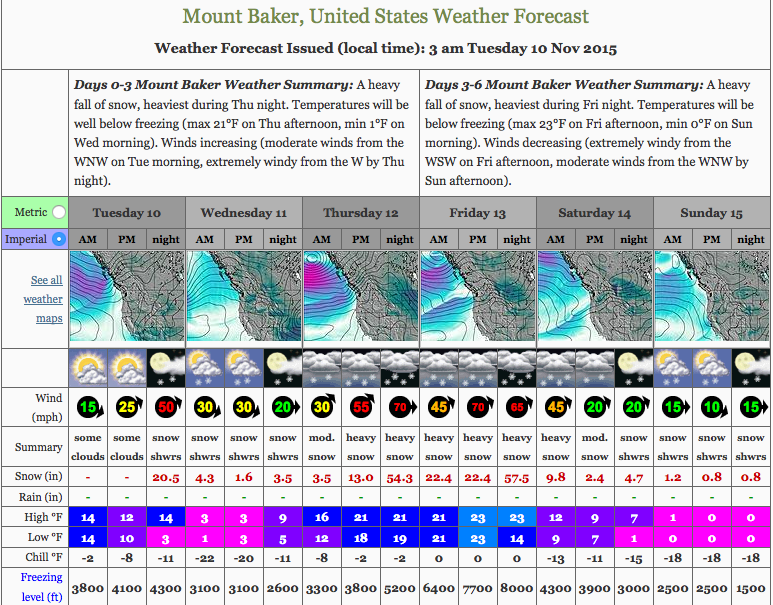
Some of these predictions are a bit optimistic and aren’t factoring in freezing levels. 75″ by Sunday would be great, but my guess is that we’ll get about 1/4 of that reflected in ski area snow base numbers.
Yesssssssss!!