Forecast By Eric McNamee 4/20/2020 1:10 PM MDT
Note: We are not encouraging skiing and riding at this time. These snow forecasts are created so that our friends in mountain communities know when challenging weather is headed their way.
Summary:
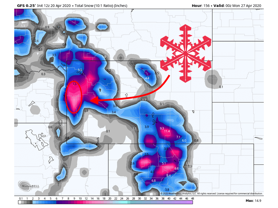
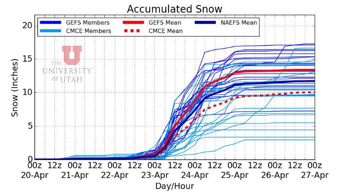
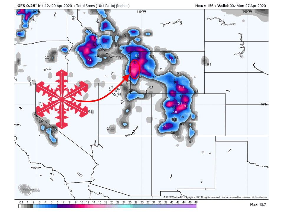
8-12″ of snow is expected to fall across the Tetons through Sunday.
A weak disturbance will slowly move across the intermountain west the next couple of days, bringing an inch at best to the area.
Relatively quiet during the middle of the week before two shortwave troughs dig into the area the second half of the week.
Short-Term:
Monday-Wednesday:
A weak disturbance will move through the intermountain west the next couple of days, bringing an inch or so to the Tetons.
Conditions will then clear out midweek with plentiful of sunshine through Wednesday.
Come Wednesday night, the chances of showers increase as a shortwave trough digs into the region.
Avalanche Forecast:
Currently, the Bridger-Teton Avalanche Center has the Tetons, WY under the ‘moderate‘ category. However, this may change over the next few days and this weekend.
Long-Term:
Thursday-Sunday:
The main bulk of the 8-12″ of snow will fall during this time period.
The first of two shortwave troughs will start to dig into the area beginning early Thursday.
The will bring widespread precipitation to the area, with rain in most valley locations and snow to the mountains due to the warm April temperatures in place.
The second shortwave trough will dig into the region Friday, bringing another chance for widespread precipitation.
Wednesday will remain dry for most of the day, but showers
begin to move into the west Wednesday afternoon, spreading across
the region overnight and early Thursday morning. With the warm April
temperatures, precip type will likely be rain in the valleys and
snow across the mountains. A second wave of energy taps into the
ample moisture with this system, bringing a second period of
increased PoPs and precip Friday afternoon. Unsettled weather and
chances of precip continue into Saturday, with a quick shortwave
moving through Saturday afternoon. The majority of the energy
however, exits the region by Friday night and PoPs beyond Friday
afternoon have been kept low.
-NWS Riverton 4/20/2020