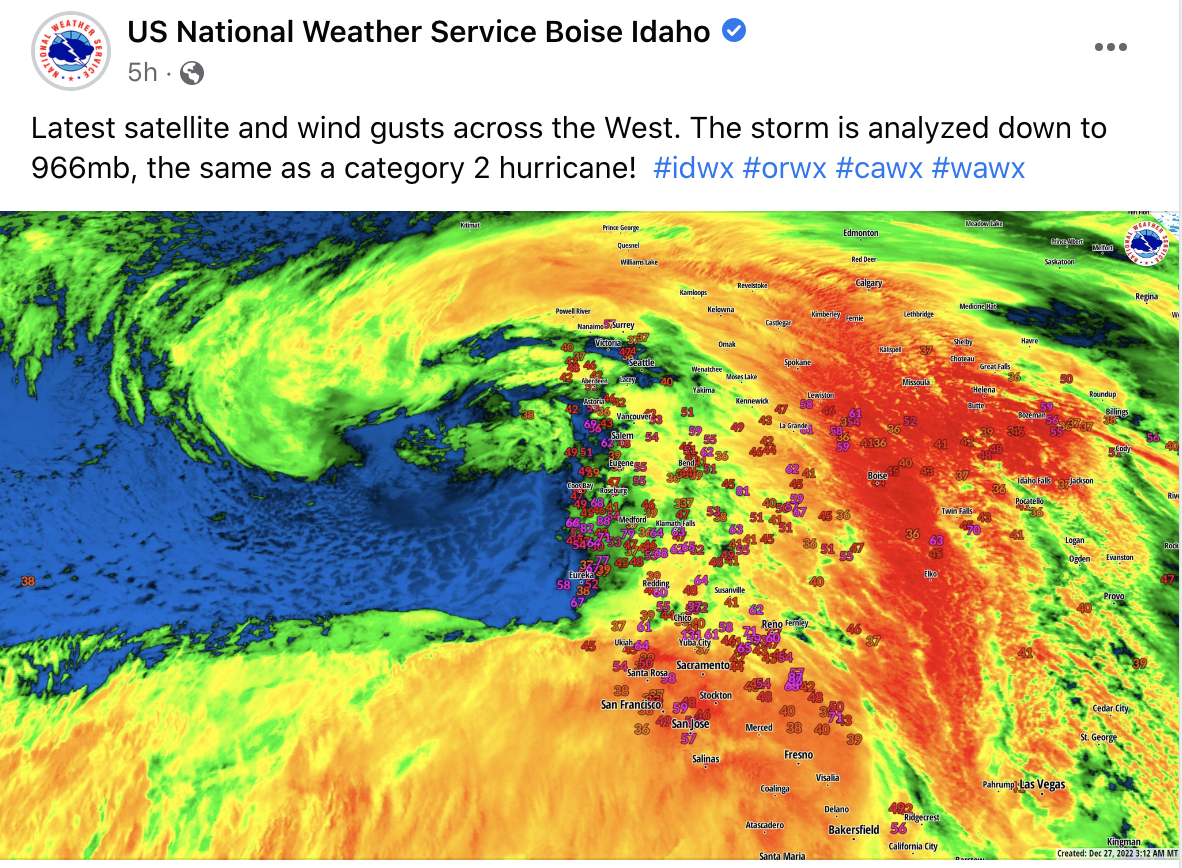
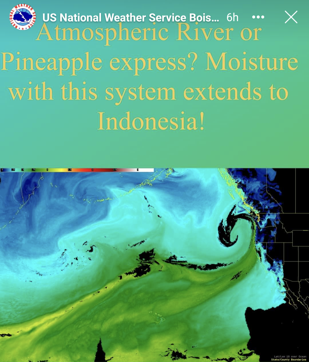
“Atompheric River or Pinapple Express? Moisture from with this system extends to Indonesia!” – US National Weather Service Boise, ID, 12/27/22
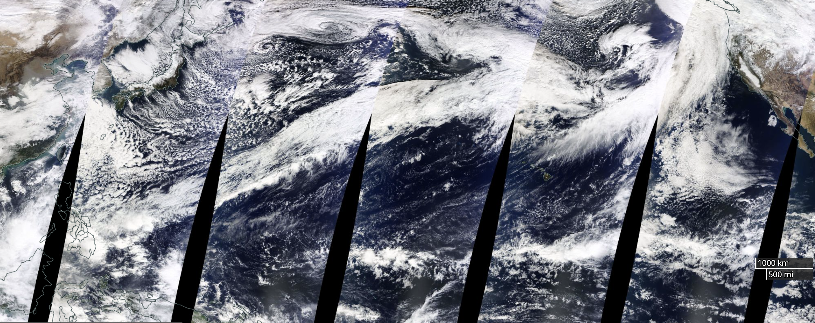
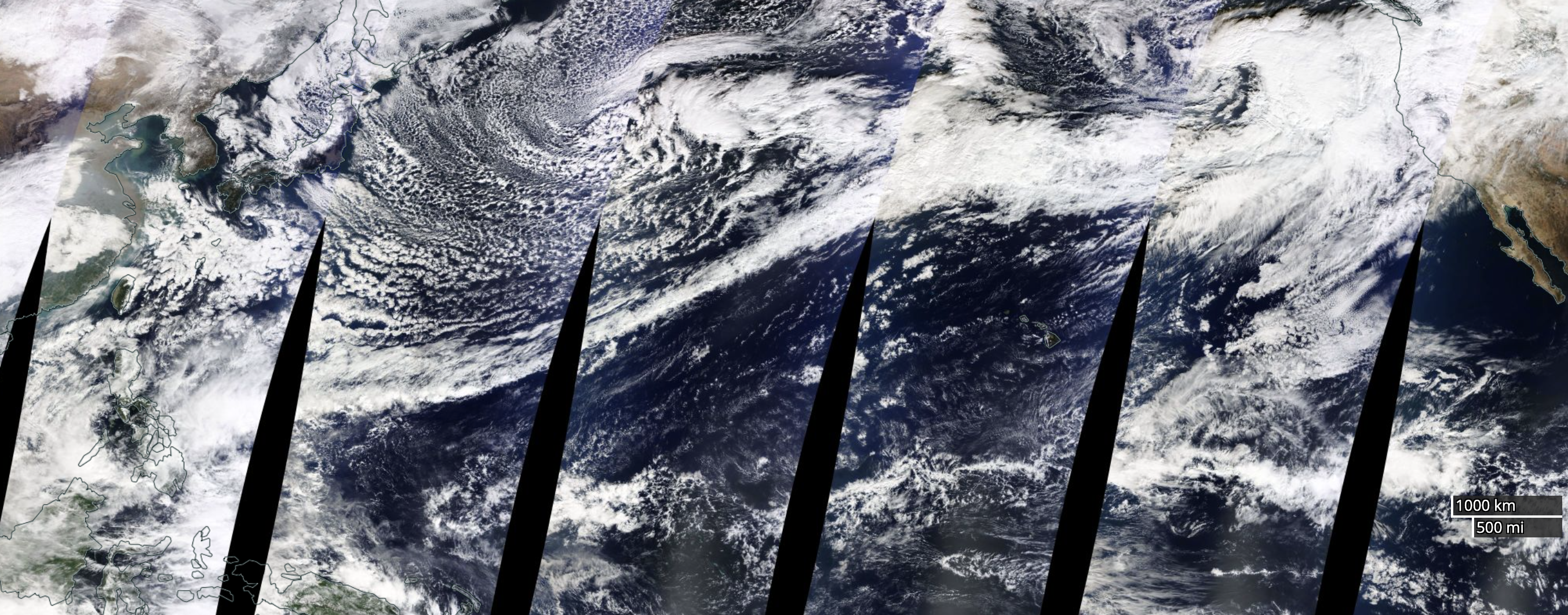
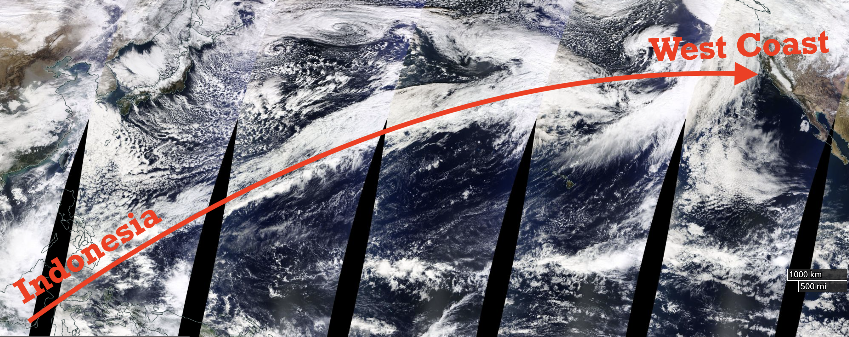
The atmospheric river impacting the US West Coast today is tapping into a moisture plume that stretches 8,000-miles to Indonesia.
Wow!
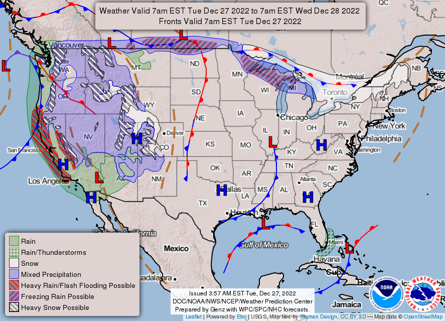
This wet, warm, windy, and wild atmospheric river is clobbering the West Coast of the United States of America today with heavy rain, high mountain snow, and hurricane-force winds.
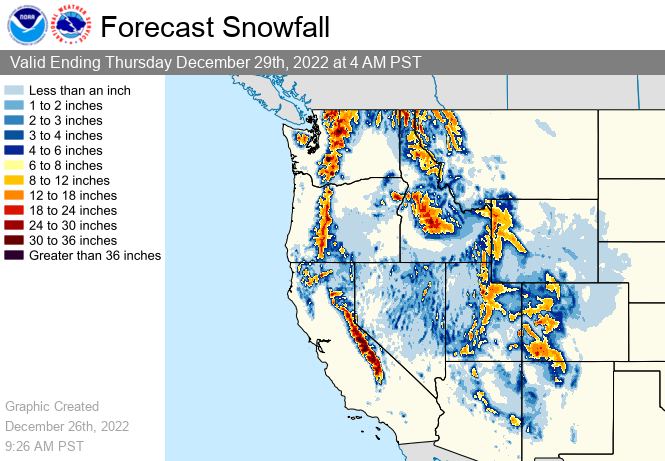
Feet of snow are forecast in the high mountains of the West Coast with this storm.
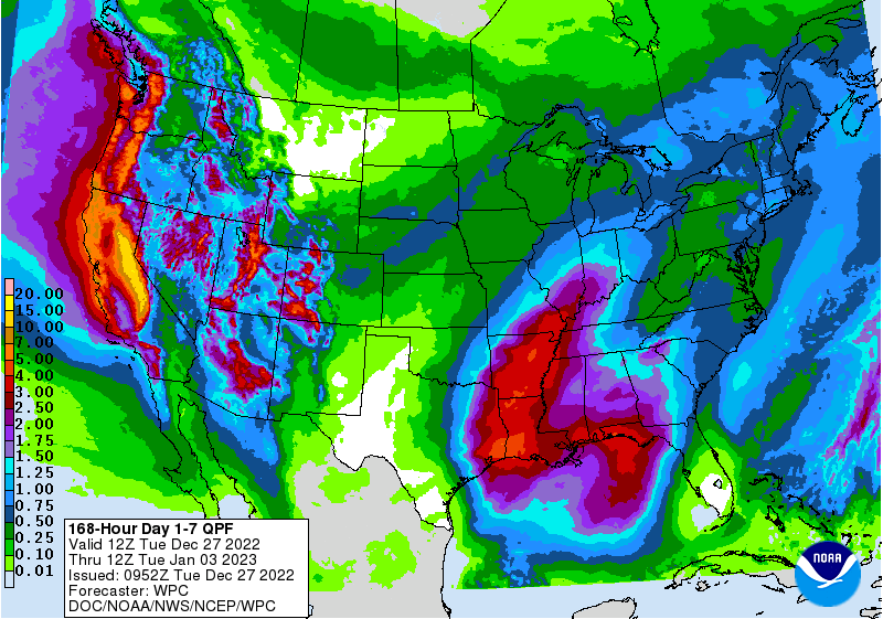
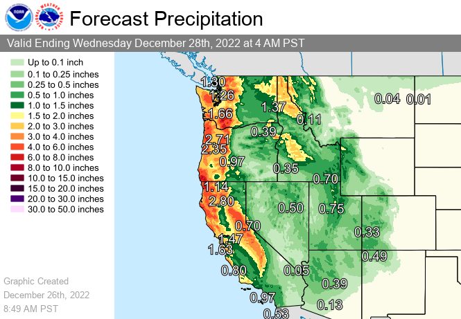
Up to 10-inches of liquid precipitation is forecast in California’s Sierra Nevada mountains in the next 7-days.
The last time we saw something like this was in 2017 when an atmospheric river stretched from China to Whistler, BC!
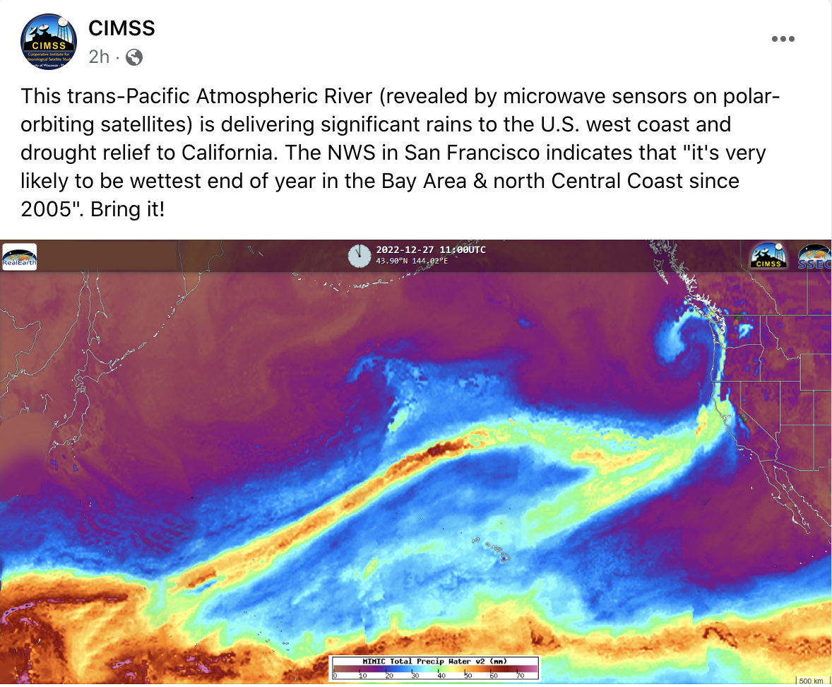
This Trans-Pacific Atmospheric River (revealed by microwave sensors on polar-orbiting satellites) is delivering significant rains to the U.S. west coast and drought relief to California. The NWS in San Francisco indicates that “it’s very likely to be wettest end of year in the Bay Area & north Central Coast since 2005”. Bring it! – CIMSS, 12/27/22
The main issue with this storm will be snow levels.
In California, snow levels will be over 8,000′ for the most intense part of the storm.
* Snow levels and character: Snow levels are expected to rise to
  8000-8500 feet for around 24 hours during the heaviest
  precipitation. Snow levels then begin to fall Saturday afternoon
  bringing impacts to most Sierra passes by evening and to Lake
  Tahoe and foothill elevations by early Sunday morning. The snow
  will be a heavy and wet Sierra cement. - NOAA, Reno NV on 12/27/22
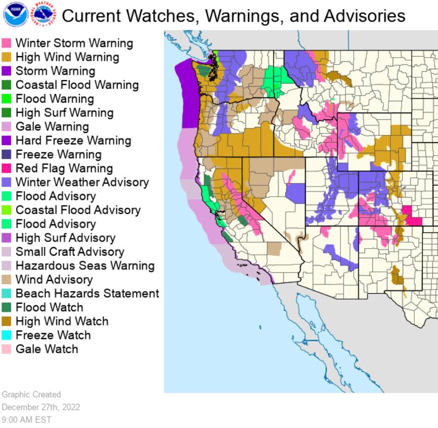
Lake Tahoe, CA Winter Storm Warning:
* WHAT...Heavy snow expected. Total snow accumulations of 3 to
  10 inches, except 1 to 2 feet above 7000 feet. Wind gusts
  around 50 mph with gusts up to 100 mph along the Sierra
  ridgetops. Waves 3 to 5 feet on Lake Tahoe. - NOAA, Reno NV on 12/27/22
Mt. Hood, OR Winter Storm Warning:
* WHAT...Snow expected. Total snow accumulations of up to 5
  inches, except 8 to 15 inches above 4000 feet. Winds gusting as
  high as 65 mph. - NOAA, Portland OR on 12/27/22
Mt. Baker, WA Winter Weather Advisory:
* WHAT...Snow expected above 2500 feet. Snow accumulations of 8 to
  12 inches. Winds gusting as high as 50 mph. - NOAA, Seattle WA on 12/27/22