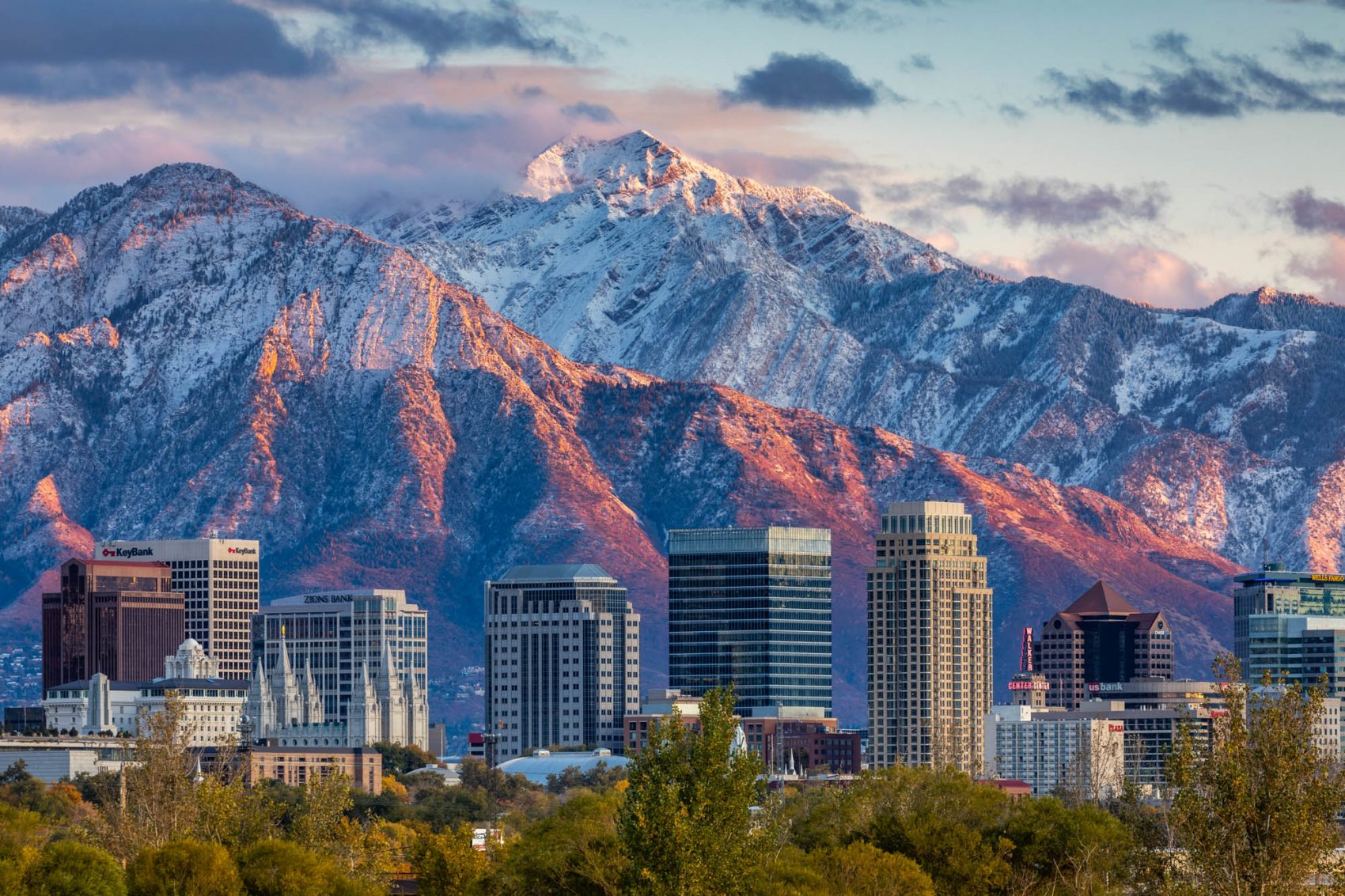
Mountainous regions have attracted people to visit and live in since the first civilizations started popping up. Mountains have offered natural protection, food, water, and other resources, but more recently, mountains draw people for their unbeatable recreational activities (and, of course, the breathtaking views). Utah has had the highest population growth rate in the country over the past ten years at 17.6%. The population growth in Salt Lake City, Utah, has been a concern for many reasons, but one that many people overlook is the ominous fact that the pressures of an earthquake are building beneath our feet.
- Related: Can Earthquakes Cause Avalanches?
The Salt Lake City Valley is not only the most populous region in Utah; it is also full of fault lines that make up the Wasatch Fault Zone. Fault lines are where tectonic plate boundaries meet and react with each other. The movements of these plates are the forces that create mountains, but these interactions with each other also cause earthquakes. Earthquake education in Salt Lake is available (especially in geology classes), and precautions are taken in modern building codes and emergency response preparedness.
The major fault in Utah is the ‘Wasatch Fault,’ running from southeast Idaho right through central Utah. It is referred to as the Wasatch Fault Zone because it comprises many connected fault segments. This fault zone has had “big” earthquakes every 1,300–1,500 years for the past 6,000-ish years, and the last “big one” was around 1,400 years ago, meaning we are due for a large surface-faulting earthquake (yes, bigger than the one in March 2020). According to Salt Lake City Emergency Management, Utah has a 50% chance of experiencing a magnitude 7.0 or higher in the next 50 years.
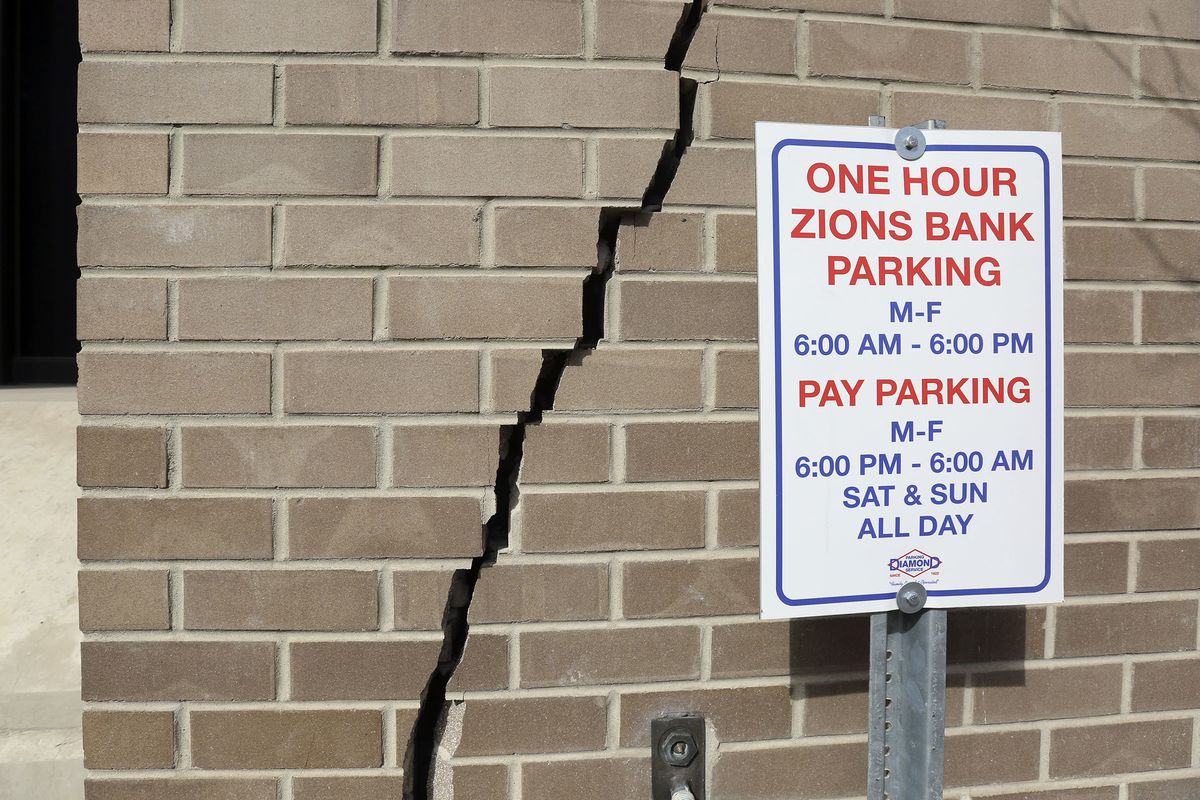
Saying that an earthquake can occur in Salt Lake might not put in perspective how serious the damage could be. There have been many projections over the years about the kind of damage a large earthquake can have on the city, and as of the data in 2015, the projection was dire. For reference, the magnitude 5.7 earthquake last March and subsequent aftershocks caused over “$62 million in structural damage and estimated public infrastructure damage at more than $70 million”(KSL). A magnitude 7 earthquake on the Wasatch Fault would have catastrophic consequences. According to research, anything above a magnitude 5 earthquake would cause ground displacement and liquefaction, which are the biggest threats to infrastructure. The Utah Chapter of the Earthquake Engineering Research Institute laid out what this kind of earthquake would do to the Salt Lake City area:
“The estimated short-term economic loss is over $33 billion; more than 84,000 households are expected to be displaced with nearly 53,000 individuals seeking shelters; and essential lifelines such as water, electricity, gas, and sewer will be disrupted for days to months, and in some locations in the Salt Lake Valley, perhaps longer.”
This earthquake would be especially devastating to the Salt Lake valley because nearly 80% of Utah’s population lives within 15 miles of the Wasatch fault. More than 75 percent of Utah’s economy is concentrated in Salt Lake, Utah, Davis, and Weber counties above the Wasatch fault. The busiest interstates in Utah run directly through Salt Lake, most state government offices are in Salt Lake, and the international airport is also within 15 miles of the fault line. The Mormon religion is also centered in Salt Lake City, with the temple and official buildings downtown. With Salt Lake being one of the fastest-growing populations in the country, this condensed infrastructure makes the earthquake more dangerous to more potential people.
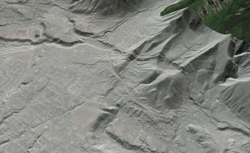
A new study has found significance to other fault lines beneath Salt Lake as well. This makes the grave predictions about an earthquake in the region even more likely, which is scary. Research is done by borehole and other geophysical studies like seismic measurements to understand better what subterranean Salt Lake City looks like. They found faulted and folded layers of the ancient Lake Bonneville lakebed that were between 13,000 and 30,000 years old, linking between the East Bench and Warm Springs faults (see figure below)
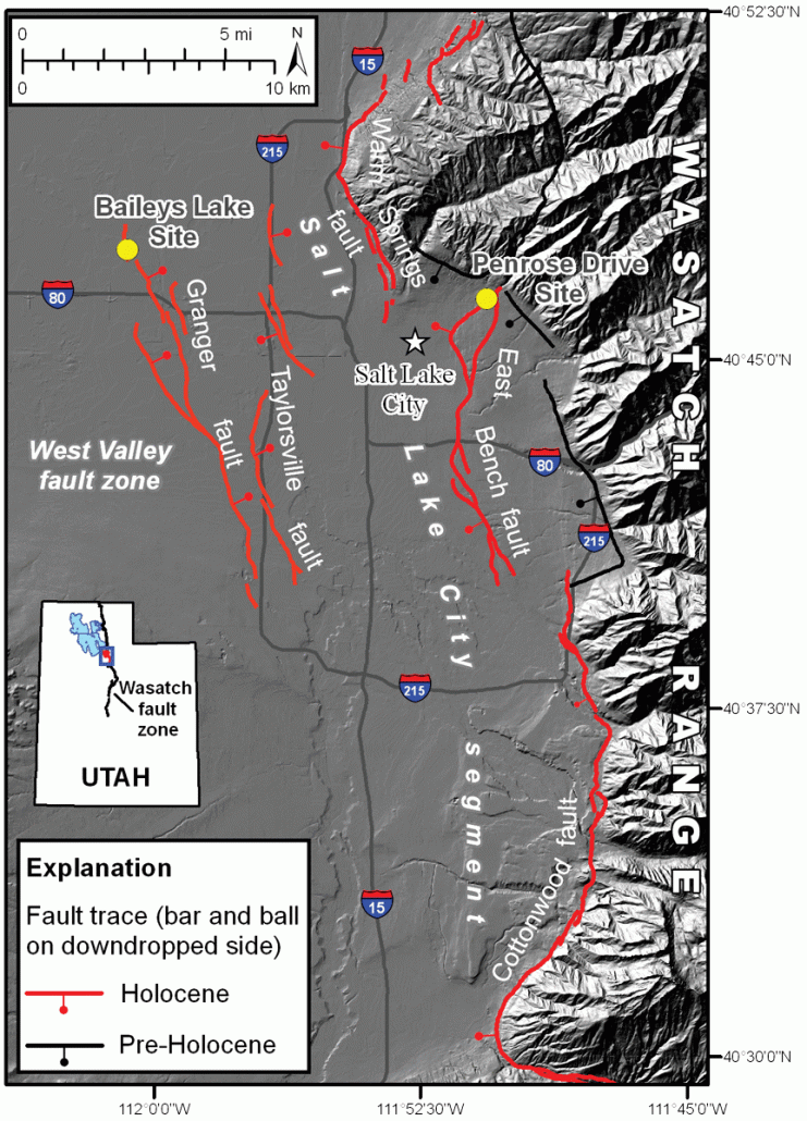
The water saturation and sediment properties found below the city by these seismic tests mean that liquefaction of the ground is even more likely. The “big one” that Salt Lake is overdue for is at least a magnitude 7.0 earthquake. The loose and saturated sediment above the bedrock connecting these fault lines makes the affected area much larger. Knowing that this earthquake is coming has been scary for Utahns for years, and these recent findings don’t ease anyone’s mind.
The best we can do is to stay informed of how to react to an earthquake. It is important to do our best, so the buildings we are in are either built or retrofit to be more stable in earthquakes. Packing emergency to-go bags with dehydrated foods, shelters, lights, tools, and water. Knowing the most stable places in the building you are in is important if you are inside when it happens (structural walls or doorways, away from windows and other falling hazards).
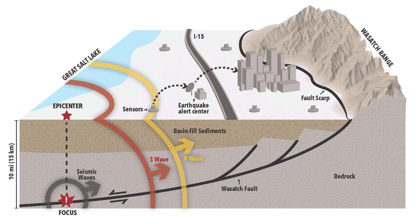
Earthquake early-warning systems are also a great way to help a community to brace for impact. Earthquake early-warning (EEW) systems use earthquake science and the technology of monitoring systems to alert devices and people when shaking waves generated by an earthquake are expected to arrive at their location. Utah currently does not have an EEW system because of the high cost and the fact that there would not be much time to prepare. The Utah Geological Survey says,”‘an ounce of prevention is worth a pound of cure.’ Conceivably, an effective Wasatch Front EEW system could save Utah billions of dollars, as well as many lives, when the Big One happens.” Japan, Mexico, and Turkey have EEW systems along with U.S. cities in California, Oregon, and Washington.
Hopefully, one day soon, there will be a system in Utah for an early warning system. Still, until then, the important things to know are: where are the highest risk areas for liquefaction and extreme ground shaking, where these fault lines lie relative to where we spend our time, and the construction of the buildings where we are spending our time.