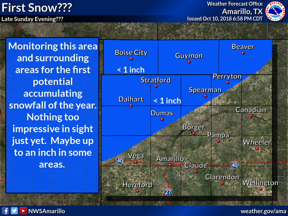
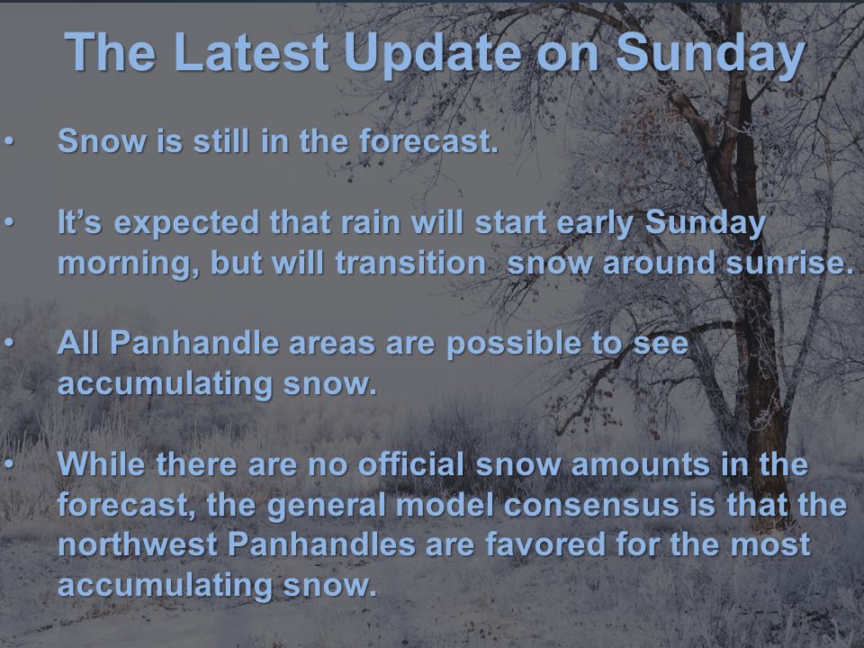
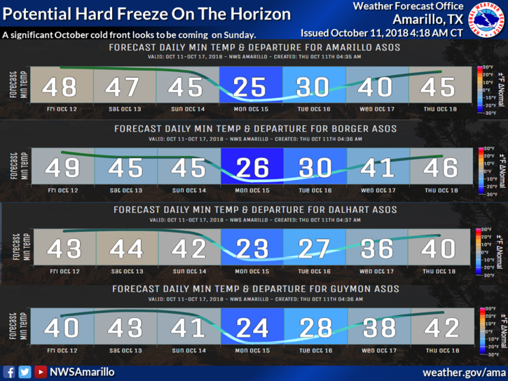
The National Weather Service is calling for hard freezes and possible accumulating snowfall in Texas this weekend. The best chance for accumulating snowfall is in the Panhandle on Sunday night. On average, the area doesn’t see its first snowfall until November.
“Its too early to say with much confidence, but chances are on the uptick for the first accumulating snowfall potential of the season. Right now all areas of the Panhandle are fair game for accumulating snow. The most favorable would be the northwest Panhandle and the least favorable would be the southeast Panhandle.”
– NOAA Amarillo, TX Today
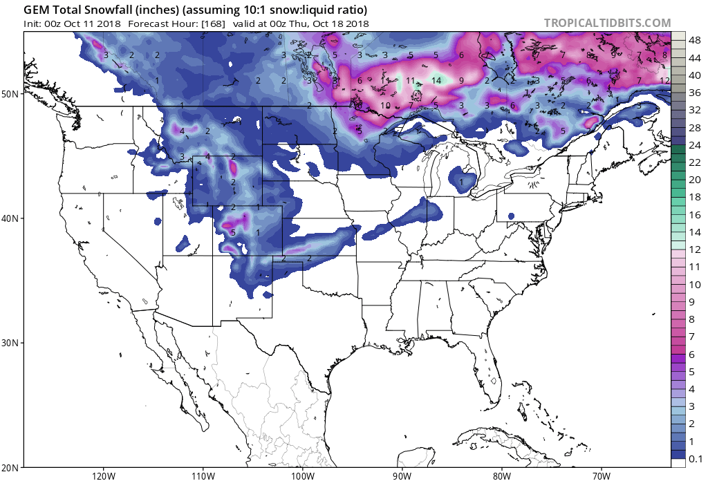
Accumulating snowfall is most likely in the northwest panhandle and least likely in the southeast panhandle.
Additional Info:
Texas: Possible Accumulating Snowfall In Panhandle Areas On Sunday Night
* Its too early to say with much confidence,
  but chances are on the uptick for the first
  accumulating snowfall potential of the
  season. Right now all areas of the Panhandle
  are fair game for accumulating snow.
- NOAA Amarillo, TX
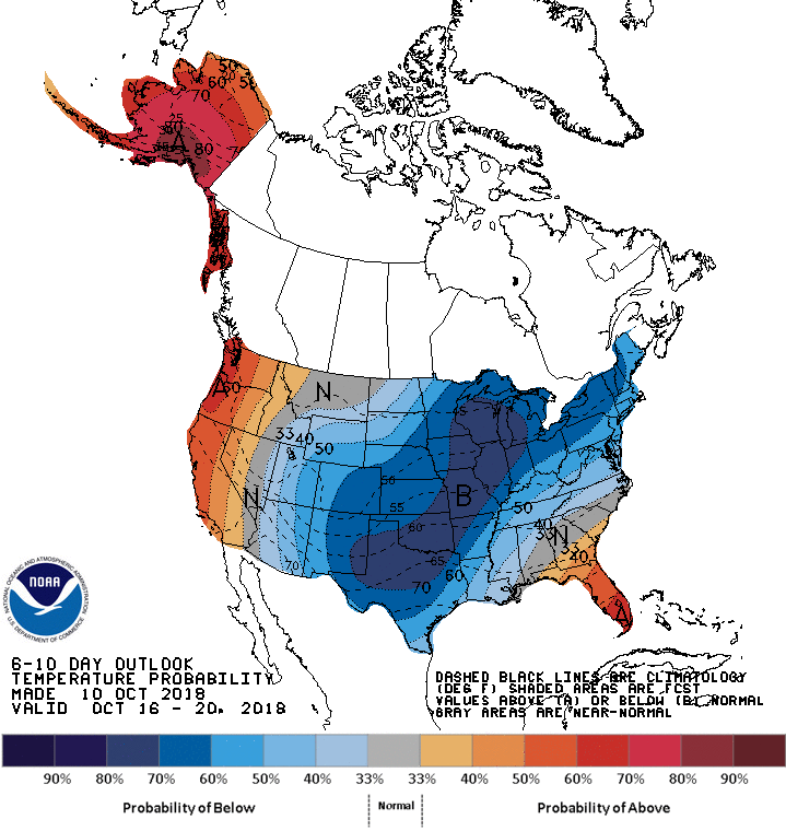
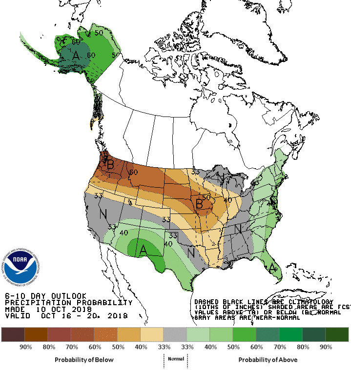
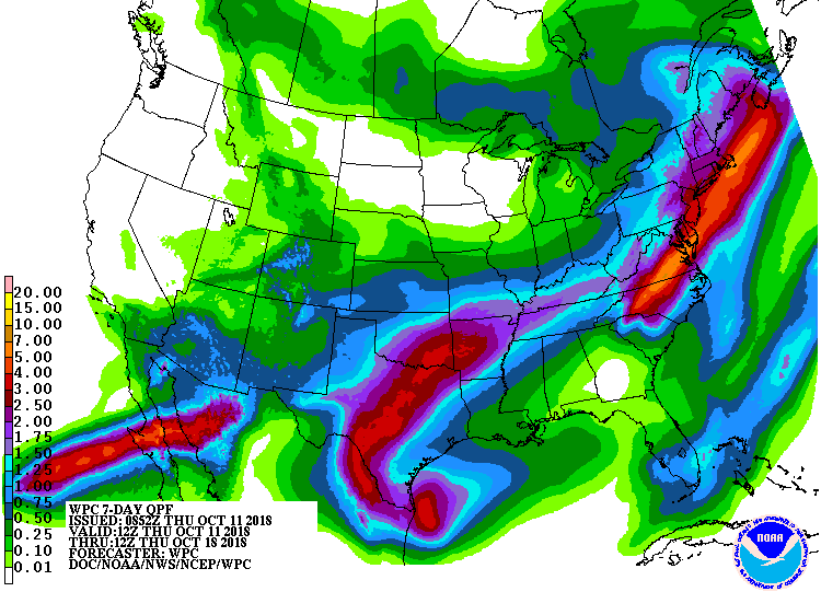
The 6-10 day outlook calls for above average precipitation and below average temperatures in Texas.
Texas Hazardous Weather Outlook:
Hazardous Weather Outlook
Hazardous Weather Outlook
National Weather Service Amarillo TX
347 AM CDT Thu Oct 11 2018

Cimarron-Texas-Beaver-Dallam-Sherman-Hansford-Ochiltree-Lipscomb-
Hartley-Moore-Hutchinson-Roberts-Hemphill-Oldham-Potter-Carson-
Gray-Wheeler-Deaf Smith-Randall-Armstrong-Donley-Collingsworth-
Palo Duro Canyon-

This Hazardous Weather Outlook is for the Texas and Oklahoma
Panhandles.

.DAY ONE...Today and Tonight.

Low clouds and drizzle will be possible this afternoon and
evening.

.DAYS TWO THROUGH SEVEN...Friday through Wednesday.

There are some signs for potentially heavy rainfall across
southern portions of the Texas Panhandle Saturday and Saturday
night. With already saturated soils, this could cause more
flooding across portions of the forecast area.

A cold front will slide through Saturday, and freezing
temperatures may occur Saturday night, Sunday night, and Monday
night, especially northwestern parts of the forecast area.
Widespread hard freezing temperatures are most likely Sunday
night when lows are forecast to range from the mid 20s to the low
30s. Sensitive vegetation could be damaged under frost and
freezing conditions.

Its too early to say with much confidence, but chances are on the
uptick for the first accumulating snowfall potential of the
season. Right now all areas of the Panhandle are fair game for
accumulating snow. The most favorable would be the northwest
Panhandle and the least favorable would be the southeast
Panhandle.