
Ariel Photos of the Wasatch, UT Right Now & A Warning:
By: Steven Lloyd
As some of you know I was almost killed in an avalanche 11 years ago. It was a memory that is as vivid today as the second it happened. I will never forget it. I also learned a lot from that day about what not to do. The year it happened was similar to this year. It had snowed really early in the fall and then stayed warm till NOV 14th and then started snowing really hard. The snow from Sep had turned rotten and had been sitting for over a month. The sunny slopes had melted and there were two very different interfaces that the new snow fell on. As we skied that almost fatal day 11 years ago we started out on a east facing peak and were quite safe. But as we changed our aspect to hike up we got in a lot of trouble because we hopped onto a North facing shaded slope holding rotten snow from Sep. And then truth hit. A slide a half a mile wide. I was hit and buried 5 feet under and for maybe 15 minutes. I was not responsive and not breathing when they found me. I was very fortunate to survive and be here today.
So last year I wanted to start a project to photograph the early snow pack to help people get a visual on what this looks like and to document where these spots are. Many might be aware of this, but i am surprised at the amount of folks who don’t. Like me 11 years ago I had no clue as to what a few degrees of angle could make in safety when skiing early snow pack.
Yesterday with the Help of Iflyheli (York Galland) and his Brother Matt Galland, we flew over the wasatch and snapped photos of our current snowpack. There is a lot of snow to say the least. From the valley it looks like a few snow patches but from the air we get a different perspective. Please look through these photos and I hope and pray that these can be a tool for some of you to use as we get closer to having our slopes buried and don’t have a visual on this stuff any more. I will be giving these photos over to the Utah Avalanche Center so if people want access to them they can have a look. If you have any questions hit me up or the Avi center.
Notice the difference in the south facing photos compared to the North facing photos. Bone dry to a foot or more snow on the north slopes. If you have a specific area you would like to see hit me up and I can send you a photo of that area. I also might add that if we stay high and dry for the next few weeks more snow could melt. So these photos are more to look at as a representation as to where the sun is hitting and where the shade is and not exactly what will be on the ground when the snow covers the ground.
Photo Tour:


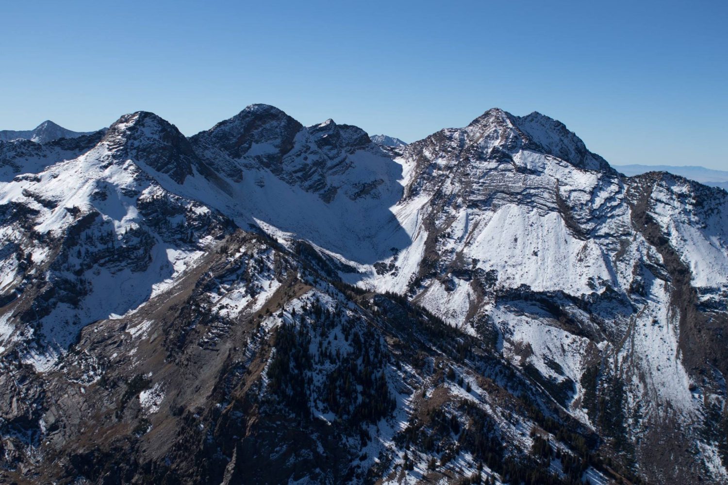
Wasatch, UT. Image: Steven Lloyd


** All Pictures & Text Courtesy of: Steven Lloyd. Check Out The Original Piece Here.**
your just not in touch if that’s what happened ! got caught hiking up? really that just show’s lack of attention and awareness. sure theres a rotten layer big deal… just stay off that steep shit and go for slopes that had no snow … when it does finally snow… SIMPLE and don’t hike below avalanche paths…