As the American West suffers a 22-year-long “megadrought” that researchers say is the worst in at least 1,200 years, water managers now have a new level of insight into just how much water will be available for their communities. Water departments in the West are using maps and models originally created by a NASA team to help track water and improve how we manage this precious resource. That team is now a private public-benefit company, Airborne Snow Observatories, Inc. (ASO), which is using the NASA-developed methods to work with the U.S. Bureau of Reclamation (USBR) – the largest wholesaler of water in the country – as well as the states of California and Colorado, and water managers internationally.
NASA Research Fills a Gap
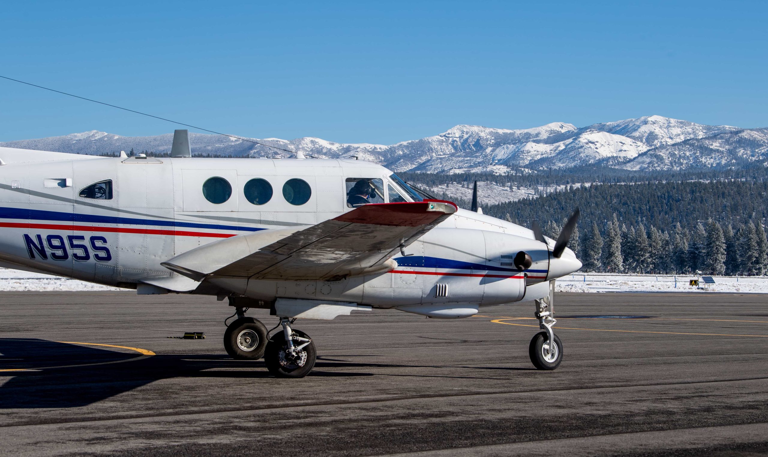
Much of the American West’s water supply depends on the snow that builds up on mountains in the winter. In the spring and summer, as the snow melts, that meltwater is used for everything from washing hands to watering crops. NASA’s Airborne Snow Observatory began as a project from NASA’s Jet Propulsion Laboratory (JPL) and NASA’s Earth Science Division, when snow scientist and project lead Tom Painter identified how NASA science and remote sensing could help fill an urgent gap for water monitoring.
Ten years ago, communities had limited ability to accurately estimate how much water they’d get from melting snow – or when it would arrive. Now, the ASO team combines measurements from lasers and spectrometers on planes with Earth observations from NASA satellites to produce up-to-date forecasts and maps of the amount of water held in the snowpack – with up to 99% accuracy. This also increases the range of area in which snowpack can be measured, allowing water managers to know earlier the amount of water coming from snowpack throughout the spring and summer and plan with greater confidence. Using a plane also allows more precise measurements of snowpack, with NASA and other GPS satellite networks telling the scientists exactly where the ASO plane is relative to the topography of the mountains below.
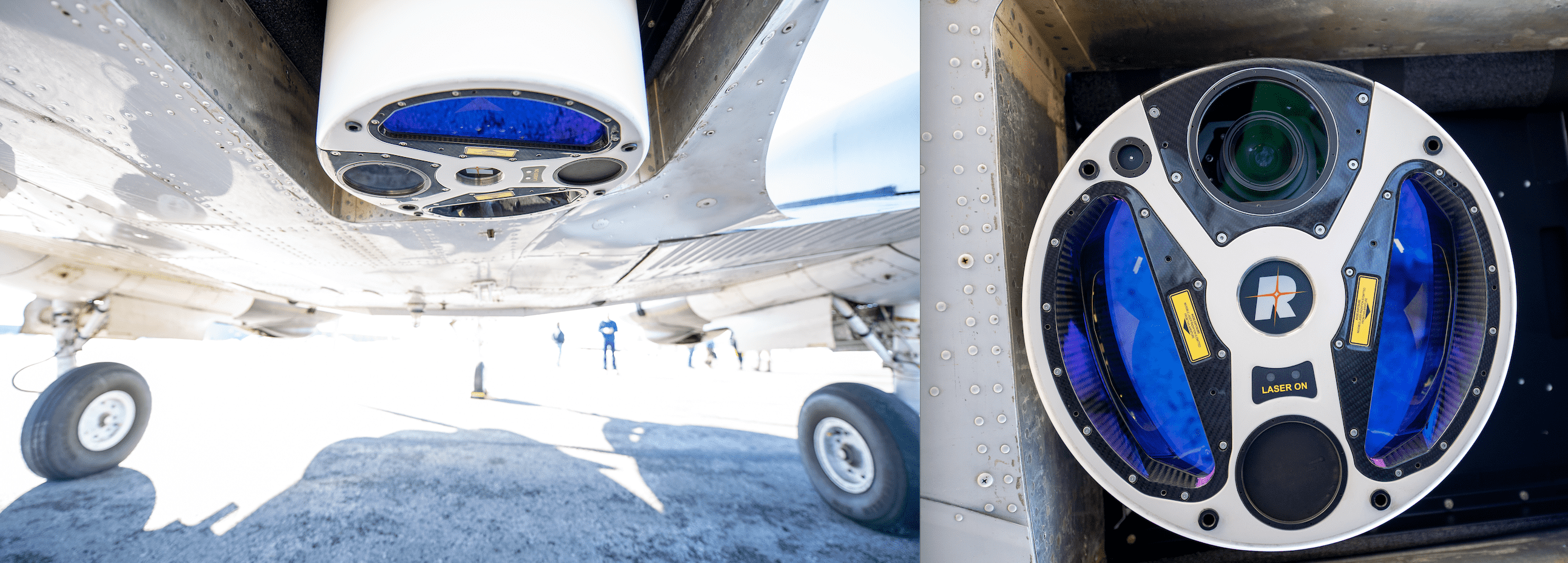
The ASO team uses higher-resolution snow cover data from the joint NASA and U.S. Geological Survey Landsat satellite mission to update model snow cover, and the Moderate Resolution Imaging Spectroradiometer (MODIS) instrument onboard NASA’s Terra satellite to guide rapid updates to flight planning. This view from above gives the team a better understanding of the area in between each flight, which allows them to update their models in near real-time.
“We actually just did that today. We looked at the most recent Landsat acquisition, which told us how much of the snowpack had melted away, and where we should update our snow model and likewise actually fly to look for remaining snow. It makes for much greater efficiency of our work.”
– Tom Painter
NASA’s Terrestrial Hydrology Program, Western Water Applications Office (WWAO), and the Applied Sciences Program helped support ASO’s work prior to its spin-off. “NASA was remarkably supportive, helpful, encouraging, and prescient,” Painter added.
Changing Tech for a Changing Climate
As the Earth warms from human-caused climate change, precipitation patterns and the timing of the melting snowpack are also changing – impacting the quantity of water available and making supplies harder to manage.
“With today’s warmer and drier climate, older forecasting techniques are struggling to produce accurate results. Using the data from these NASA-developed methods for the 2021-2022 winter allowed us to understand that we had about half the water stored in the Sierra Nevada snowpack than was estimated from older snowpack estimation tools, which are based on historical distributions of the snow that are less relevant today due to climate change. This more accurate knowledge of how much water is stored in the snowpack and precisely where the snow has accumulated allows water managers like Rizzardo to better respond and plan.
– David Rizzardo, manager of the Hydrology Section for the California Department of Water Resources (CADWR)
Understanding the amount of water available from snowpack “has a direct impact on everything from watering crops to simple everyday hydration,” Painter said. “If you drink a glass of water in San Francisco, it’s from [California’s] Tuolumne basin – one of the places we are actively monitoring.”
Painter adds that the combination of NASA satellite data with observations from ASO flights also allows for a fast turnaround of information overall. “Now it’s [a case of], ‘here’s the information from yesterday, our lasers touched every inch of the snowpack.’ For our partners who are now our customers, that became the enormous game changer.”
This post first appeared on NASA.gov and was written by Lia Poteet, Earth Applied Sciences.