Just in time for a winter that will see a huge increase in skiers entering the backcountry, Backcountry Ski Maps are adding two new maps to their already wide selection this Fall – one for Mammoth, CA, and the other for the Presidential Range in New Hampshire.
Whether you’re looking for steep couloirs, mellow pow, open bowls, or anything in between, Backcountry Ski Maps has you covered. Backcountry skiers new to an area can expect to find all the classics, while even the most seasoned locals will discover new, rarely-skied lines to explore.
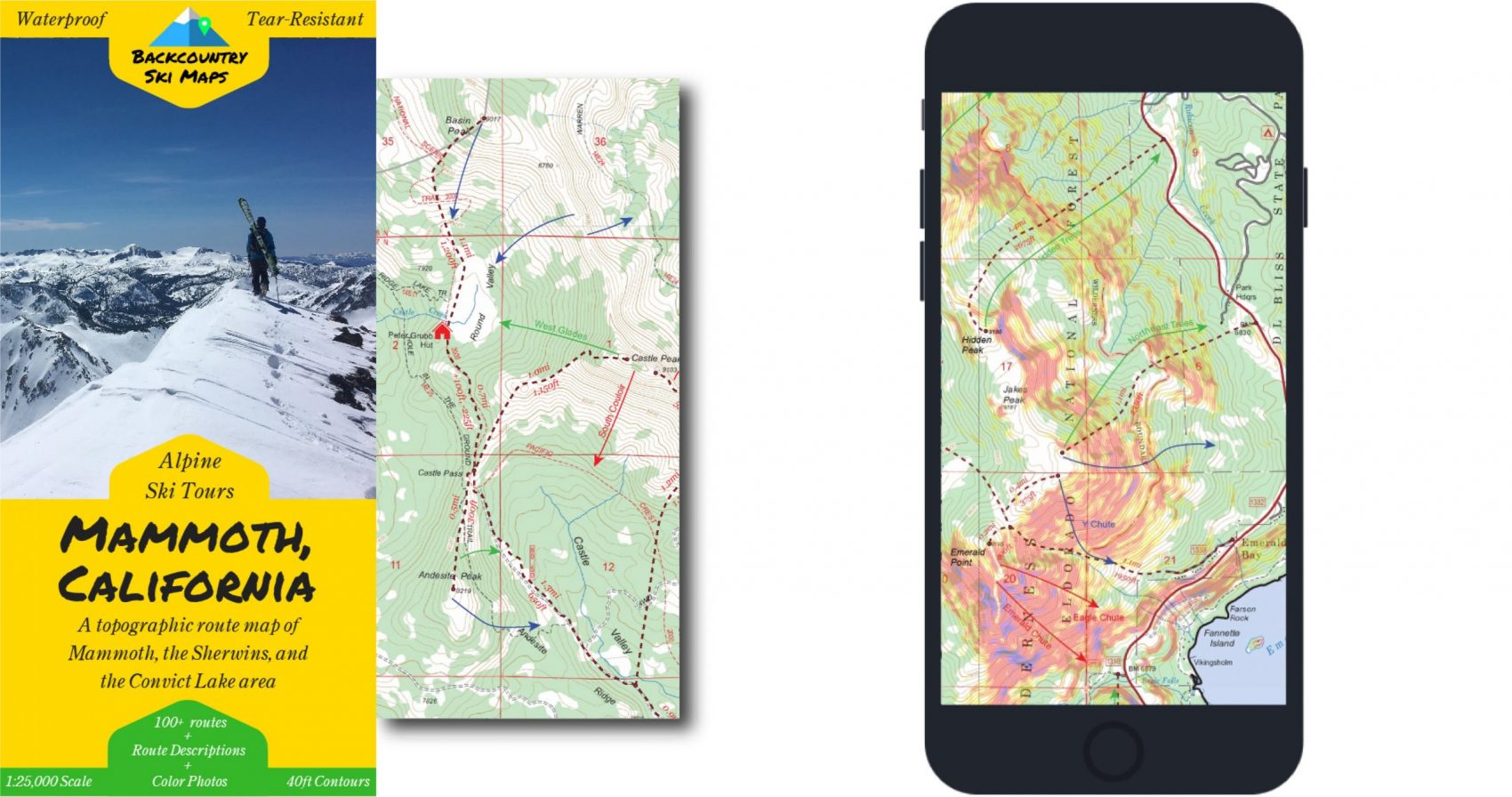
Every Backcountry Ski Map is based on the latest US Forest Service maps with the most up-to-date information. With 40ft contour lines and scales at 1:25,000, the maps are some of the most detailed and easily readable around. Plus you can use the maps on your smartphone to navigate in real-time with GPS accuracy on your next ski touring adventure.
Mammoth, CA
If you’re looking to access the unbeatable high alpine terrain around Mammoth, this topographic map route map is the place to start. With backcountry ski routes from the glades of Punta Bardini to the steeps of the Bloody Couloir and Convict Lake, there are enough world-class ski descents on here to keep even the most avid powderhound sated.
- A new addition to the California lineup which already includes several maps of Lake Tahoe.
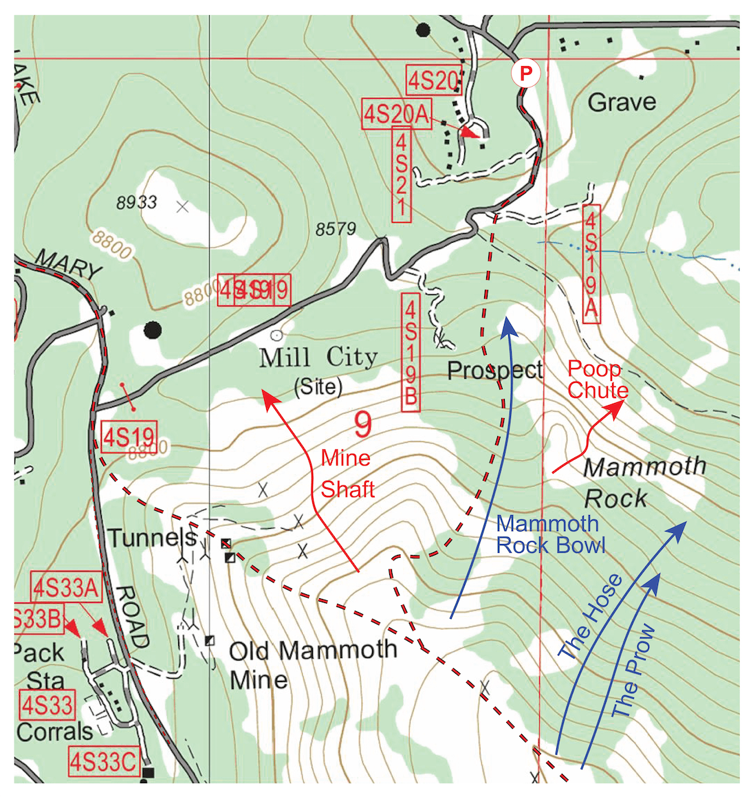
- An easy-to-use topographical map covers the area around Mammoth Lakes, including everything from the Sherwins and the Mammoth Crest down to the couloir-filled area around Convict Lake
- With up and down tracks for more than 100 descents listed, this is the most comprehensive backcountry ski coverage of the area yet – helping backcountry users travel safely and efficiently throughout the region.
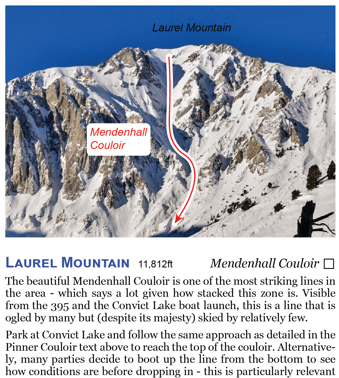
- The map is accompanied on the back by a self-contained field-guide containing photos and descriptions of a variety of “top picks” – a selection of some of the most worthy descents. The field guide includes a good variety of lines and is the perfect hopping off point for anyone new to the area.
- Available in paper and digital formats.
- Available to pre-order, shipping in time for the kickoff of the 2020-21 season.
- Link: https://backcountryskimaps.com/product/mammoth-california/
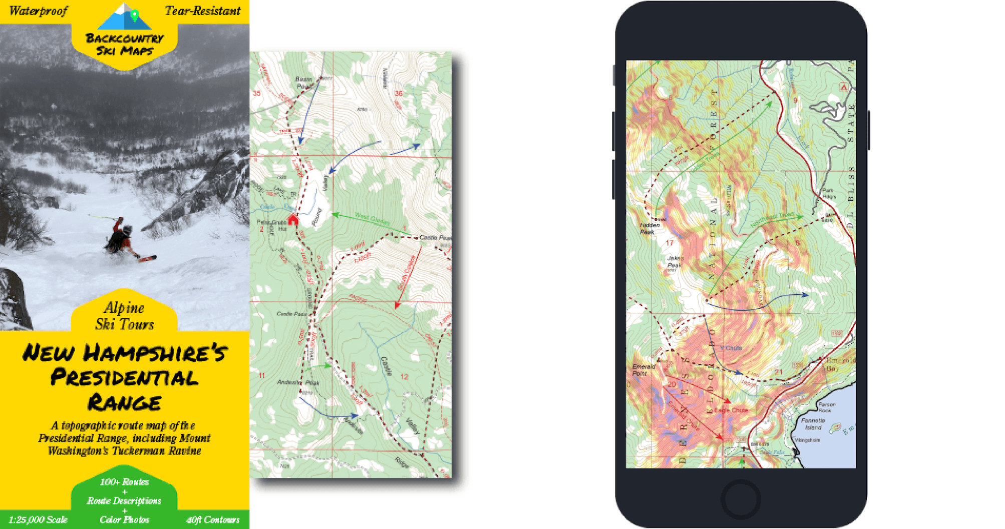
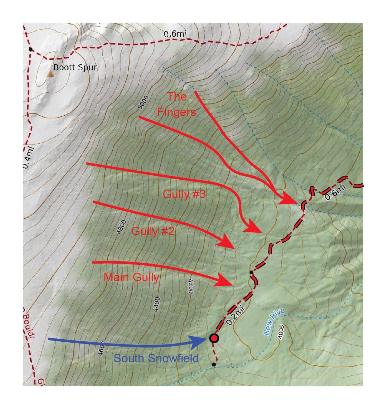
Presidential Range, NH
If you’re looking to access the incredible ski terrain around New Hampshire’s Presidential Range, this topographic map route map is the place to start. From classic backcountry ski tours on Mount Washington’s Tuckerman and Huntington Ravines to rarely skied descents on Mount Adams, Jefferson, and beyond, there are enough world-class ski descents on here to keep even the most avid skier or ski mountaineer sated.
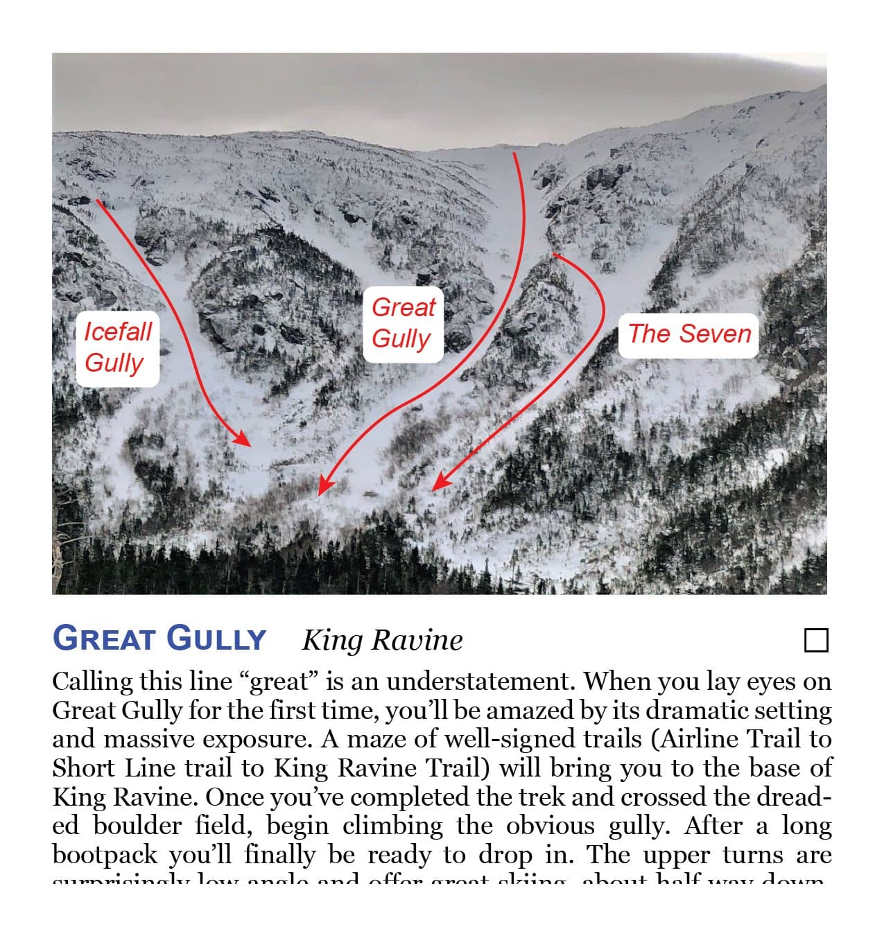
- The map contains uptracks and descents for more than 100 routes ranging from the classics at Tucks and Huntington to obscure lines like Pony Express and Eisenhower Slide. In addition to Tuckerman and Huntington Ravines, it features lines in The Great Gulf, The Gulf of Slides, Jefferson Ravine, Castle Ravine, Oakes Gulf, King Ravine, Burt Ravine, Ammonoosuc Ravine, and more.
- With up and down tracks for more than 100 descents listed, this is the most comprehensive backcountry ski coverage of the area yet – helping backcountry users travel safely and efficiently throughout the region.
- The map is accompanied on the back by a self-contained field-guide containing photos and descriptions of a variety of “top picks” – a selection of some of the most worthy descents. The field guide includes a good variety of lines and is the perfect hopping off point for anyone new to the area.
- This map was made in consultation with several local guides and heavy users of the NH backcountry.
- Available in paper and digital formats.
- Available to pre-order, shipping in time for the kickoff of the 2020-21 season.
- Link: https://backcountryskimaps.com/product/new-hampshires-presidential-range/
All the maps are printed on waterproof, tear-resistant paper that stands up to the abuses of backcountry skiing. That means when a storm comes in a day earlier than expected while you’re out on a multi-day ski tour in the Desolation Wilderness, you’ll have no problem finding your way home – even if your cell phone has long-since run out of juice.