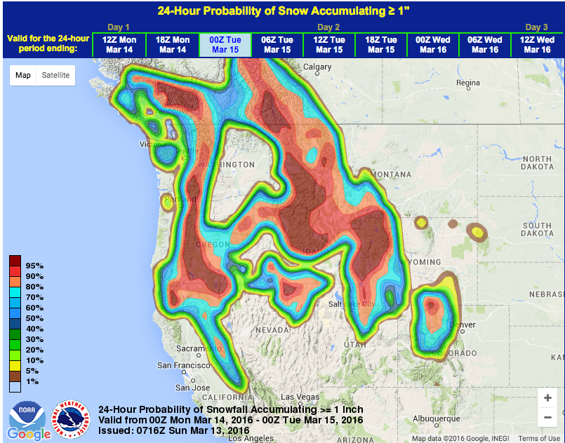
NOAA is forecasting big snow across the Western USA today and tomorrow. Up to 2-feet of snow is forecast in the Western US by Monday evening.
Winter Advisories are in effect for: CA, NV, OR, WA, ID, UT, WY, MT
California
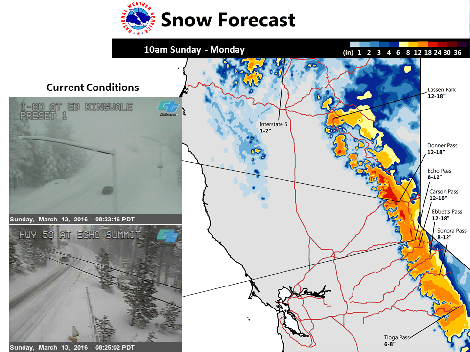
* ADDITIONAL SNOW ACCUMULATIONS: OVER 2 FEET ABOVE 7000 FEET. 10
  TO 16 INCHES OF SNOW ARE FORECAST FOR SOUTH LAKE TAHOE...8 TO 14
  INCHES AT TRUCKEE...AND 14 TO 20 INCHES ALONG HIGHWAY 89.
  - NOAA Reno, NV today
Oregon
* ACCUMULATIONS...GENERALLY 2 TO 5 INCHES THIS MORNING. SNOW WILL
  BE INCREASING THIS AFTERNOON...WITH 12 TO 24 INCHES OF NEW SNOW
  TONIGHT THROUGH MONDAY MORNING.
  - NOAA Portland, OR today
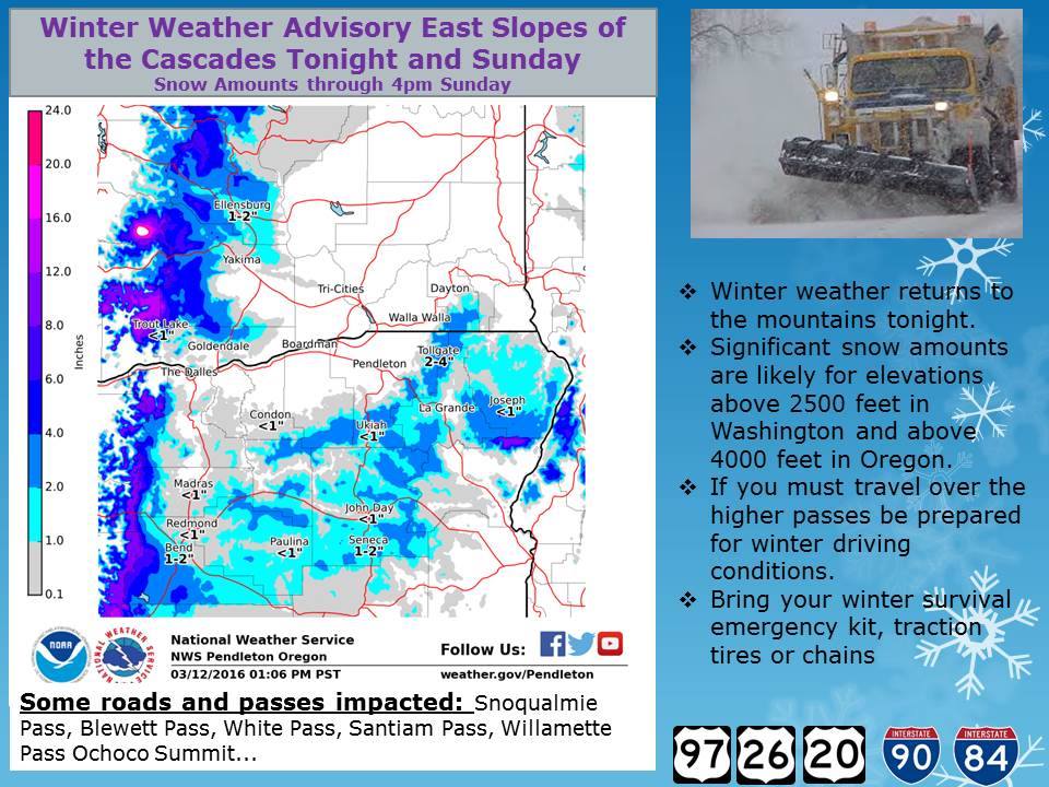
Washington
* OTHER IMPACTS...ANOTHER 1 TO 2 FEET OF SNOW IS LIKELY TODAY
  THROUGH NOON MONDAY. THE SNOW LEVEL WILL BE 2500 TO 3000 FEET
  TODAY AND FALL TO 2000 FEET ON MONDAY.
  - NOAA Seattle, WA today
Nevada
* ADDITIONAL SNOW ACCUMULATIONS: OVER 2 FEET ABOVE 7000 FEET. 10
  TO 16 INCHES OF SNOW ARE FORECAST FOR SOUTH LAKE TAHOE...8 TO 14
  INCHES AT TRUCKEE...AND 14 TO 20 INCHES ALONG HIGHWAY 89.
  - NOAA Reno, NV today
Utah
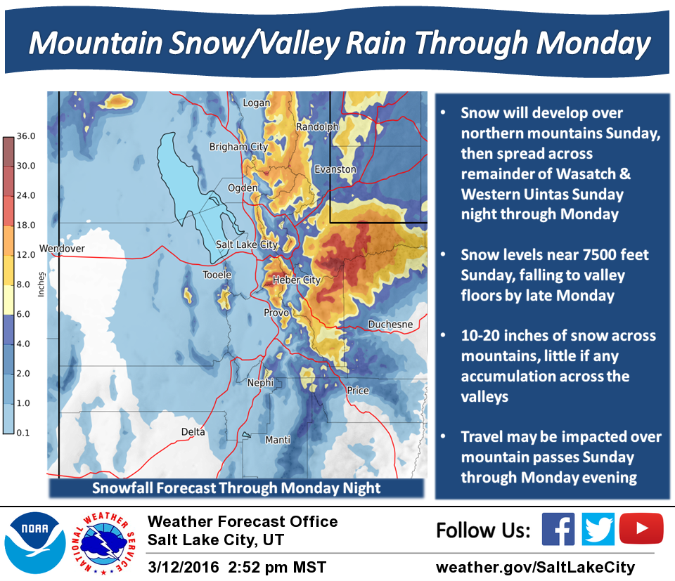
“A pacific storm system will bring mountain snow and valley rain to northern Utah beginning Sunday and continuing through Monday. 10 to 20 inches of new snow is expected across the higher terrain during this time. Snow levels may fall to the valley floors by late Monday with little to no accumulation expected.” – NOAA SLC, UT today
Idaho
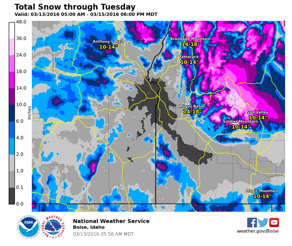
❄ Significant mountain snow expected today through Monday. Here are total amounts through Tuesday.” – NOAA Boise, ID today
* SNOW ACCUMULATIONS...AN ADDITIONAL 2 TO 6 INCHES OF SNOWFALL IS
  POSSIBLE PRIMARILY ABOVE 7000 FEET MSL TODAY. UPWARDS OF A FOOT
  OF ADDITIONAL ACCUMULATION IS POSSIBLE TONIGHT AND MONDAY. SNOW
  LEVELS WILL LOWER TO VALLEY FLOORS BY MONDAY...WITH 4 TO 6
  INCHES OF ADDITIONAL ACCUMULATION BELOW 7000 FEET.
  - NOAA Boise, ID today
Wyoming
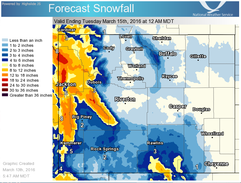
* SNOW ACCUMULATION...10 TO 20 INCHES.
  - NOAA Riverton, WY today
Montana
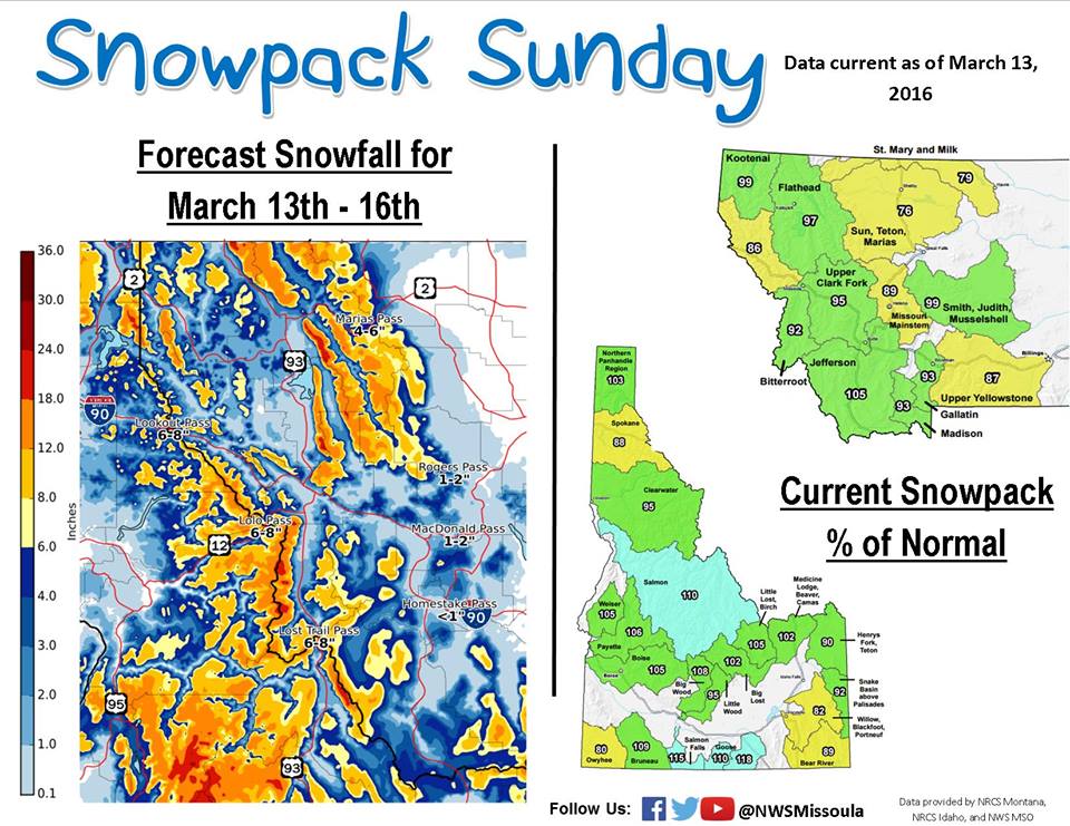
* SNOW ACCUMULATIONS...3 TO 6 INCHES NEAR MOUNTAIN PASS LEVEL AND
  IN HIGHER VALLEY AREAS...7 TO 12 INCHES ABOVE PASS LEVEL AND
  NEAR RIDGE TOPS.
  - NOAA Great Falls, MT today