A relatively strong spring storm is expected to hit Wyoming Tonight through Saturday morning. Heavy snowfall and difficult travel conditions are expected to impact the area.
14-18″ of snow is expected to fall above 9000ft Tonight-Friday Morning.

Snow levels will start out around 8500ft tonight and drop down to 6500ft by early Friday morning.
Additional Storm Information:
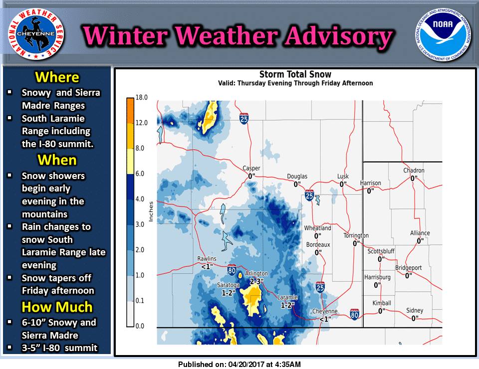
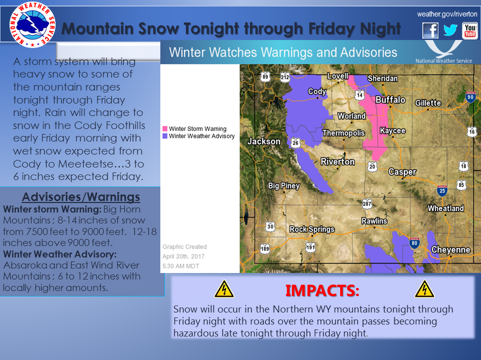
Wyoming: 14-18″ of Snow Above 9000ft Tonight-Friday Night
* TOTAL SNOW ACCUMULATION...4 to 8 inches between 6500 feet and
  7500 feet...8 to 14 inches from 7500 feet to 9000 feet...and
  14 to 18 inches above 9000 feet.
- NOAA Riverton, WY


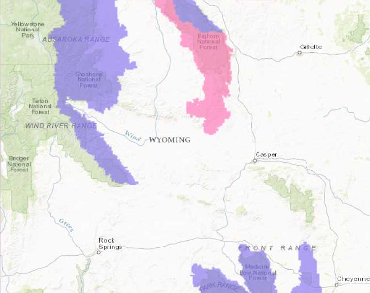
Wyoming Winter Storm Warning:
URGENT - WINTER WEATHER MESSAGE
National Weather Service Riverton WY
118 AM MDT Thu Apr 20 2017

...Another significant snowfall event slated for much of the
Northern and Central Mountains for tonight through Friday
night...

.The combination of a strong upper Pacific trough modest lee side
cyclogenesis will produce significant amounts of snowfall over
portions of the Absaroka, Wind River, and Big Horn Mountains from
tonight through Friday night.

Bighorn Mountains West-Bighorn Mountains Southeast-

...WINTER STORM WARNING REMAINS IN EFFECT FROM MIDNIGHT TONIGHT
TO 6 AM MDT SATURDAY...

* TIMING...Snow showers will generally begin after midnight
  tonight with the snow levels starting out above 8500 feet. After
  midnight tonight, the snow levels should lower to around 7500
  feet by sun up then down to 6500 feet through Friday morning.
  Heaviest snowfall expected between midnight tonight and
  midnight Friday.

* TOTAL SNOW ACCUMULATION...4 to 8 inches between 6500 feet and
  7500 feet...8 to 14 inches from 7500 feet to 9000 feet...and
  14 to 18 inches above 9000 feet.

* MAIN IMPACT...Highways may become slick and snow packed
  including Highway 16 over Powder River Pass and Highway 14
  over Granite Pass. Visibility may lower to around 1/4 of a
  mile in heavier snowfall.
Us