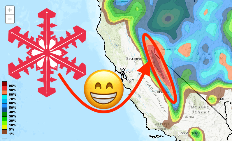
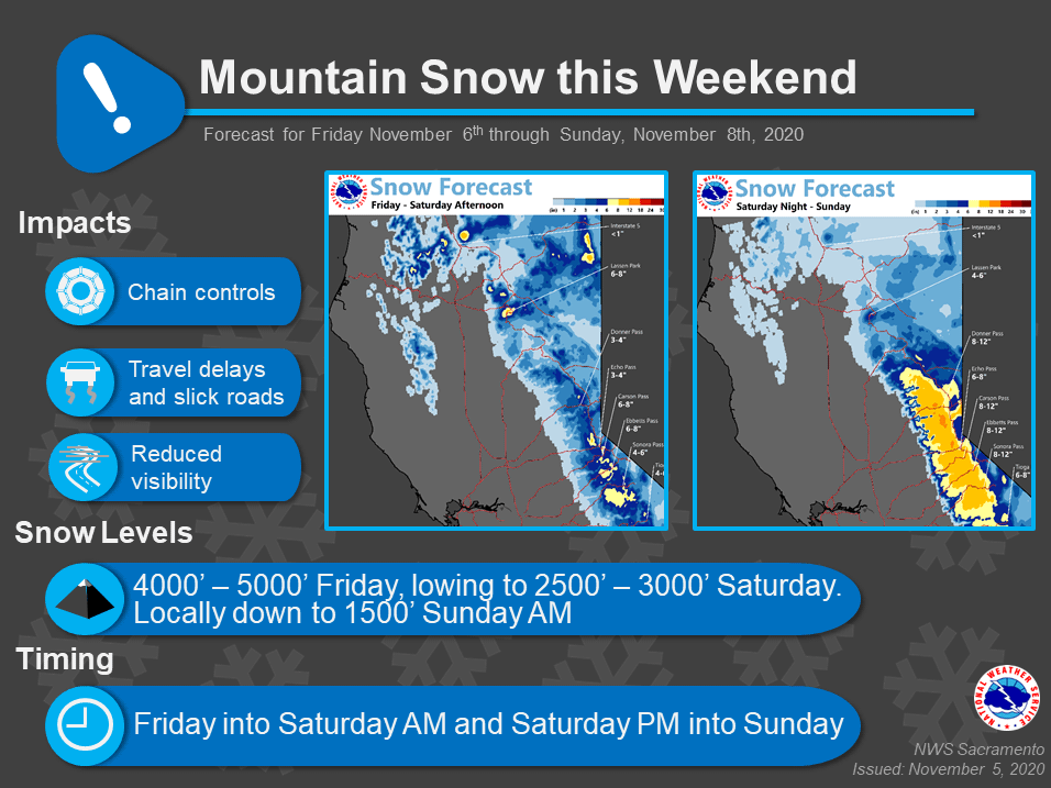
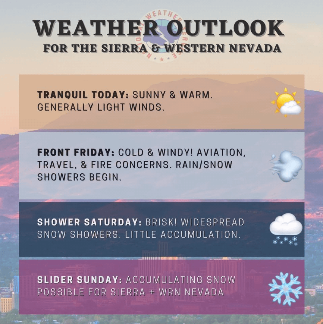
A winter weather advisory is in effect for the Sierra Nevada, becoming a winter storm warning Saturday afternoon through Sunday, as the first significant storm of the seasons hits California. North Tahoe resorts could see up to 12″ of fresh snow, with South Lake resorts 18-24″. Mammoth, who plans to open next week, will also receive a few inches.
205 AM PST Fri Nov 6 2020
...First High Elevation Snow of the Season Today through
Sunday...
.The first winter storm of the season will bring periods of light
to locally moderate snow to the higher elevations of the Sierra
Nevada and mountains of Western Plumas County today through
Sunday.Snow levels above pass levels fall to 4000-5000 feet early
Friday night. There may be some lighter precipitation by Saturday
morning through afternoon, before possible heavier additional
snow moves through early Saturday night through Sunday. Mountain
travel delays, chain controls, and slippery road conditions are
possible, especially during the overnight hours.
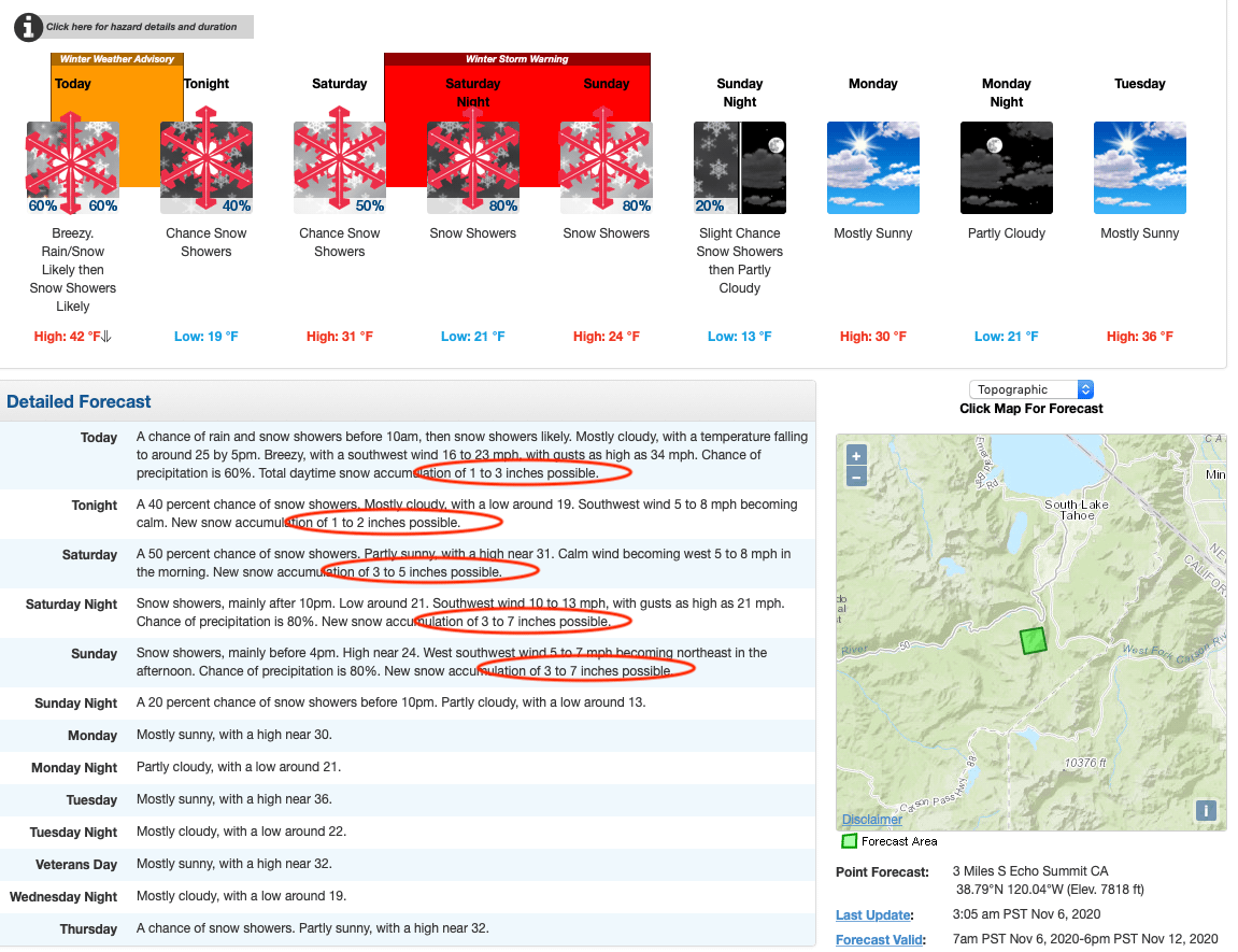
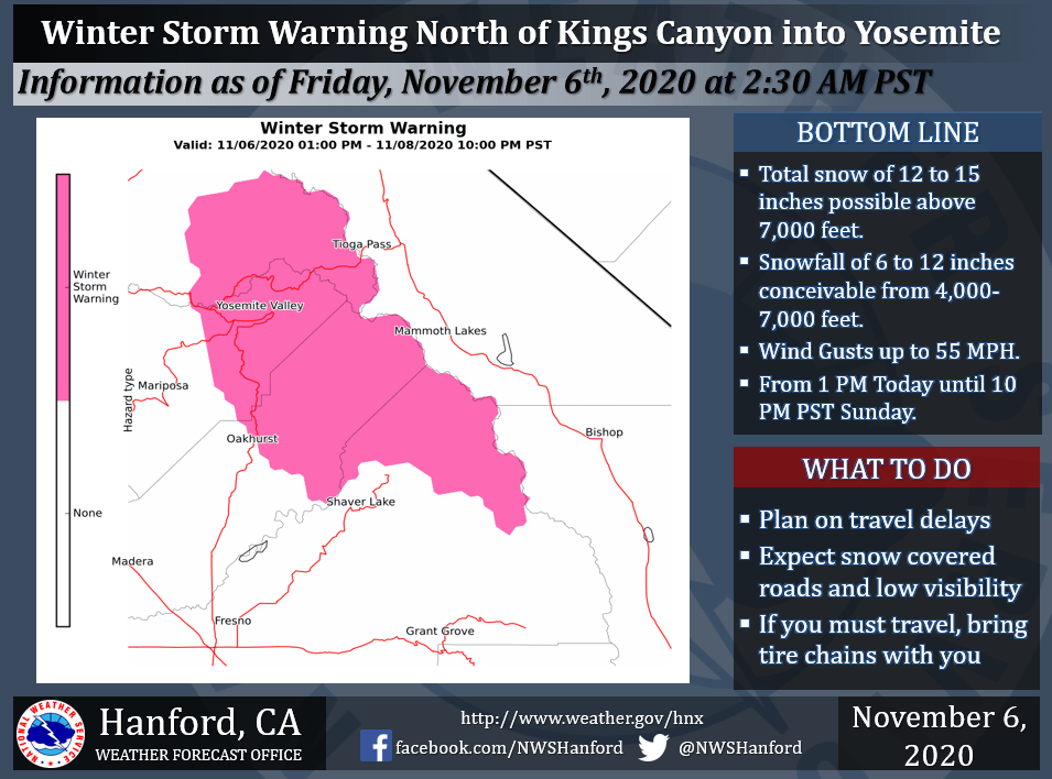
...WINTER WEATHER ADVISORY REMAINS IN EFFECT FROM 10 AM THIS
MORNING TO 10 PM PST THIS EVENING ABOVE 5000 FEET...
...WINTER STORM WARNING REMAINS IN EFFECT FROM 4 PM SATURDAY TO
4 PM PST SUNDAY ABOVE 4000 FEET...
* WHAT...Heavy snow expected above 4000 feet. Plan on difficult
travel conditions, especially Saturday night into Sunday over
Sierra passes. For the Winter Weather Advisory, total snow
accumulations of 3 to 6 inches above 5000 feet, with localized
amounts up to 8 inches, are expected. For the Winter Storm
Warning, total snow accumulations of 3 to 8 inches above 4000
feet, with localized amounts up to 12 inches, are expected.
* WHERE...Western Plumas County/Lassen Park and West Slope
Northern Sierra Nevada.
The first dusting will be today, with light snow likely above 7,500 feet. The NOAA discussion explains that most of the precipitation will be confined to the foothills and mountains but the valley may see some precipitation out of this system. Snow levels will lower during the day and early evening down to around 3500 to 4000 feet. 2 to 5 inches of snow may be possible out of this system mostly over the higher elevations with lesser amounts down to around 4000 feet. Noticeably colder temperatures will occur today as the cold low moves over the region.
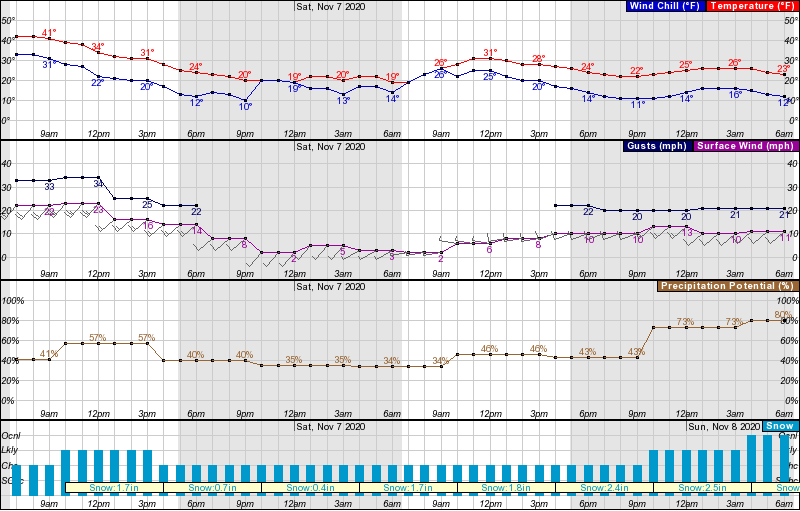
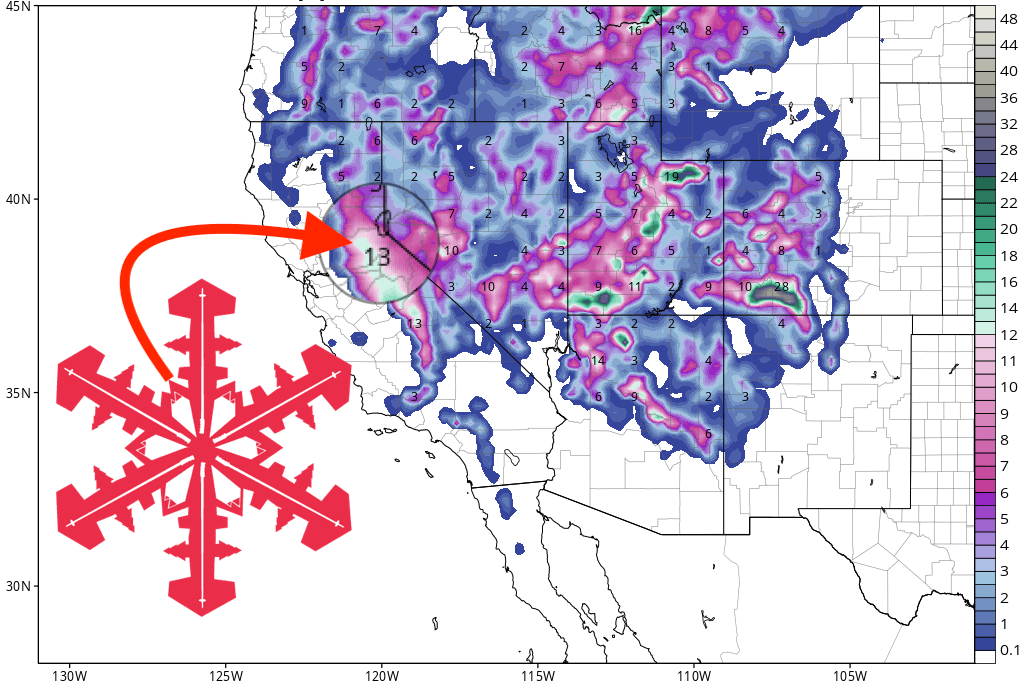
A second and stronger system will move in Saturday night with further snow on Sunday. This may bring us even more snowfall over the higher elevations than the first system but models are mixed. As a result, confidence is low on the amount of snow with this second system. Currently, we have a foot or more possible over the higher elevations.
Most resorts should see 8″ of fresh snow, with the potential for up to 18″ at Sierra-at-Tahoe, and Kirkwood.
Other Info:
How’s that 2-4″ treating ya?