Why do mountains get snow? It may seem like a simple question; mountains are high and cold, so snow forms, right? That is true, but there’s a lot more to it than just that.
To understand why it snows in the mountains, we must first understand some basic atmospheric dynamics. There are three main ways that precipitation occurs: convective, cyclonic, and orographic.
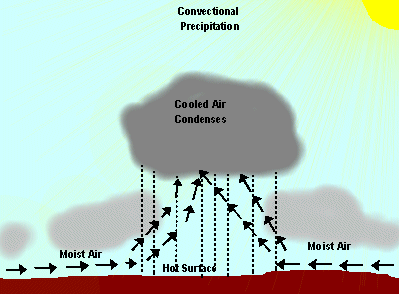
Convective precipitation occurs when air vertically rises through a portion of the atmosphere, usually driven by self-sustaining mechanisms. Said primary mechanisms are heating, moisture, and vertical forcing. Imagine a large air mass that is relatively high in humidity. The energy from the sun heats the air near the surface, which usually (but not always), combined with vertical wind or forcing, causes the air to rise. As the air rises higher into the atmosphere, it cools; cooler air can hold less moisture than warmer air, therefore the relative humidity increases as the moisture cools and ascends through the atmosphere. Eventually, the moist air hits a point where the relative humidity is 100%, and the air cannot get any colder without dispelling of water. The moisture is then forced out of the atmosphere as precipitation.
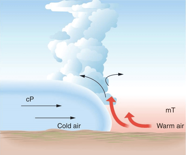
Cyclonic precipitation occurs when two temperature or pressure fronts meet. Say, for example, that a warm front was rapidly approaching a cold airmass. When the warm front makes contact with the colder air, it is forced up and over the colder air. As the warmer airmass increases in altitude, it decreases in temperature. Similar to convective precipitation, cyclonic forcing causes the warmer airmass to hit 100% humidity, which causes it to shed moisture in the form of rain.
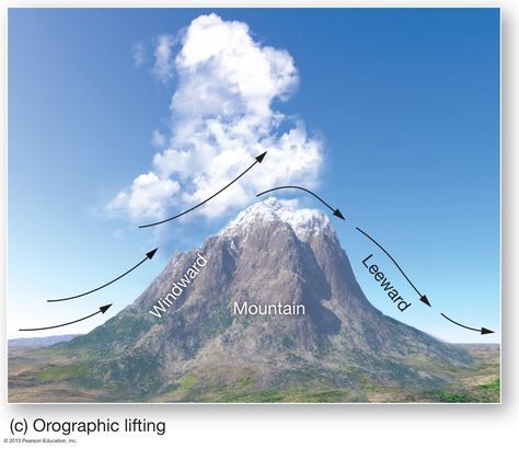
The final and most important precipitation type when discussing mountains is orographic precipitation. Orographic lift precipitation occurs when moderate to strong winds force an airmass into the leeward side of a mountain range, causing the air to lift, cooling as it goes until it reaches 100% RH, forcing moisture out as rain or snow.
Orographic and convective precipitation is the most prominent cause of precipitation in the mountains. If a storm has a lot of moisture and enough wind to rapidly force an airmass over a mountain range, orographic lift can cause some very steep snow totals. Similarly, if the conditions are ideal for convection, convective precipitation can bring strong, consistent bands of snowfall to mountainous regions. The most ideal scenario occurs when there is convective motion upstream of a mountain range, and the tropospheric airmass is saturated at or near 100% humidity. This way, when strong winds force the system into the mountains, orographic and convective precipitation occur simultaneously.
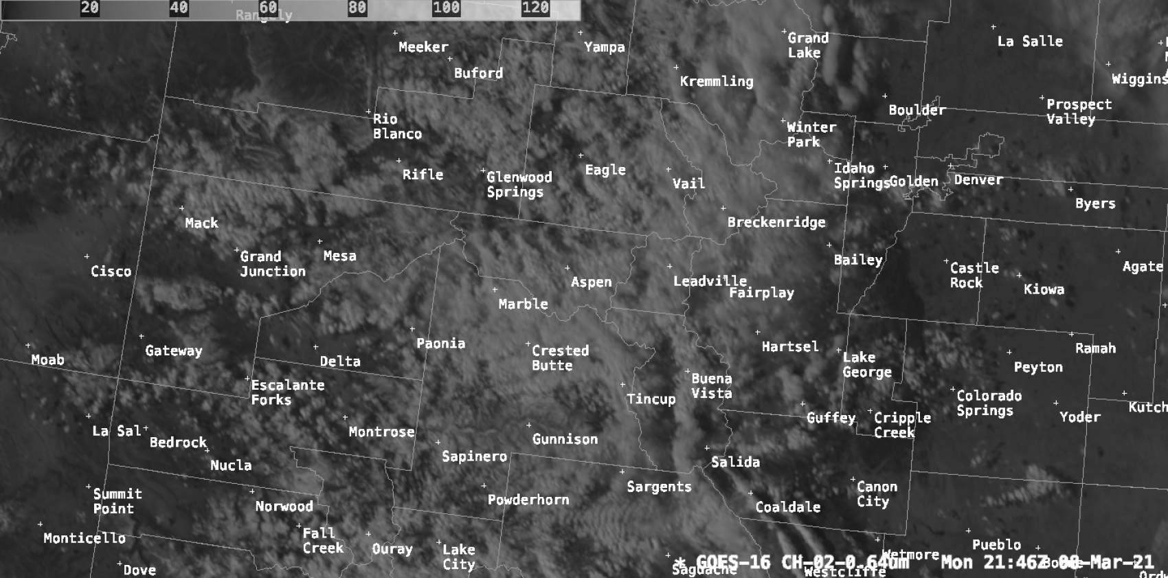
So how can you tell what is what? Typically, orographic precipitation is associated with fog or mist. This is because the clouds are low, typically forming on the flanks of mountains as air is forced into them. On satellite imagery, orographic precipitation can be identified using trapped lee waves as visual clues. As air is quickly forced up and over mountains, it can cause turbulent flows on the leeward sides of mountains, causing stationary clouds. Lee waves over Colorado are seen here on the 0.64um band from the GOES-16 geostationary satellite:
Convective precipitation, on the other hand, is associated with high, tall clouds. Convective clouds typically aren’t very close to the surface. In the following video of developing convective thunderstorms in Texas seen from the 10.35um ABI band 13 on the GOES-16 satellite, you can see airmasses proliferate upwards, cooling as they go. In this color table, warmer colors are associated with colder cloud-top temperatures and higher elevation cloud tops.
Snow forecasting is so difficult due to the myriad of factors that go into how precipitation forms. Forecast models need to take into account convection, tropospheric wind speeds, moisture, and much more in order to forecast snowfall. Tiny errors in just some of this modeling can lead to drastically incorrect forecasts. So next time your favorite weather service gets the snow forecast wrong, don’t blame them, blame the inherently complicated nature of meteorology!
Well reported Clay.
Great post! Really informative!