Brought to you by Monarch Mountain
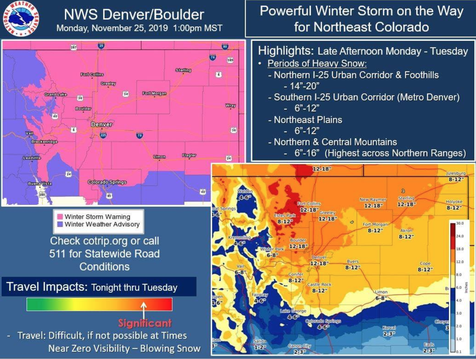
The NOAA is reporting a winter storm warning for northern Colorado. A major snow storm is now hitting northern Colorado with snow in Loveland, Fort Collins, and parts of Wyoming as far as Cheyenne.
The storm could bring historic snow totals for the month of November in Colorado.
Snow will increase in coverage and intensity as the afternoon progresses, moving into the metro-Denver area around 5pm. Snow totals may reach as high as 2 FEET or more.
- Related: Colorado’s Best Winter Festivities
* WHAT...Heavy snow expected. Total snow accumulations of 8 to 13
  inches. Winds gusting as high as 40 mph east of I-25 with areas
  of blowing snow.

* WHERE...Denver and points eastward along I-70 to Deer Trail.

* WHEN...Snow will develop this evening and will become heavy by
  late evening. There may be a brief break in the snow before the
  snow becomes very heavy by late this evening. Snow will taper
  off Tuesday afternoon.

* IMPACTS...Travel will become very difficult to impossible
  tonight through mid day Tuesday. Road closures and impassable
  side streets and rural roads are likely.
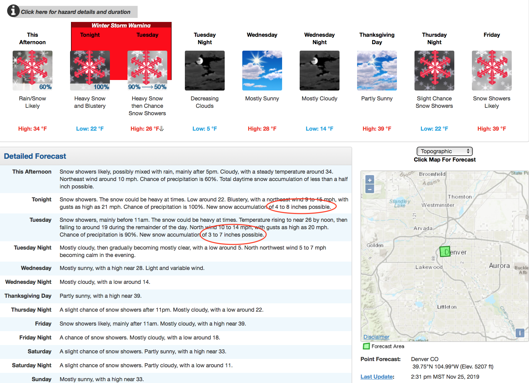
A winter weather advisory has been placed in effect for tonight through Tuesday night. This is when the storm will hit the hardest. The weather looks like it will clear up in the Denver area by mid-week only to start snowing again by the weekend. 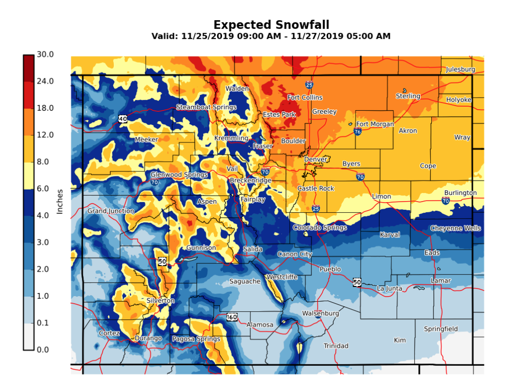
Expected snowfall 11/25/19. Credit: NOAA
The National Weather Service warns that travel will become EXTREMELY dangerous, if not IMPOSSIBLE overnight and into Tuesday morning in parts of northern Colorado. The sooner you can get home, the better. The storm could last through most of Tuesday.
Heavy snow combined with gusty northeast winds will cause visibility restrictions.
People planning travel tonight and Tuesday should consider an alternate travel
time. Travel is strongly discouraged, however if must you must travel, allow
extra time, carry a shovel and extra food. Don’t place yourself in danger. -NOAA 11/25/19

Blizzard conditions are likely due to an expected 1-2 feet of snowfall accompanied with wind gusts near 40 mph. ‘Whiteouts’ are possible and travel during the storm is strongly discouraged.
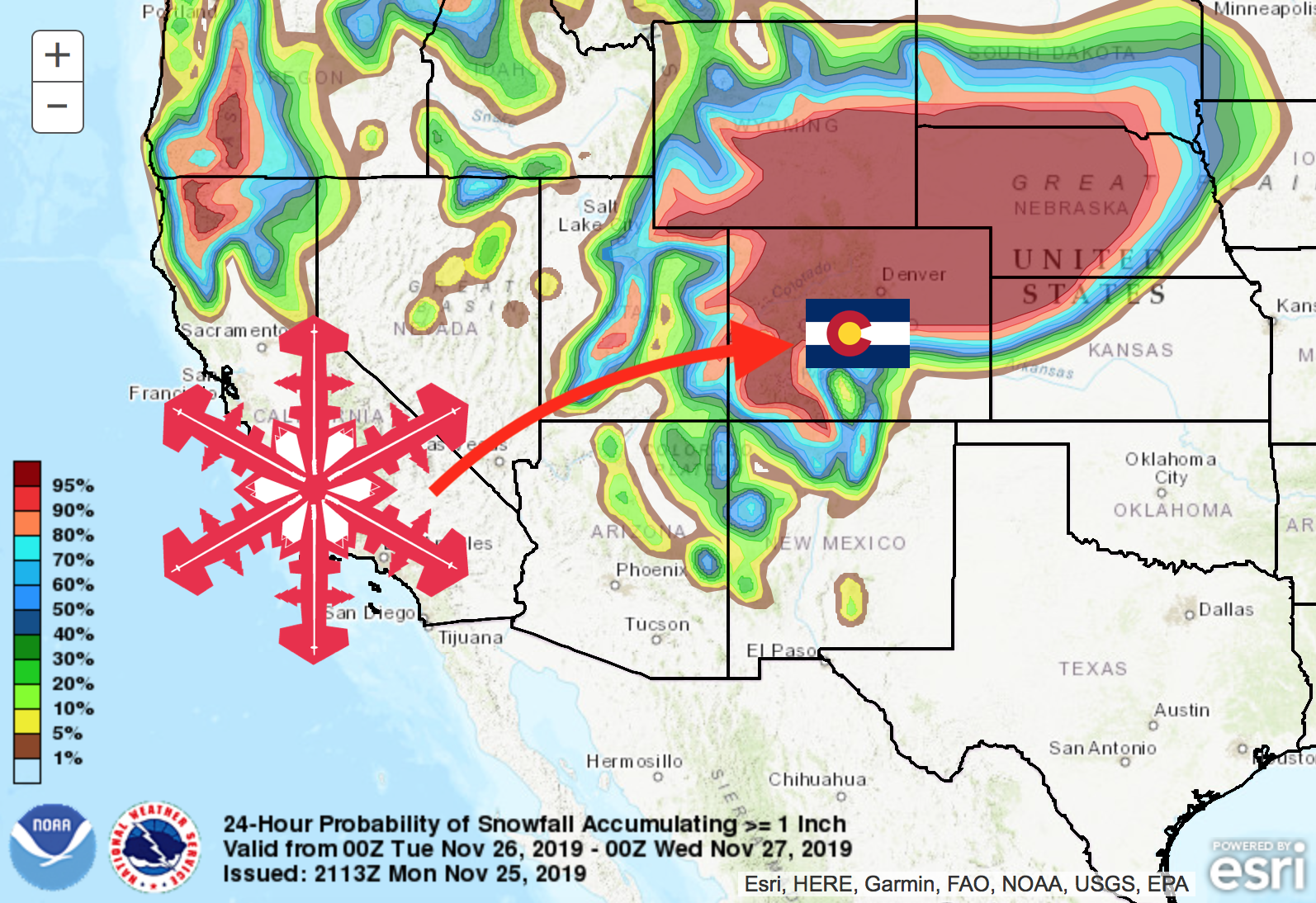
ALSO: A large spread of snowfall totals along the southern edge of the storm is possible. The greatest impacts will most likely be north of I-70.
Additional Info: