Snow levels have been relatively high as of late, but snow levels are expected to drop to 5000ft tonight. Winter Storm Warnings and Winter Weather Advisories are in effect through tomorrow.
Total snow accumulations of 2-5 FEET above 7500ft.

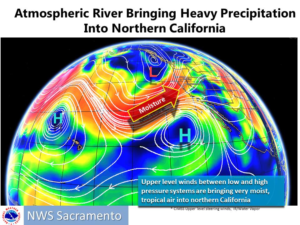
A lot of high elevation rain is falling currently, but that is expected to change tonight through tomorrow, when snow levels drop. Heavy accumulations are likely through Tuesday.

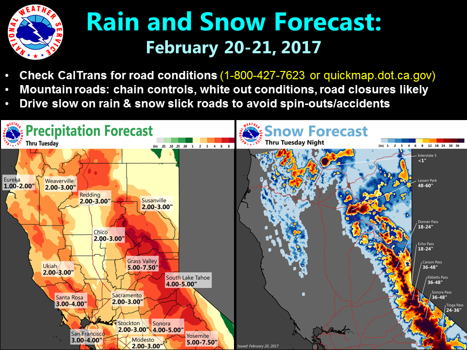
California: 2-5 FEET of Snow Total Above 7500ft
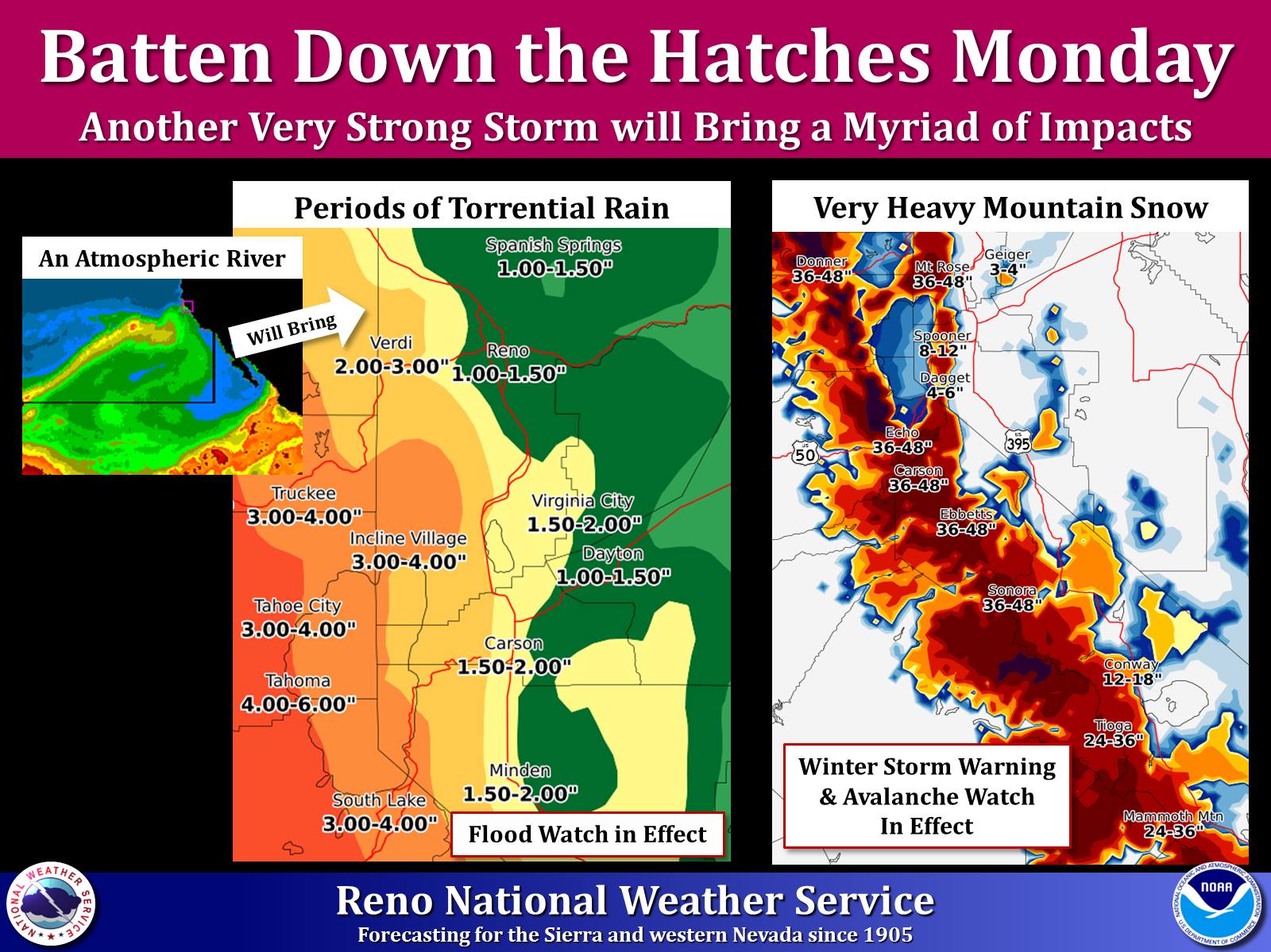
* Snow Accumulations: Above 7500 feet...2 to 5 feet. Between 6500
  and 7500 feet...8 to 24 inches. Heaviest snow will be west of
  Highway 89 and along the Sierra crest. Below 6500 feet...Up to 8
  inches mainly on Tuesday.
- NOAA Reno, NV
Winter Storm Warning:
URGENT - WINTER WEATHER MESSAGE
National Weather Service Reno NV
508 AM PST Mon Feb 20 2017

Greater Lake Tahoe Area-
Including the cities of South Lake Tahoe, Truckee, Stateline,
and Incline Village

...WINTER STORM WARNING REMAINS IN EFFECT UNTIL 4 PM PST
TUESDAY...

* Timing: Moderate to heavy snow and rain will continue through
  Tuesday with the heaviest snow expected this afternoon and
  evening.

* Snow Accumulations: Above 7500 feet...2 to 5 feet. Between 6500
  and 7500 feet...8 to 24 inches. Heaviest snow will be west of
  Highway 89 and along the Sierra crest. Below 6500 feet...Up to 8
  inches mainly on Tuesday.

* Winds: South to Southwest winds 25 to 35 mph with gusts to 55
  mph. Sierra ridge gusts over 100 mph, with peak gusts up to 150
  mph tonight.

* Wave Heights on Lake Tahoe: 2 to 5 feet with highest waves
  expected tonight from mid lake to the north and east shores.

* Snow Levels: Between 7000 and 7500 feet through this evening,
  possibly lowering to near 6500 feet at times during periods of
  heavy precipitation. Snow levels will then fall to near 6500
  feet by early Tuesday morning and below 6000 feet by Tuesday
  afternoon.

* Impacts: Heavy snow will create dangerous conditions, with
  travel being severely impacted over the Sierra passes. Snowfall
  rates will exceed 2 inches per hour at times, producing whiteout
  conditions over the passes and in the backcountry.
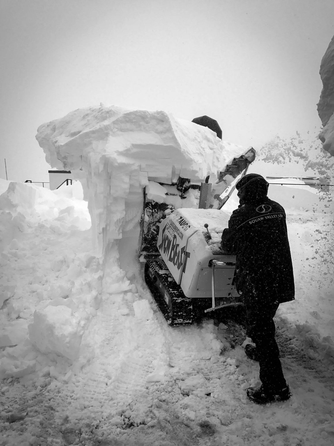
It snowed to the base of Squaw bell to bell today. Where was the rain?!!! An absolute phenomenal day. “A lot of high elevation rain is falling currently…” where exactly was that Chris?