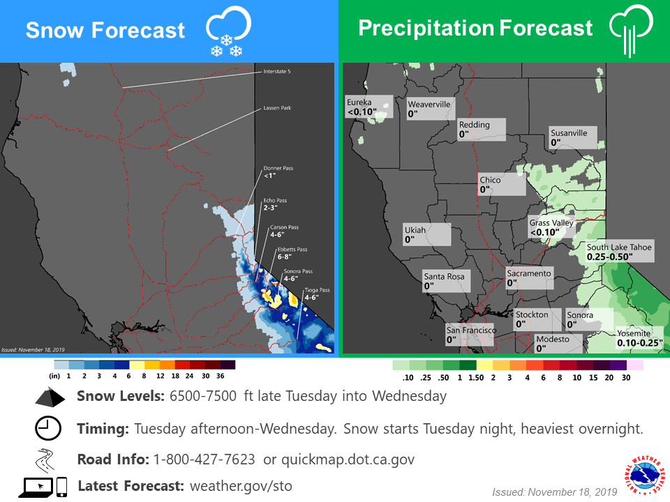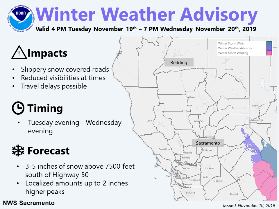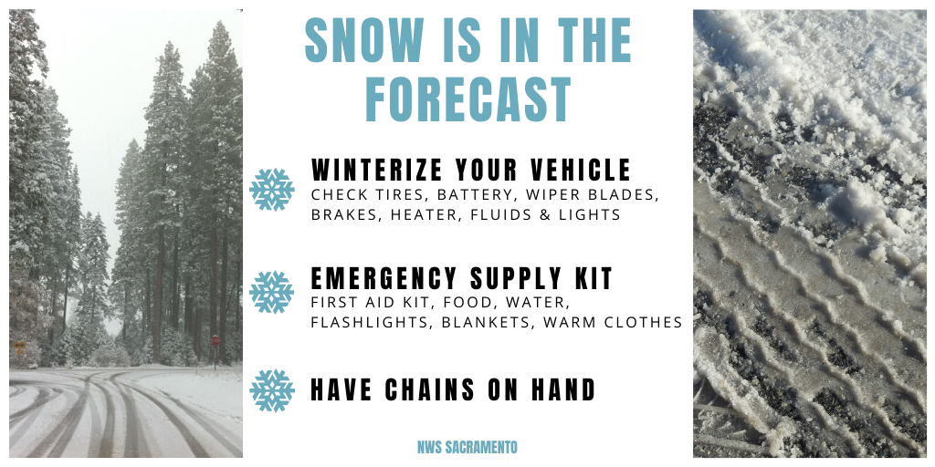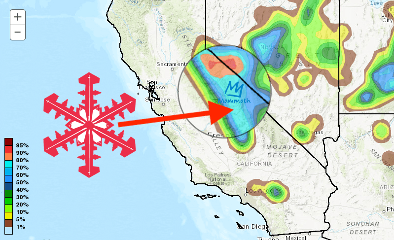
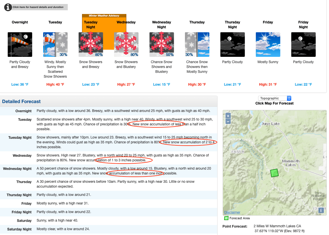
California, rejoice! It looks like winter will be arriving in the Sierra Nevada this afternoon. A special weather statement for snowfall has been issued for the Greater Lake Tahoe Area and Mono County, and a Winter Weather Advisory has been issued for elevations above 7500 feet south of Highway 50 for tonight through Wednesday evening. 3-5 inches are possible with local amounts up to 12 inches.
...A LIGHT SNOWFALL EXPECTED FOR THE SIERRA TUESDAY NIGHT AND
WEDNESDAY...
A low pressure system is likely to bring a light snowfall to the
Sierra as well as far southern Lyon and far western Mineral counties,
mainly above 6500 to 7000 feet, Tuesday night through Wednesday
evening.
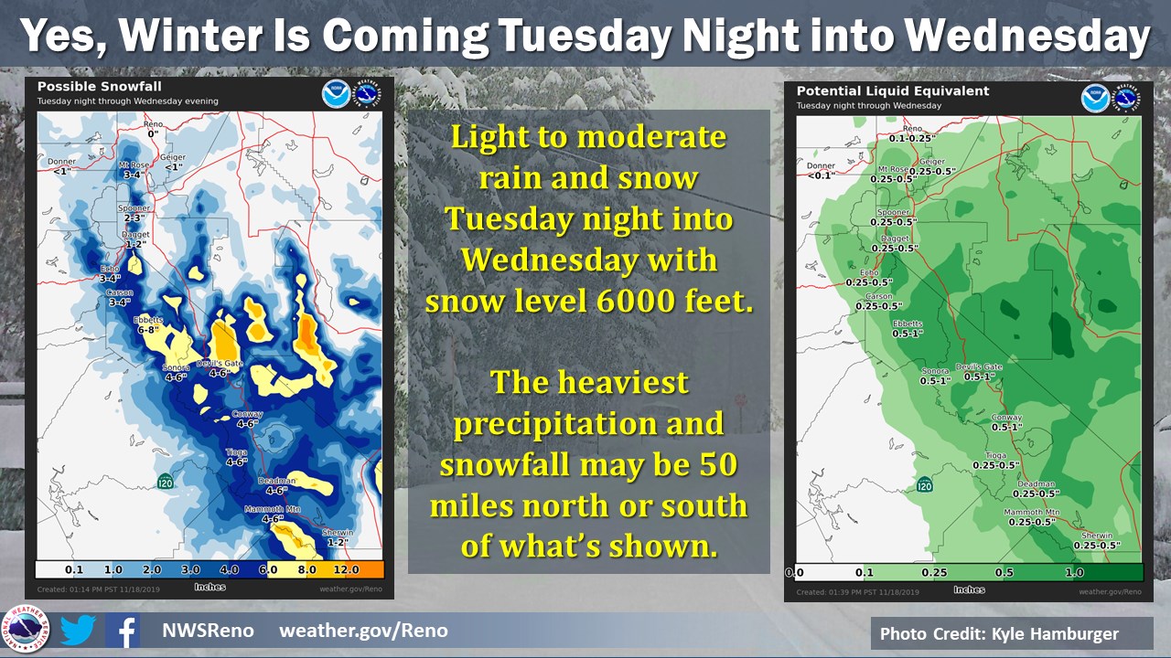
The current snowfall predictions are: 2 to 3 inches for Mount
Rose and Spooner Summits, 4 to 7 inches for Ebbetts, Sonora, and
Tioga passes as well as for passes along Highway 395. Light snow
accumulations of 1 to 2 inches are possible down to 6000 feet in
Mono County. Even though accumulations will be light, hazardous
driving conditions on these roads are likely Tuesday night into
Wednesday.
Snow levels will start near 6500 to 7000 feet then fall to near 5000 to 5500 feet late Wednesday with most accumulating snow above 6000 feet. Mammoth Mountain, which was the first Californian resort to open this season, could see up to 6″ of fresh snow with heavy snow falling at a rate of 2″ per hour at its peak.
...WINTER WEATHER ADVISORY IN EFFECT FROM 9 PM THIS EVENING TO
NOON PST WEDNESDAY ABOVE 6000 FEET...

* WHAT...Snow expected above 6000 feet. Total snow accumulations
  up to 3 inches, except 2 to 4 inches above 7000 feet. Locally
  higher amounts in excess of 4 inches are possible where heavier
  bands set up.

* WHERE...Mono County above 6000 feet.

* WHEN...From 9 PM this evening to noon PST Wednesday. Impacts
  will begin at area passes above 7000 feet late this evening and
  gradually lower to roadways down to 6000 feet by Wednesday
  morning.

* IMPACTS...Plan on slippery road conditions especially across
  area passes along Highway 395. The hazardous conditions will
  impact the morning commute Wednesday.
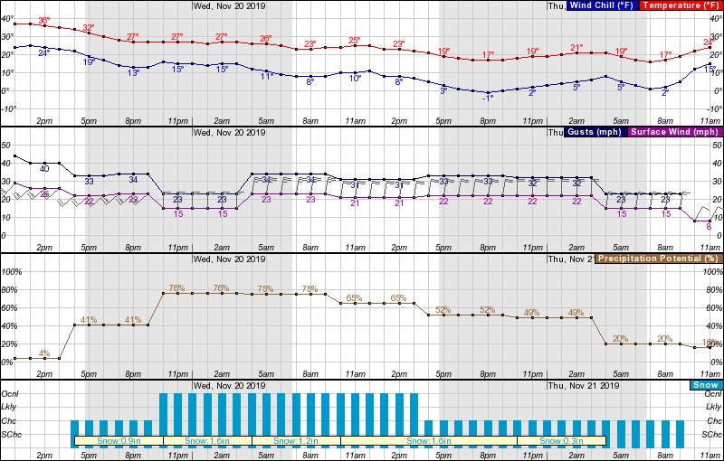
Temperatures will drop to the low teens as the storm moves through, and expect winds gusting up to 34-mph. As the week progresses, precipitation will stall, but winds and low temperatures will remain. Long term, there may be snow early next week. We will keep you updated!
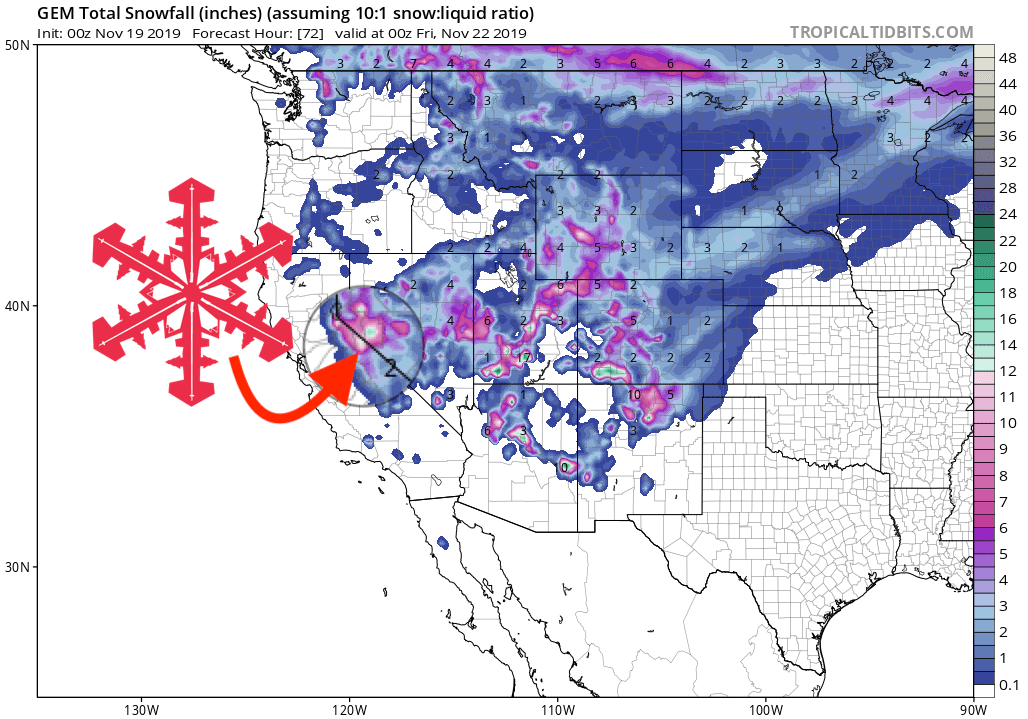
GEM Snowfall Forecast Model:
Other Info: