A slow start to December with warm temperatures and clear skies had a lot of us skiers in Colorado skeptical about the season to come. The latest positive El Nino conditions have kept temperatures warm and the air moist, but haven’t provided the consistent storm track we need. The 2-3 feet that fell during the end of November was all we were left with until the two systems that have come through Colorado in the past week. Starting this past Saturday night, a warm and very moist system moved into Colorado from the southwest. Projected storm totals were low because the storm did not seem to have the vorticity, or strong vertical uplift, required to get the max snowfall and also because the warmer temperatures implied denser than the average December Colorado storm. Regardless of storm totals, the prospect of dense, more stable base building snow excited me.
The storm started with a southwest flow hitting the southern and central mountains and as the trough moved to the east, flow across Colorado changed to northwest and the northern mountains joined the fun. By early Monday morning, the Berthoud Pass Snotel read 14″ of new snow. Wind remained relatively calm during and after the storm, although there was minor wind slab development on SE through W aspects. Here in Colorado, a storm without high winds, especially after the storm passes, is very rare and a boon when it comes to snowpack stability.
Monday through Wednesday night flakes stayed in the air, but new accumulation was limited to an inch or so each day. On Thursday, a quick storm clipped us from the west and most areas saw about 4″.
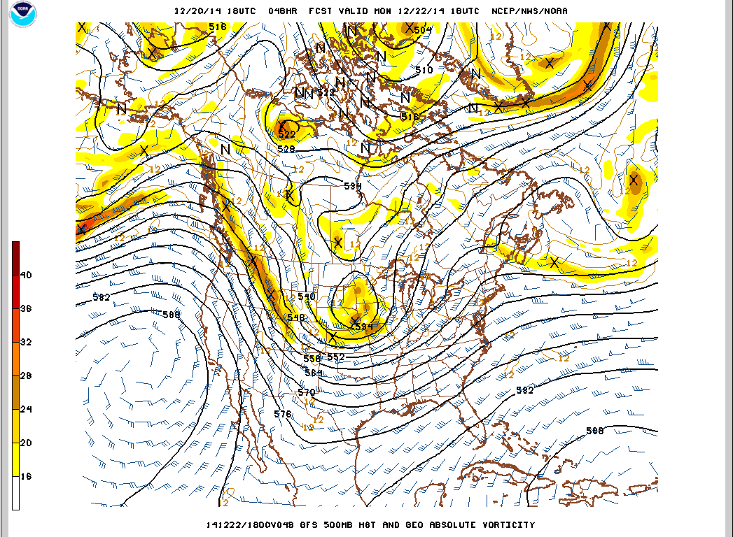
Tonight is the jet stream will make a big move directly over Colorado and should provide cool, moist air to give us dumps for days. Models are showing almost 4″ of precipitable moisture in the air. The northern mountains are projected for 1-2+ feet through Tuesday, while the central mountains and northern San Juan’s should get 8-12″.
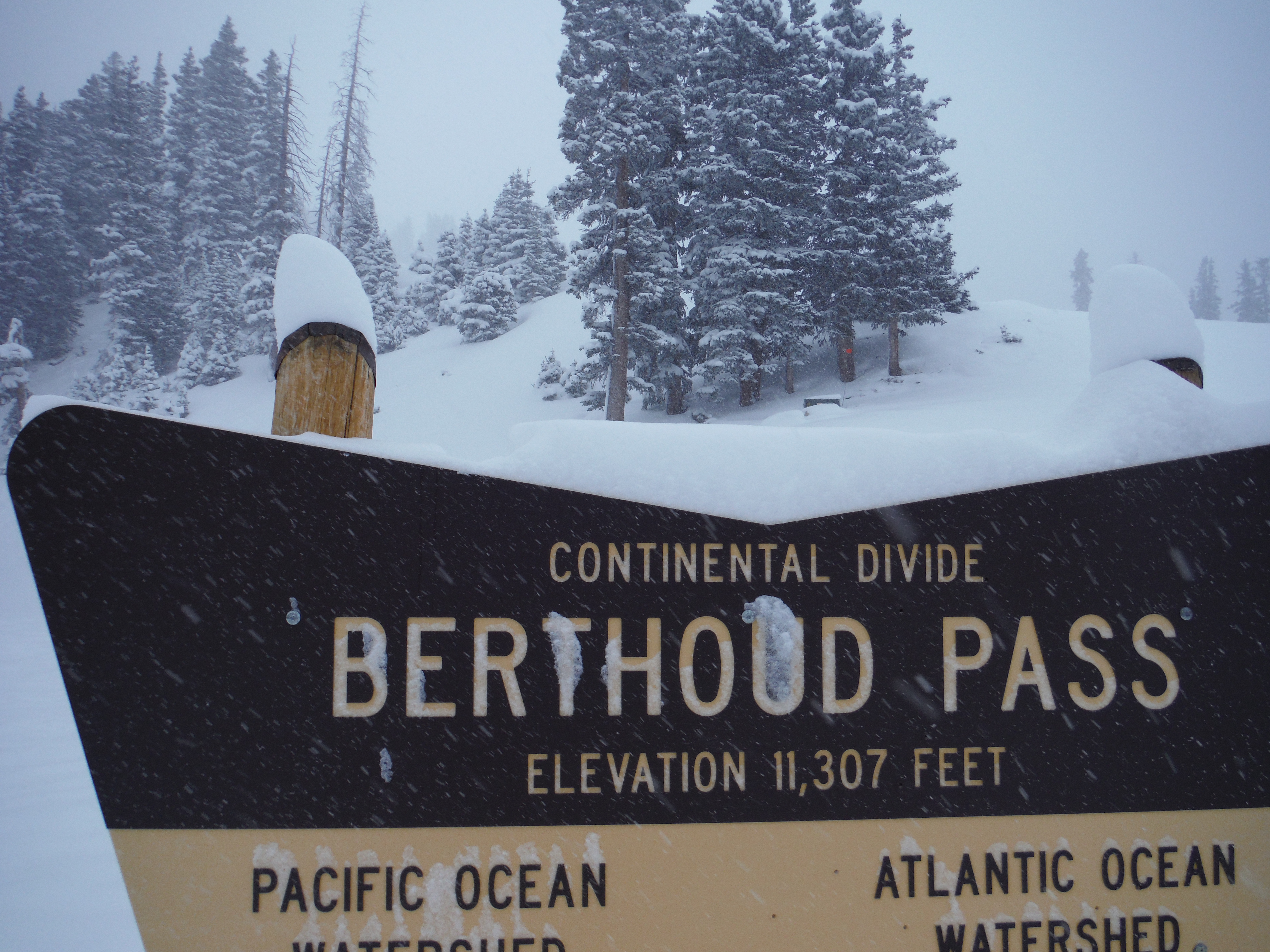
This past Sunday I made my way up to Berthoud Pass to score some powder for the first time in the Front Range for almost two weeks. I had not been up in the backcountry since the last storm cycle, so I was curious how the snowpack had changed and what this new storm meant for stability and base building. Prior to the storm, the Colorado Avalanche Information Center had reported low avalanche danger at all elevations. There was concern over persistent slabs that formed with October and November snowfall, mostly on NW to ENE aspects. We arrived at 8 AM and were surprised by 10-12″ at the parking lot, which sits over 11,000 feet. Lower elevation totals were significantly less. This was probably due to the above average temperature this storm from the central Pacific brought. Accumulations on the east side of the continental divide were 3-4″ lower on account of the northwest flow. It snowed throughout the day and the pass probably picked up another 4″ while we were there.
We skinned up the west side of the pass to the base of Russell’s Face. I was expecting that the alpine held on to a good portion of the late November storms, but was surprised to see that most of the snow had either been blown into the trees and gullies or had melted during the warm stretch. Only the new storm snow covered most of the alpine. We headed north and down into a gully, where the snowpack was much deeper.
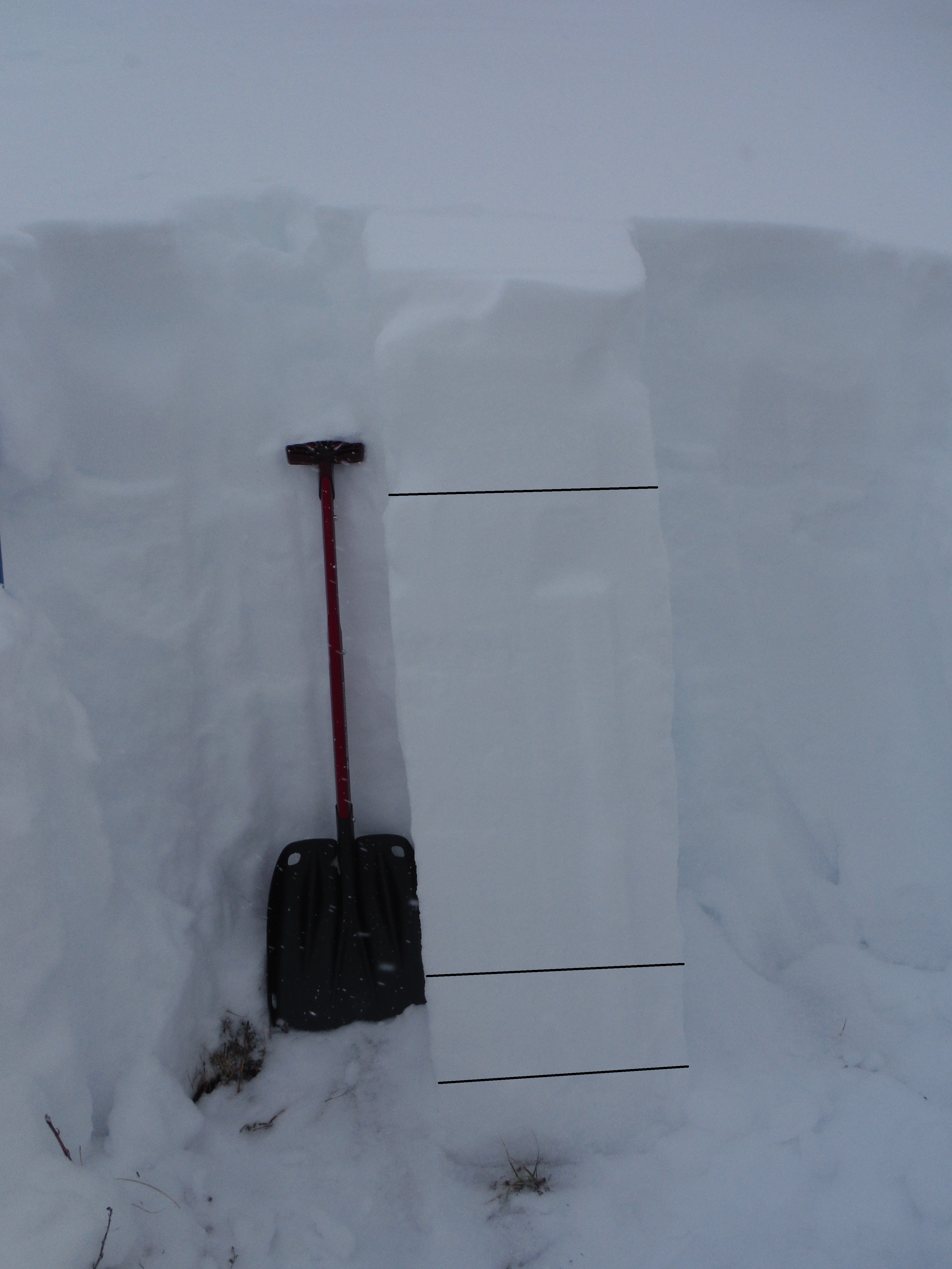
We dug a pit on a SSE slope at around 11,500 ft. The pit showed 4 distinct layers. There was 35 cm storm slab. This sat on top of a suncrust that formed on the top of a well consolidated layer. The storm slab was poorly bonded to the suncrust so we knew that sluff would be intense. The lower few cm of the storm slab were denser, due to the warm temperatures and SW flow the storm started with. The well consolidated layer was about 50 cm thick and was from the late November storms. Beneath this layer was another suncrust on top of a 10 cm persistent slab. This slab is the persistent slab the CAIC has been concerned about, even though we were on a different aspect than they were concerned with. I suspect this was due to wind deposition and local shading that helped this area hold onto early season snowfall. After a quick compression test, this was the only layer to fail at a 26. The shear quality was poor, Q3. An ECT showed non-planar break. We were surprised by only 6-8 cm of depth hoar. The depth hoar wasn’t even that well developed.
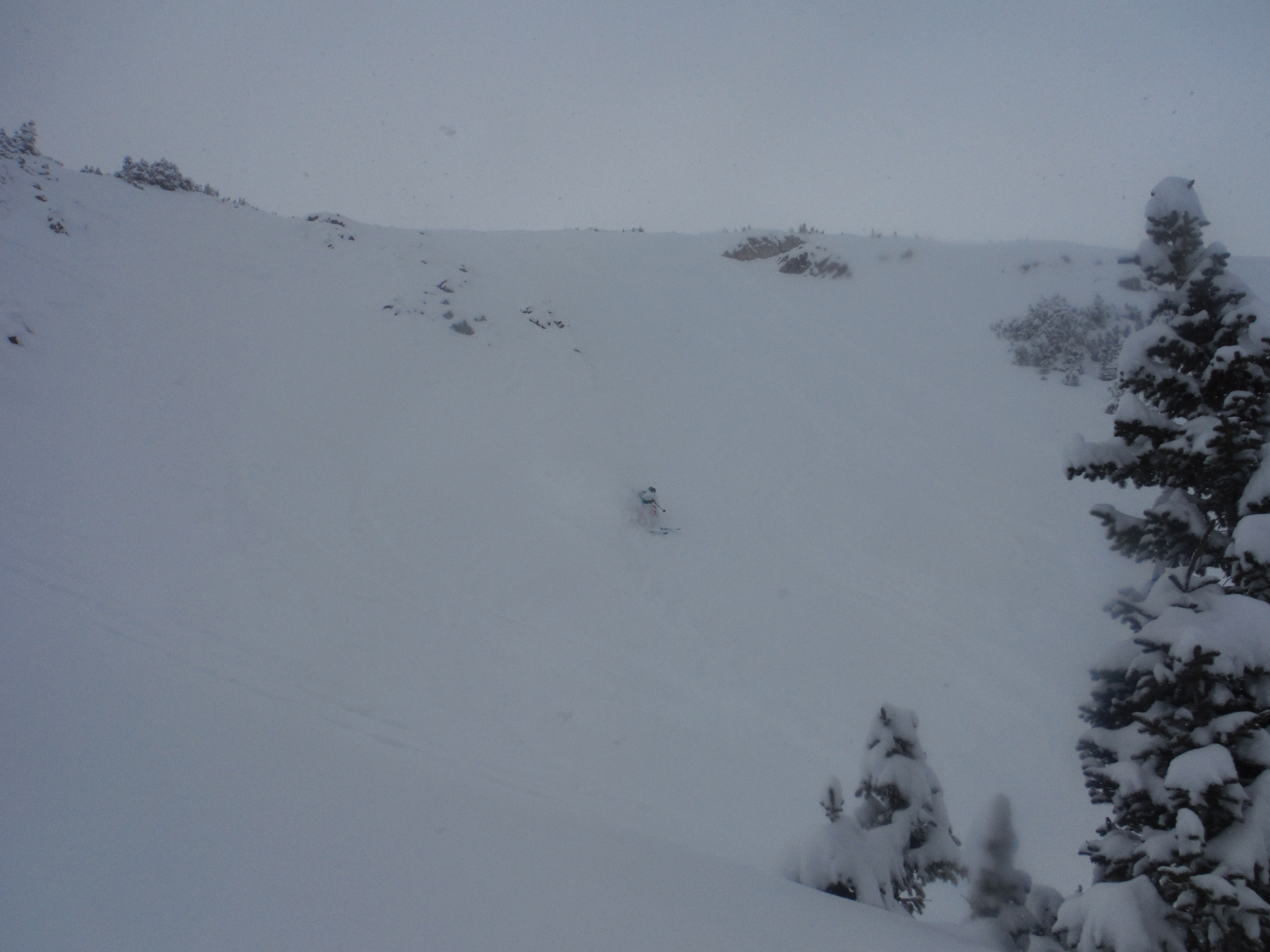
We decided to ski a ESE chute off of “Hidden Knob,” which was just above us. I ski cut the slope, sending a 20 ft wide slow rolling sluff-train down the 32 degree chute. The skiing was still phenomenal, especially as we entered the trees below the chute.
This next storm should lead to amazing conditions pretty much everywhere, but especially in the Front Range. Large storm totals will test the persistent slab layer, so be weary of the potential for large avalanches. On the bright side, this upcoming storm looks like it will drop slightly denser snow than we are used to in December/January in Colorado. Lets hope that this bonds well to the old snow, doesn’t blow around too much and makes for safe and deep conditions for the next week or two!
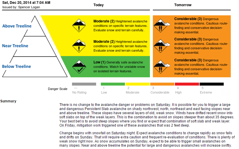
CAIC Front Range Avalanche Forecast 12/20/14