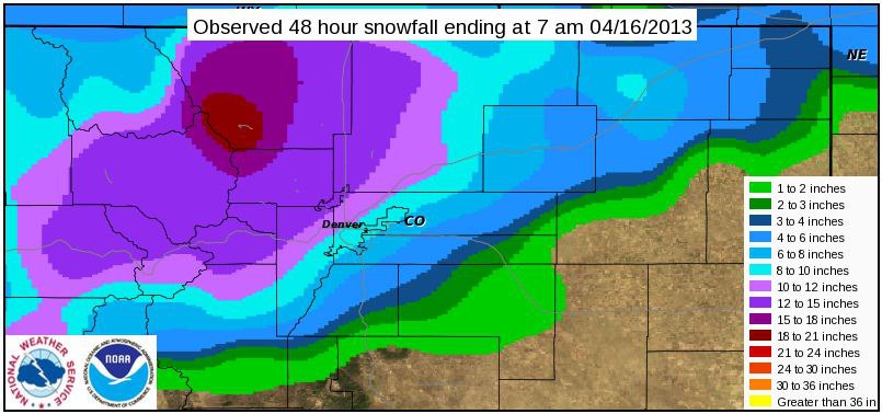
Big snow rolled through Colorado in the past 48 hours with some resorts reporting up to 20 inches in that timeframe. It’s been a relatively dry season in Colorado this year, so ending the season like this is a true blessing.
Avalanche Danger is HIGH is many areas of the Front Range. Be smart out there and check the CAIC website before you go out: Colorado Avalanche Information Center.

COLORADO OVERNIGHT SNOW TOTALS:
– Winter Park = 12 inches
– Loveland = 11 inches
– Aspen Highlands = 10 inches
– Arapahoe Bain = 10 inches

COLORADO FORECAST:
– Tuesday = Snow band comes through this afternoon. Some spots will see heavy snow.
– Wednesday = Small bursts of snow midday.
– Friday = “A new storm moves through in northwest flow on Friday night through Saturday night with a good chance of another 3-6 or 4-8 inches for areas favored by this flow, including most of the remaining resorts that are open (Loveland, Abasin, Winter Park, and a bit less at Aspen Highlands).” – Joel Gratz/opensnow.com
– Monday = Possibility of more snow early in the week next week
It’s looking solid out there and we’re hearing reports of crazy good late-season skiing. Some resorts are extending operations based on this new snow and we’ll get you a post on that tomorrow. Have fun.
But most CO ski areas are CLOSED for the season.
??? ??? ??? ???? ?????
If you could only see my blank-eating-grin right now.