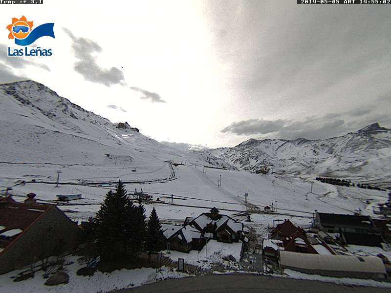
Las Lenas and the Andes got hit pretty hard by an early season storm at the beginning of this month. Most of the energy hit Las Lenas north into the Santiago mountains.
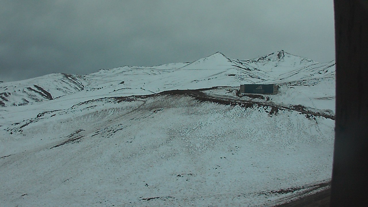

This last storm that hit was not particularly a cold storm it started off with some wet paste, and then turned to rain briefly at the base of Las Lenas, which sits at 7,349. The second portion of the storm was colder and they received a considerable amount of snow. The goal for this Austral winter is to provide a forecast specific to the Las Lenas area, while providing a general idea for what is going on in the rest of the Andes.
Currently Las Lenas was getting brushed by a storm that looks to be moving into the Termas de Chillan region. Leaving them on the warm side of the jet with a ridge building in leading to a significant warm up the next few days. The pattern looks to remain active to the south through the remainder of the week with a zonal flow hitting the Patagonia area.
Long range outlook
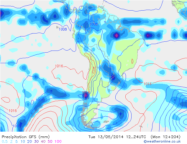
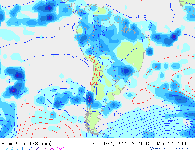
The long range models have been looking interesting the last couple of days. Currently it shows the possibility of another storm cycle hitting the Las Lenas region starting on Tuesday the 13th and extending through the 18th and possibly beyond. It looks like ridging shifts to the south building into the Bellingshaussen Sea sending the jet stream just south of Las Lenas and then eventually driving it further to the north into the Santiago region. This is just an outlook at this stage but confidence is high for how far out it is considering how well the models have been performing.
Fantasy charts
The climate forecasting system (CFS) has been performing really well in both hemispheres especially considering we are in between seasons. It predicted the storm that just hit the Tahoe area end of April a month in advance, and it predicted the storm that just hit Las Lenas three weeks ahead of time. Currently the CFS is promoting the continuation of the storm cycle that is predicted to begin on the 13th for Las Lenas extending through the 23rd of the month. Then beyond that it looks like June starts off stormy after a week break or so.
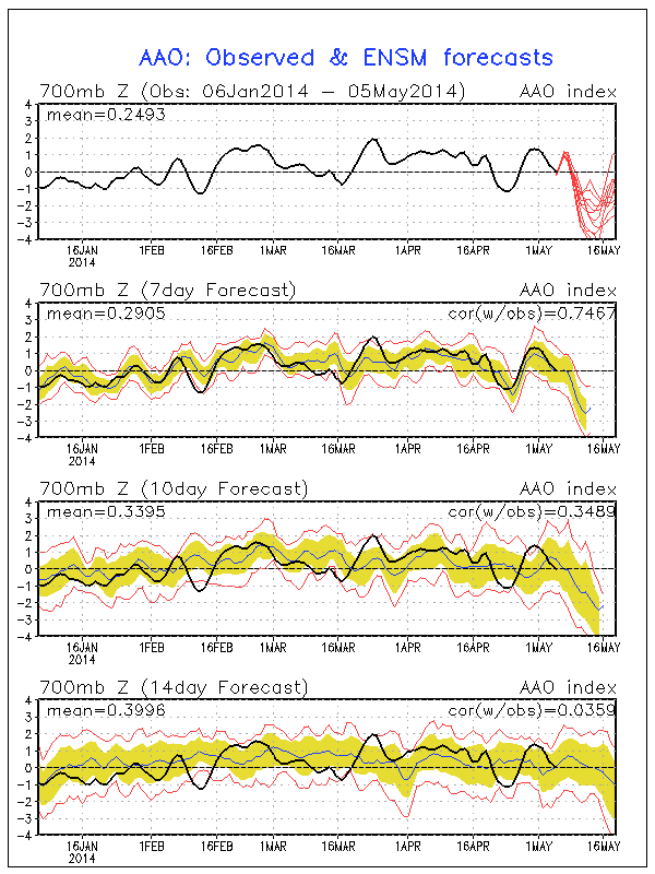
El Nino showing its signature in the Southern Hemisphere
There is a definite correlation that can be drawn from both the storm that hit Tahoe and this early season dump to hit the Andes. The belief is it is in response to the Kelvin Wave that is moving through the Pacific. The current models are showing a strong block in the Bellingshaussen Sea forming with a corresponding severe spike predicted in the Antarctic Oscillation (AAO) driving the jet stream and cold air north from the Antarctic.
This pattern mimics what would happen during a moderate to strong El Nino in the Southern Hemisphere. Is this a sign that El Nino is forming? The verdict isn’t officially out yet but the atmosphere is definitely showing sings that it is. It will be interesting to see what happens because during especially a strong El Nino Las Lenas gets hammered. If the El Nino prediction verifies Las Lenas will have a great season, and it will provide insight to the strength of our next winter here in Tahoe.
One thought on “Will El Nino = Big Snow for South America? | Early Storm Hits the Andes…”