On Monday, Strava, the subscription platform at the center of connected fitness, announced the acquisition of FATMAP, a mobile app for discovering, planning, navigating, and memorializing outdoor adventures. The acquisition will give Strava subscribers access to the full FATMAP offering.
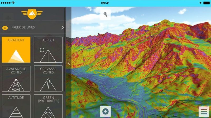
FATMAP is a 3D mapping and outdoor navigation company used heavily in the backcountry. I love FATMAP, it has all the features I need to get beta on backcountry lines. The gradient tool is crucial in scouting safe routes through the zone you plan to explore.
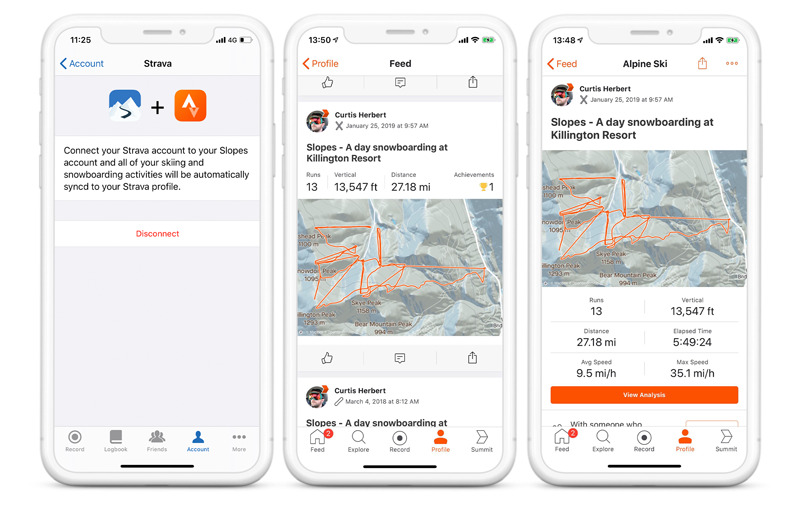
If you’re unfamiliar with Strava, it’s a social fitness network and app that allows users to track their athletic activities, such as running, cycling, skiing, snowboarding, and almost everything in between. Strava’s social network has created friendly competition in all activities by challenging your friends to beat your best time, distance, etc. Read how Strava users can track their day on the slopes.
Misha Gopaul, Founder and CEO of FATMAP, said this on the partnership: “We started FATMAP with a mission to make outdoor experiences more accessible. Where other map platforms have been designed for navigating streets and cities, we wanted to build a map designed specifically to help people explore. Joining forces with Strava opens up new exciting possibilities and will accelerate our progress to enable millions more people to explore the world’s wild places safely and sustainably.” Read more on FATMAP’s press release.
FATMAP ensures its customers that subscription prices won’t change due to the partnership. Users will continue to have the same access to the features they enjoy, but as the integration develops, users should expect an increase in benefits and features.
Strava is equally excited to apply the 3D maps of FATMAP to its platform. In its January 23rd press release, Strava said this about the partnership. “FATMAP has built a global proprietary 3D mapping technology that will be enabled in all of Strava’s services, empowering active individuals to holistically discover and plan an outdoor experience with curated local guides, points of interest and safety information.”
Both companies are leaders in their respective fields. The integration of both products could mesh the incredible social network of Strava with the immense backcountry data FATMAP possesses. It seems like a perfect match to me. As a user of both products, I cannot wait to see how this partnership improves both platforms.
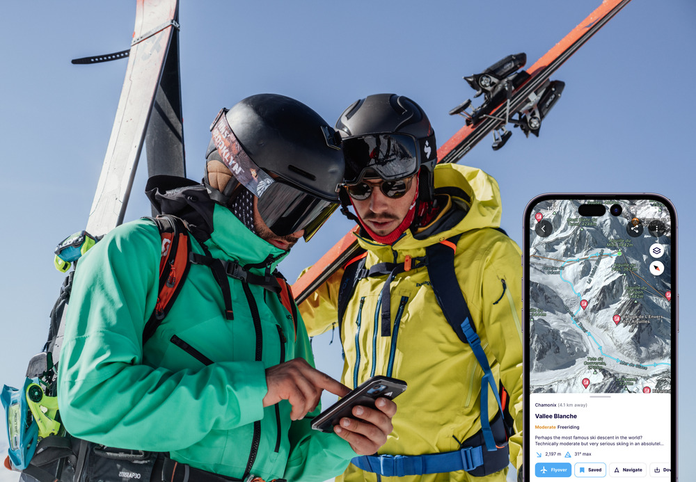
If you are curious about how FATMAP can help you navigate your way on your next ski tour, check out this article by Charlie Boscoe.