To say it’s been a slow start in the Northwest (Baker, Whistler and Vancouver’s North Shore) would be an understatement. A cold, dry November followed by warm December left little to no snow on key mountains making opening dates slow and bleak, but this weekend gave the west coast snow scene a huge boost.
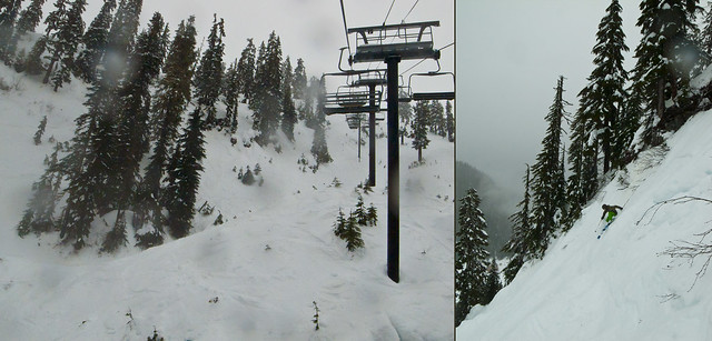
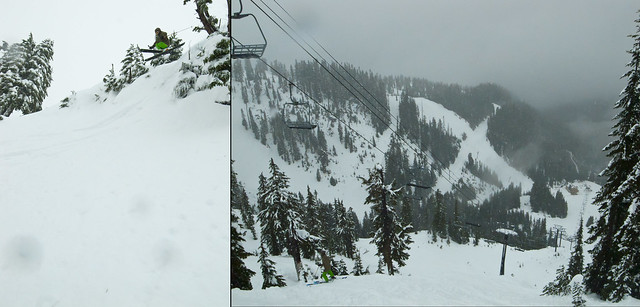
The first big storm of the season pushed through dropping a total of about 50 inches of snow on Mount Baker and Whistler between Wednesday and Sunday providing for deep powder and a near doubling in snow base.
With constant snowfall from Wednesday through to Sunday, good skiing was had all weekend long and tracks were filled in as skiers took their lines and trumped the famous Baker steeps. Even some snow was left some to play with Monday when Snowbrains reporters were able to make the trek down from Vancouver to see what the storm had produced.

As the week progresses, the storm will make it’s way out as clearer skies will appear bringing what could seem like spring skiing conditions until the next storm makes its way through (which has not yet made it’s way into the 14 day forecast).
If you missed out on the fresh snow this weekend, the temperatures have risen bringing a little rain to soften things up and slow them down, but there is still fun to be had. The thick layer of recent snow is still loose and forgiving for riding the bigger lines and taking some good turns.
Despite a recent warming, the storm left behind a strong base depth which should be added on as the Pacific Ocean reaches it’s coolest temperatures in January and February bringing in cooler average temperatures throughout the Northwest Region.