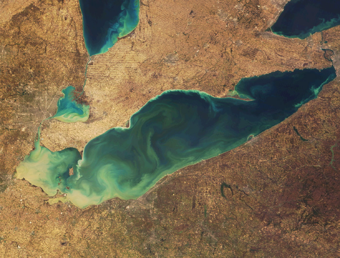
According to the latest issue of the journal “Science,” Earth’s glaciers lost 260 gigatons of water every year between 2003 and 2009. To put it in layman’s terms, that’s 1 Lake Erie (240 miles long 57 miles wide, average 60 feet deep) every 2 years.
“There was a large amount of uncertainty in how much these glaciers were contributing to sea-level rise prior to this study. What our study provides is a really strong estimate for what the glacial contribution was over this time.” – lead researcher Alex Gardner, a professor of geography at Clark University in Massachusetts/livescience.com
The study found that glacial melt contributes to 30% of sea level rise right now. Between 2003 & 2009 the ocean has risen about .03 inches per year from glaciers alone.
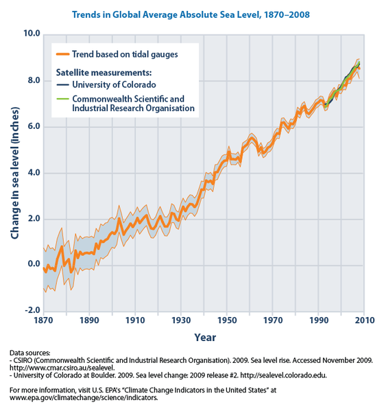
Since 1870, the ocean has risen over 8 inches worldwide:
A separate study (November, 2012) conducted on Earth’s ice sheets, showed that ice sheet melting on Earth contributed to 2.2 inches of sea level rise since 1992.

Glaciers are very difficult to measure due to their remote locations and difficult local climates. Before 2002, researchers had to hike out to glaciers, violate them with instruments, take measurements manually, and do a lot of guess work.
Since 2002, NASA has gotten involved with 2 projects to assist with tracking glaciers and their melt water amounts.
1. GRACE (Gravity Recovery and Climate Experiment) uses 2 satellites to measure the Earth’s gravitational field and it’s variations. When a glacier gains or loses ice, it alters the Earth’s gravitational field. From these gravitational field variations, GRACE satellites can measure net gain or loss in glacier mass. These 2 satellites were launched in 2002 and 2003.
2. ICESat (Ice, Cloud, and land Elevation Satellite) measured the Earth’s elevation across the globe. These elevation measurements were able to reveal changes in glacial ice thickness.

These remote measuring techniques have revolutionized the way we measure glacial meltwater’s contribution to rising sea levels. Scientists know these numbers are very important but they aren’t just yet treating them as acutely accurate.
“All we know is that every region on Earth right now, regardless of any additional warming, is losing glacial mass to the oceans. We anticipate that the rate will increase with additional warning.” – lead researcher Alex Gardner, a professor of geography at Clark University in Massachusetts
so shocking
thanks to all people the world aready keep my soul my life everythink….so I want to tell all people greenland is man…maybe 30 year again can die….. so becareful…@jakarta 26 august 2013….RB GREENLAND
Bye bye Manhattan
surf’s up brah!