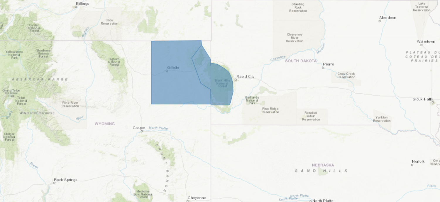
The National Weather Service has issued a Winter Storm Watch for the Black Hills of South Dakota and Wyoming. It’s in effect from late Saturday Night through late Monday Night. Heavy snowfall is forecasted to impact the area throughout that time period. There is low confidence in the snowfall amounts on the plains.
“The rain will change to all snow Sunday night. 6 to 10 inches of snow is expected for the Black Hills Sunday through Monday. Snowfall accumulation across the plains of northeast Wyoming and northwest South Dakota will be very dependent on when the rain changes to snow and where the heaviest precipitation is located. At this time, it looks like 4 to 8 inches of snow is possible for northeast Wyoming.”
– NOAA Rapid City, SD
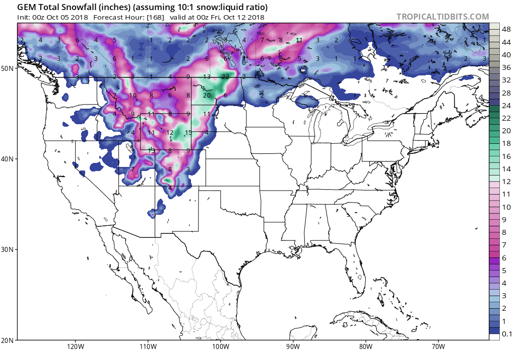
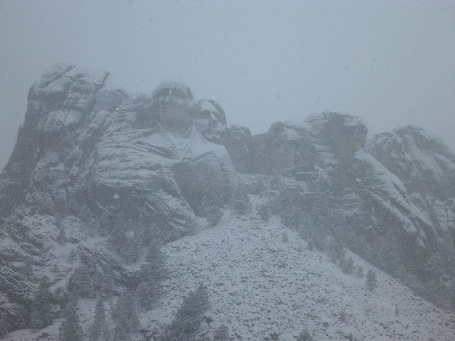
Heavy snow accumulations will likely be constrained to the mountains, but a small change in temperature could change that.
Additional Storm Info:
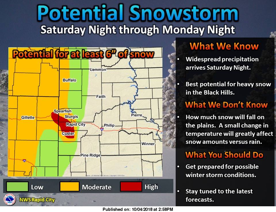
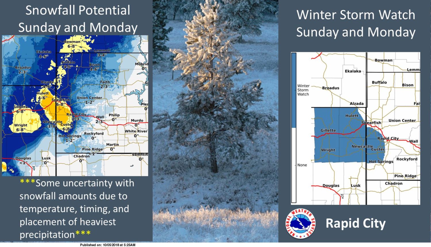
Black Hills: 6-10+” of Snow Saturday Night – Monday Night
* Heavy snow possible. Total snow accumulations
  of 6 to 10 inches possible.
- NOAA Rapid City, SD
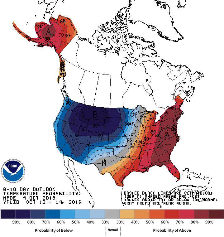
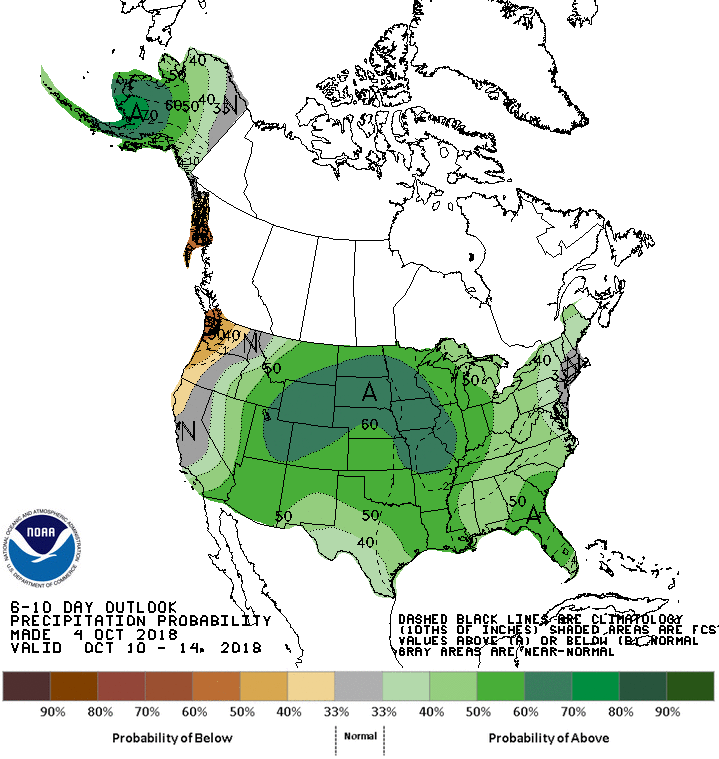
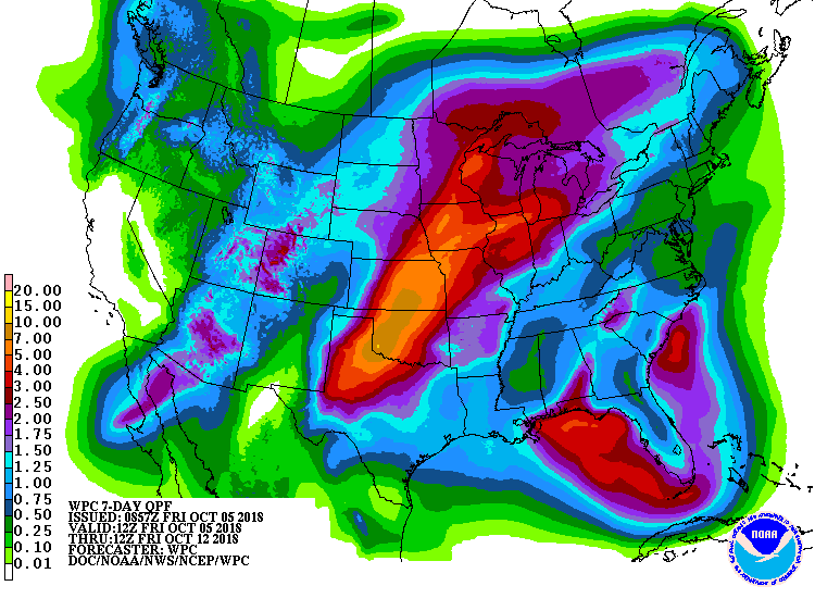
The 6-10 day outlook calls for above average precipitation and below average temperature for the Black Hills.
Winter Storm Watch:
URGENT - WINTER WEATHER MESSAGE
National Weather Service Rapid City SD
417 AM MDT Fri Oct 5 2018

...SIGNIFICANT SNOWFALL POSSIBLE SATURDAY NIGHT THROUGH MONDAY
NIGHT...

.A potent storm system will move into the region Saturday night,
bringing a long duration of snowfall to northeast Wyoming and the
Black Hills. By Monday night, 4 to 8 inches of snowfall will be
possible across much of northeast Wyoming, and 6 to 10 inches of
snowfall will be possible across the Black Hills, with locally
greater amounts over the highest elevations. Winds should remain
fairly light, so blowing and drifting snow are not expected to
cause significant impacts.

Northern Black Hills-Central Black Hills-Southern Black Hills-
Wyoming Black Hills-
Including the cities of Lead, Deadwood, Hill City, Mt Rushmore,
Custer, Four Corners, and Sundance

...WINTER STORM WATCH REMAINS IN EFFECT FROM LATE SATURDAY NIGHT
THROUGH LATE MONDAY NIGHT...

* WHAT...Heavy snow possible. Total snow accumulations of 6 to
  10 inches possible.

* WHERE...In Wyoming, the Wyoming Black Hills. In South Dakota,
  the Northern Black Hills, the Central Black Hills and the
  Southern Black Hills.

* WHEN...From late Saturday night through late Monday night.

* ADDITIONAL DETAILS...Travel could be very difficult.