The National Weather Service has issued a Special Weather Statement for Jackson Hole Mountain Resort, WY. Accumulating snowfall is forecasted to impact the area Tonight – Saturday morning. The resort has already received nearly 5 FEET of snow this season.
Jackson Hole Mountain Resort:
- 4-6″ of Snow Tonight – Saturday Morning
This snow comes at the perfect time, as JHMR opens for the season on Saturday, November 24th, 2018.
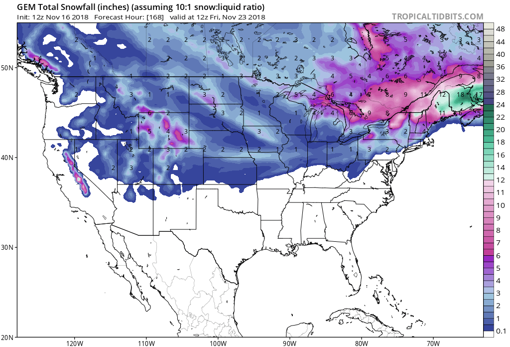
Snow is forecasted to fall at all elevations, but the heaviest accumulations will be in the Teton and Gros Ventres.
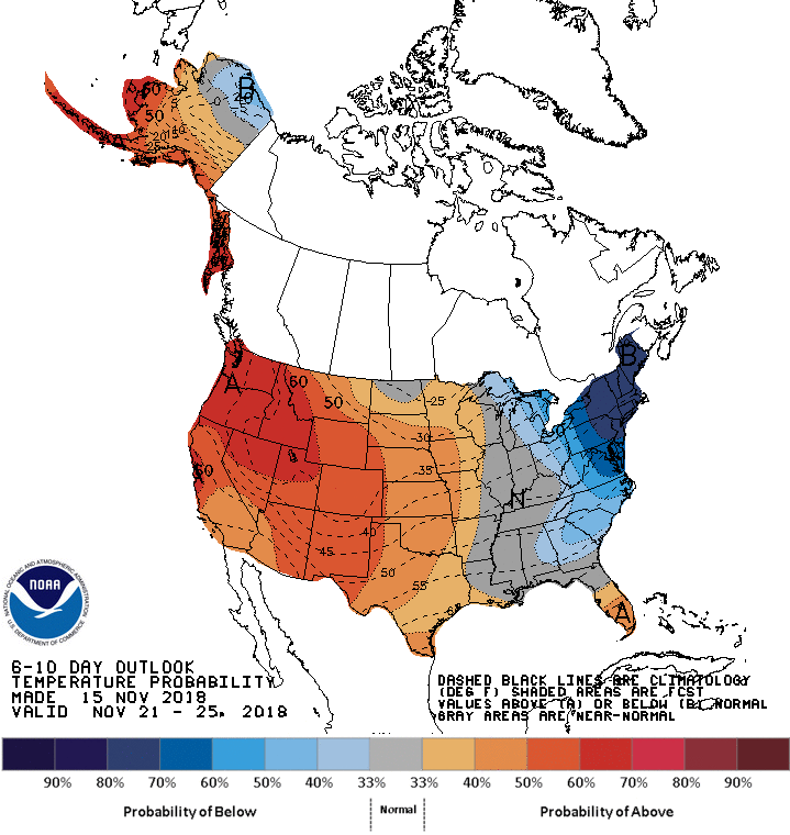
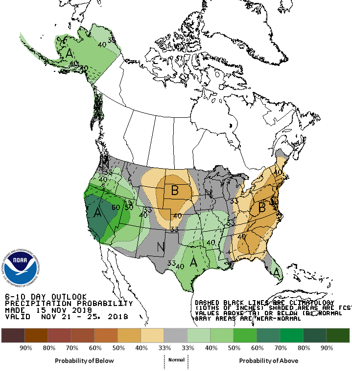
The 6-10 day outlook calls for above average temperatures and average precipitation in Wyoming.
Additional Info:
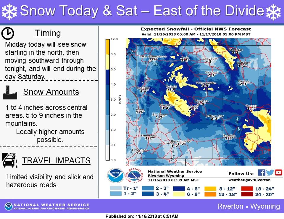
Wyoming: 4-6″ of Snow Tonight – Saturday Morning
* 4 to 6 inches are expected in the Tetons and Gros Ventres.
- NOAA Riverton, WY
Special Weather Statement:
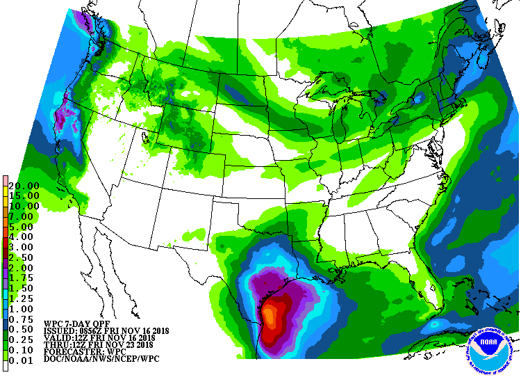
Special Weather Statement
National Weather Service Riverton WY
256 AM MST Fri Nov 16 2018

Teton and Gros Ventre Mountains-Jackson Hole-Star Valley-
Salt River and Wyoming Ranges-Upper Green River Basin Foothills-
Upper Green River Basin-South Lincoln County-
Rock Springs and Green River-Flaming Gorge-East Sweetwater County-
Including the cities of Alta, Jackson, Afton, Alpine,
Star Valley Ranch, Thayne, Fossil Butte National Monument,
Pinedale, La Barge, Big Piney, Farson, Kemmerer, Cokeville,
Rock Springs, Green River, and Wamsutter

A cold front will move through the area Friday afternoon in
northern areas and then move southward into Friday night. This
will bring a new round of snow to much of the area. Light snow
will start over the Jackson area Friday afternoon, spreading
southward through the overnight hours. Snow will gradually end
from north to south through the morning hours Saturday, with snow
showers lingering over the I-80 corridor during the afternoon. 1
to 2 inches is expected for most of this area, with some areas
receiving less than 1 inch. 4 to 6 inches are expected in the
Tetons and Gros Ventres.