To avoid beating around the bush, July was a complete bust. They may have manged one meter the entire month, with the biggest storm dropping 40 cm (16 inches). So much for the Weatherbrains prediction of a big July. The fantasy charts from the timing perspective performed really well but from the intensity perspective failed miserably. All the storms were trying to come through the ridge, instead of using the ridge as a steering mechanism. This pattern repeated itself the entire month leaving the entire Andes with periodic non dynamic storm systems. A pattern change is occurring which is firing things up from Termas de Chillan southward down to Bariloche, which just received upwards of six feet this last week.

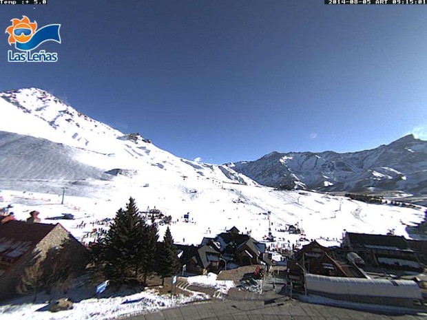
Las Lenas is terrible at keeping snow fall measurements, supposedly they average between 250-275 inches per season. That seems like a low average, but after attempting to keep track since 2009, the highest total in the last 5 years was approximately 190 inches. June was big for Las Lenas this year they received 5-7 feet. However no big slab storms, all cold blower pow (before they opened) so after a couple dry/warm spells there is not much of a base to work with. Add the July totals of 3 feet and you’re up to approximately 10 feet or 120 inches, but still operating with low tide conditions. Fortunately there was no extensive heat wave or dry spell. That is still below 50% of average for the entire season. What are the chances Las Lenas can top 10 feet the month of August and get close to their season average by months end?

Short Term Forecast
Looks like one more weak disturbance which looks a little colder then the last 2 which is coming in early Wednesday morning with 3-6 inches possible. Then a ridge builds in right behind it and it warms up. A weak short wave brushes the area late on Saturday the 9th allowing for a modest cool down. Another similar brush by on the 12th which looks to amount to just some clouds and maybe some flurries at this stage.

Long Range Forecast
The long range models are extremely chaotic. Normally the GFS (Global Forecasting System) has 4 runs in 6 hour intervals every 24 hour period. So on a normal day you would get 4 different model solutions, yesterday there were at least 12 different solutions that popped up with in that same 4 model cycle. Forecast confidence beyond the 12th is non existent. Currently the 12Z GFS is showing a ridge that builds in on the 13th and extends into the 21st but that was after a rapid refresh that showed a storm on the 16th no more then 2 hours previous.
So that is two completely varying solutions for this most current model cycle. There has to be a teleconection going on out in the Pacific or Antarctic that the models are not picking up on? Is the waning El Nino, finally triggering a reaction with the atmosphere? It is still uncertain weather the rapidly weakening El Nino is going to have an effect on this Austral Winter for South America, still not seeing the signals.

An update for the long range forecast may be required after the 18Z model run cycles. This most current ridge solution probably will give way to some type of cut off low, which will make for a tricky forecast due to their lack of predictability.
Long Range Update: 18Z is out, it shows the eastern periphery of the ridge buckling and allowing for a cut off low to form off the coast of Chile with a storm hitting Las Lenas 16th and 17th.

Fantasy Charts
At this stage, wondering when/if this 10 feet of new snow for August is going to come in? Current models take us through the 21st with no significant storms! The Climate Forecasting System (CFS) currently is showing a storm cycle starting on the 23rd and extending through the 30th with a couple of good size storms. If the snow machine does crank on, 10 feet of snow during that time frame would not be out of the question! Unfortunately, have to remain skeptical on the intensity of the storms due to the Fantasy Charts poor performance level regarding storm dynamics. The CFS shows a weaker storm cycle for the first week of September, with a drying period beyond that. Then more storms. Keep in mind that anything beyond the 21st is just an outlook not a forecast, and there are expectations of interesting changes that are going to occur between the 13th and the 21st. If your storm chasing Termas de Chillan south to Bariloche are going to get hammered 7th-10th!