The drive from Vancouver to Whistler is one of the most picturesque drives one can find. The Sea to Sky highway is flanked on one side by the Howe Sound and amazing backcountry ski terrain on the other. There has never been a high detailed backcountry-oriented map for this region, but there will be soon.
Two experienced backcountry riders that use these mountains as their winter playground are now releasing detailed maps of the area to help others travel safely. Eric Carter and Evan Stevens, the owner of Zenith Mountain Guides, have used their collective knowledge of the region to fill a gap in terrain information.
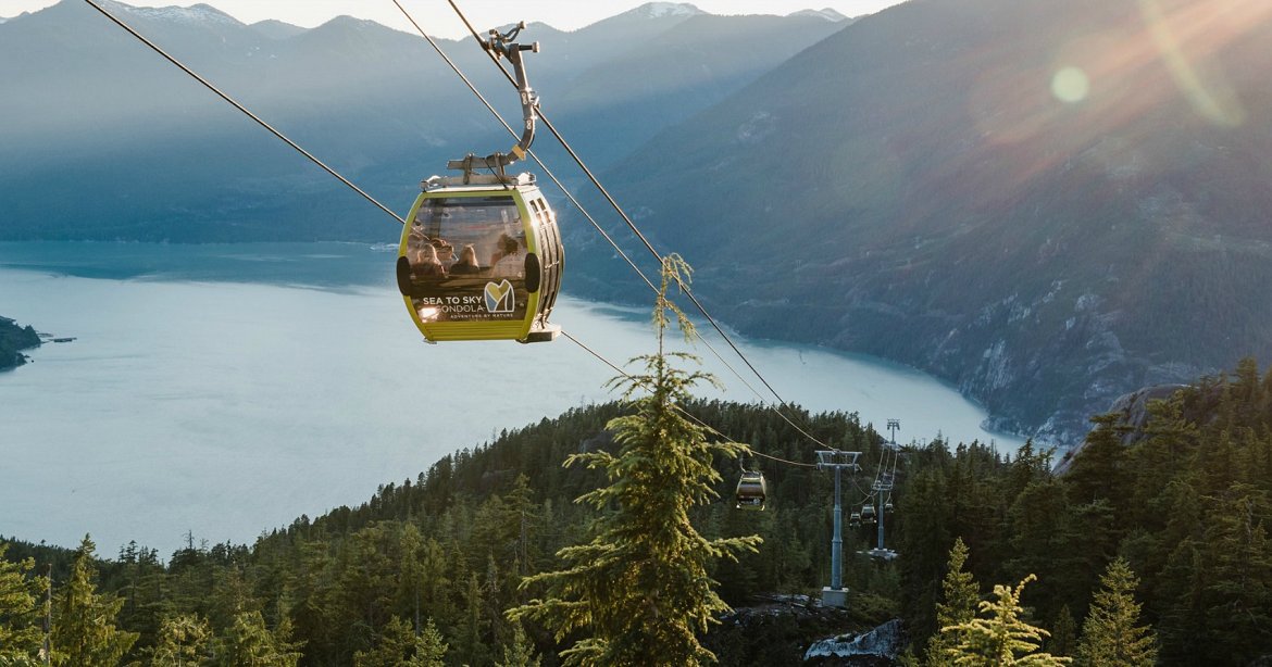
Eric and Evan knew that there is a demand for these maps due to large quantities of people who explore these regions in the winter. Access via the Sea-To-Sky Gondola has opened up backcountry enthusiasts to insane amounts of terrain. The one major thing missing is a good source of information about the region; Eric and Evan hope their map will fill that void.
The maps will include the Stawmus Chief and Shannon Creek Basin. Not only do you get high-resolution topography lines, but also marked trails and photos to give you all the information you need to know. This will allow users to better route find and travel safely in the region. The total area the map covers is 24 square kilometers.
You can see where the trees are. You can see where the gullies are. It’s almost like Google Earth, so I think that’s a really big advantage to it.”
– Eric Carter
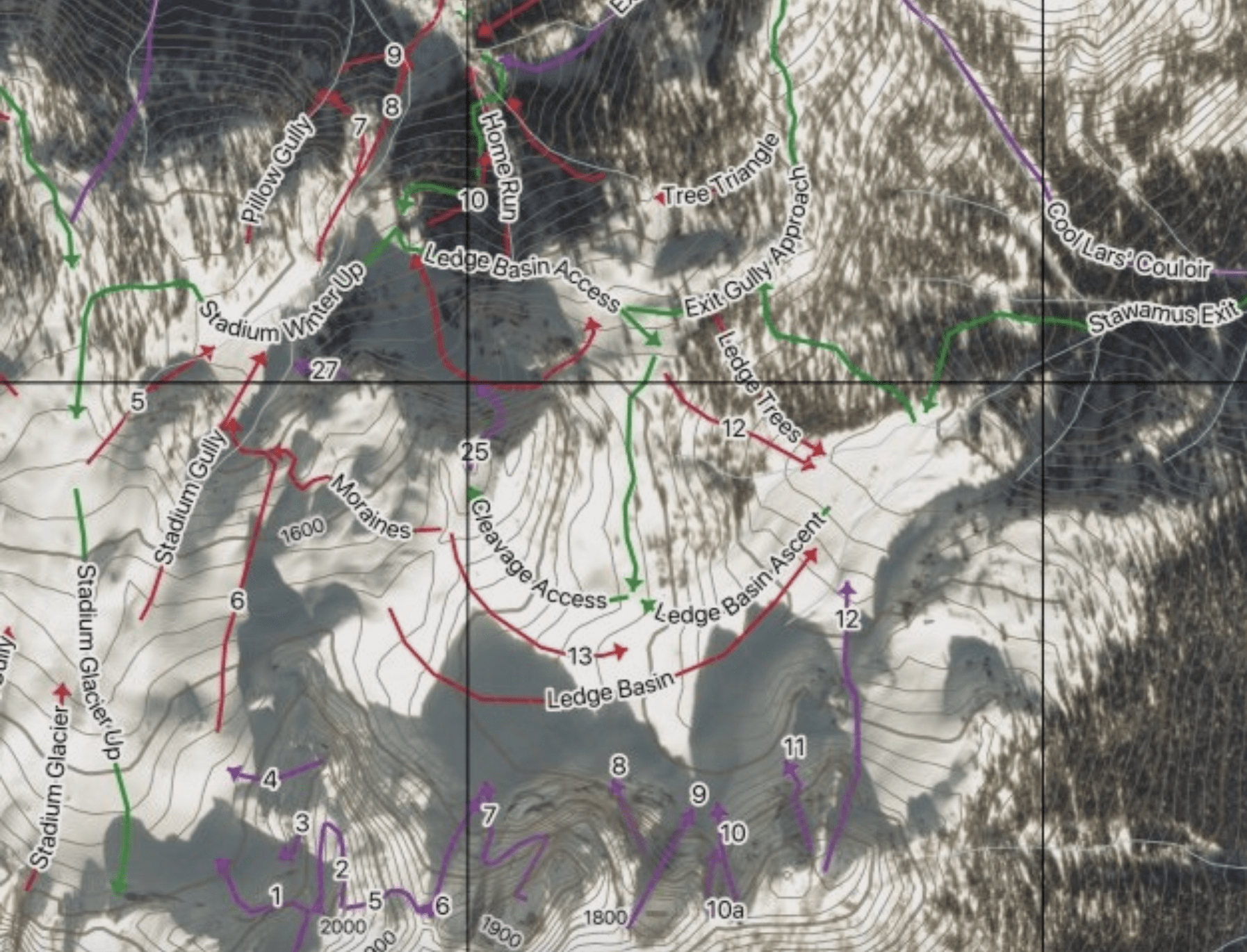
The duo understands that this map might have some backlash from long-term users of the region. There has been a recent increase in the use of the Sea-to-Sky backcountry and some believe that a map will only bring more traffic. They hope that while this may be the case, the map will help make sure that skin tracks are made in the correct areas. They made sure to clearly establish access points, safe descents, and ascents so that those out there are safe. Additionally, the map is designed for ski touring, mountaineering, trail running, hiking, and climbing.
Eric and Evan want people to use this as one of many resources to make sure they have a safe trip in the backcountry. You should always watch avalanche reports and leave a detailed trip report in your car to let others know where you are. You can currently pre-order the map at https://www.seatoskybackcountry.com/ for $19.99 CAD until August 12th. Once the pre-order period is over the map will cost you $25 CAD. Safe travels!
