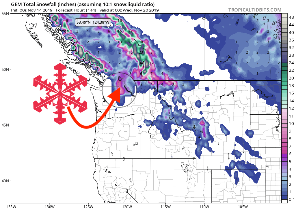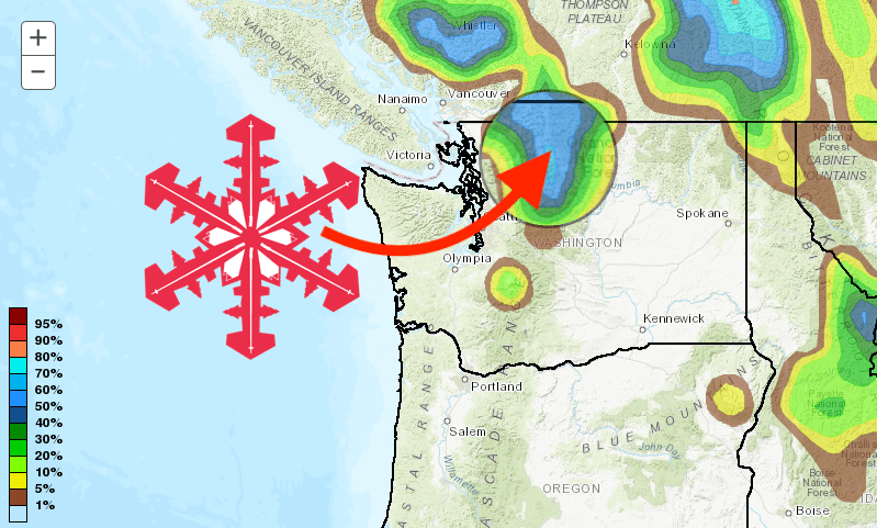
The NOAA is calling for snow to hitting the PNW this weekend, with the northern Cascades likely to see a few inches of fresh snow.
Mount Baker Ski Resort will be the clear winner here, with 5-day totals calling for a potential of double-digit accumulations. (Actual Mount Baker could see over 5-FEET at the summit!)
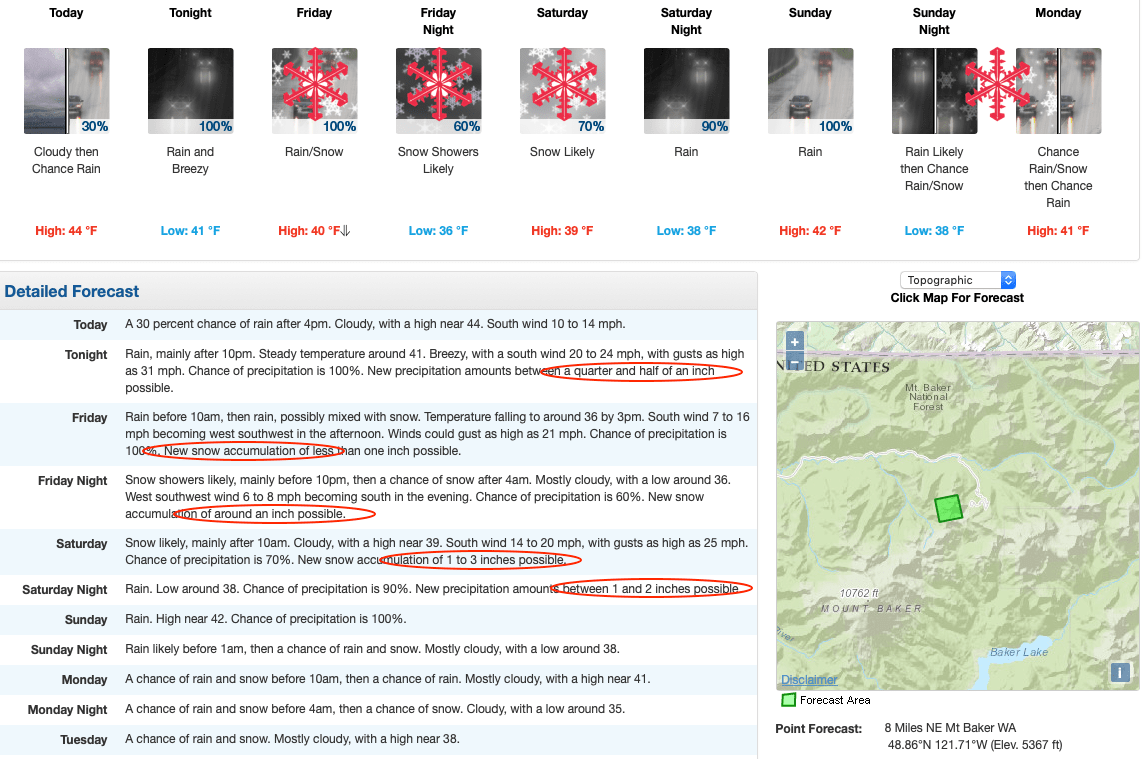
Snow will begin Friday morning and continue through Saturday afternoon down to around 5,000-ft. Following a brief hiatus, the precipitation will begin again Sunday night into Monday when a potent system could drop snow onto some of the higher mountain passes.
Temperatures will hover around freezing, the lowest they will drop to being 28ºF, so it won’t get too cold, and wind will be fairly mild.
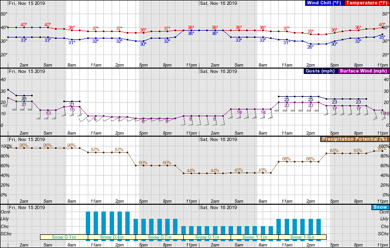
Other ski areas should also see snow, Stevens Pass and Crystal Mountain should see up to 4″.
Opening day at Mount Baker depends on conditions, so hopefully, this storm brings us a little closer to that being a reality! Last year the resort opened on Wednesday, December 12th.