A proposal that began in 2013 to increase the skiable terrain at Mt. Rose Ski Tahoe, NV has won final approval from the US Forest Service.
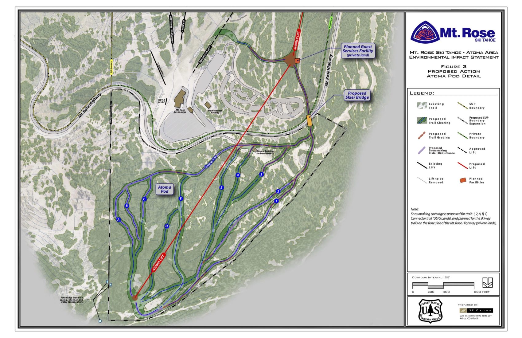
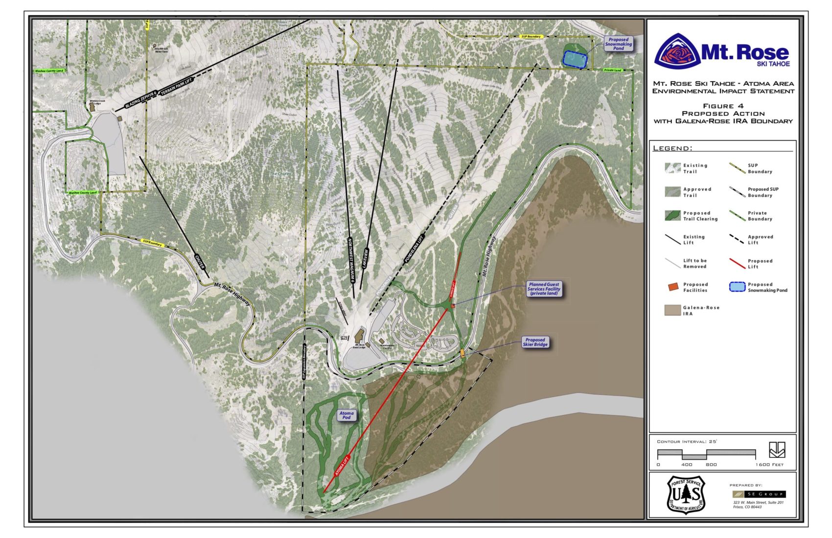
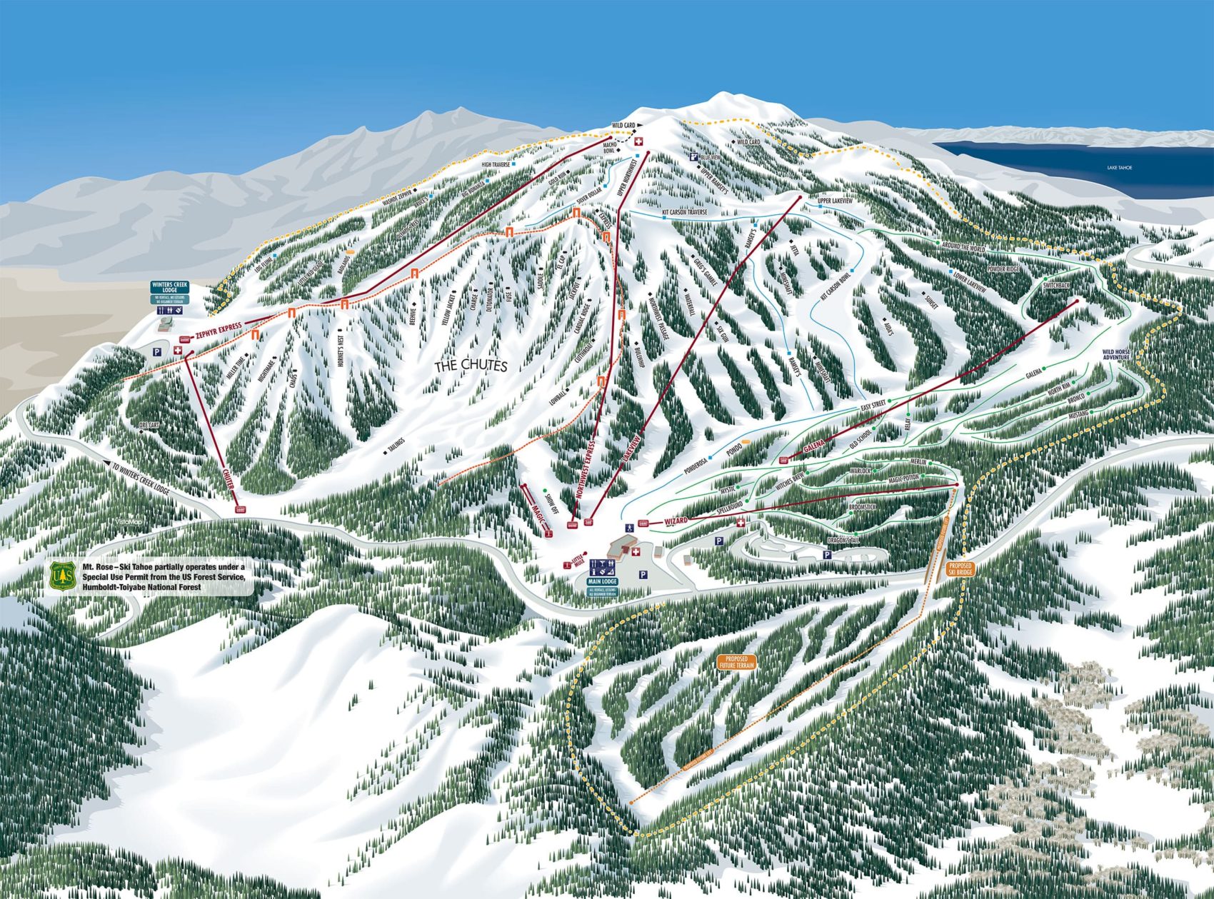
Humboldt Toiyabe National Forest Supervisor Bill Dunkelberger yesterday signed off on a plan that will add 112-acres of skiable terrain, 11 new runs, a bridge over the highway, and a new multi-stage angled lift, crossing the highway (Nevada State Route 431) and taking riders up the north side of Mt. Rose Highway, opposite the main resort. New snowmaking equipment will also be installed.
Known for its abundance of expert terrain, the proposal aims to increase suitable terrain for low-level skiers and riders. Mt. Rose currently struggles to provide a full range of beginner, novice, and intermediate terrain that is necessary for the logical “learning progression” critical for skiers and riders as they gain skills and confidence. Also, at Mt. Rose advanced-intermediate and expert skiers/riders descend through lower-level terrain on their way to the base area. This mixing of ability levels is intimidating for lower-level skiers and riders and is inconsistent with the type of recreational offering that Mt. Rose strives to provide.
“Just the whole experience over there is another piece of ski terrain that is unique,” said Mike Pierce, a spokesman for the resort.
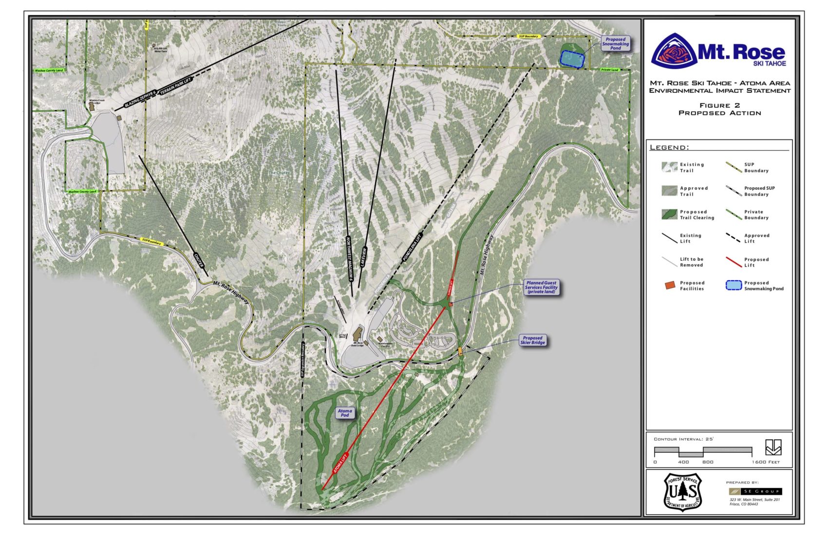
According to US Forest Service documents, the current 746-acre Forest Service-administered boundary will be expanded north of the Mt. Rose Highway (directly across from the Mt. Rose base area) into the Atoma area, which was previously utilized as a Nordic skiing facility in the early 1980s (offering groomed trails, a small lodge, and a parking area). With the inclusion of the Atoma Pod, Mt. Rose’s boundary would increase by approximately 112 acres.
The Atoma Pod will offer lower-level skiers and riders a unique, secluded experience that is removed from the main ski area. The proposed Atoma trail plan includes 11 defined trails and takes advantage of both the location and topography of the area while strategically preserving large tree islands that will be appropriate for lower-level skiers and riders to navigate. No new roads are proposed; the design makes use of the existing road network (including the Old Mt. Rose Highway) by incorporating it into the trail plan. These existing roads will also facilitate the construction and maintenance of the proposed lift and trail network. All proposed trails will be groomed on a rotating basis, as needed, to maintain a consistent snow surface. Glades between formal trails will not be groomed.
Addressing environmental concerns, the Atoma Expansion Project also restricts future commercial uses on approximately 3,446 acres in the area known as Galena Land Exchange with the exception of the 112-acre Atoma and 168-acre Chutes areas. It also protects the endangered whitebark pine with a reduced footprint area for a water tank and avoids impacts on wetlands and streams by focusing new ski trails on existing road alignments and openings, the agency said in a written statement.
“We are excited to be able to start moving forward on Mt. Rose Ski Tahoe’s Atoma Area Expansion Project,” said Mt. Rose Marketing Director Mike Pierce. “This project will provide locals an enhanced winter recreation opportunity as well as transform Mt. Rose Ski Tahoe into a key destination attraction.”
Three plans were submitted, each addressing environmental needs (and one of them being ‘No Action – boundary expansion not approved’). Alternative 3 was chosen as it best meets the need of improving the quality of the ski area’s recreation offerings on NFS land and enhancing the recreation experience for skiers while minimizing environmental and human impacts.
“The Mt. Rose Ski Tahoe’s Atoma Area Expansion Project aligns with the direction of the forest’s land and resource management plan to provide diverse recreational opportunities for this area,” Dunkelberger said. “I chose Alternative 3, because the two-stage chair lift system and skier bridge reduces potential safety risks to both motorists and skiers.”
There has been no timeline set for the project to begin and all timing will require approval from the US Forest Service.
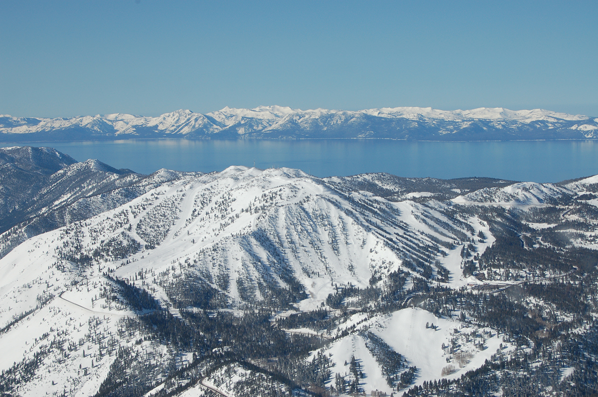
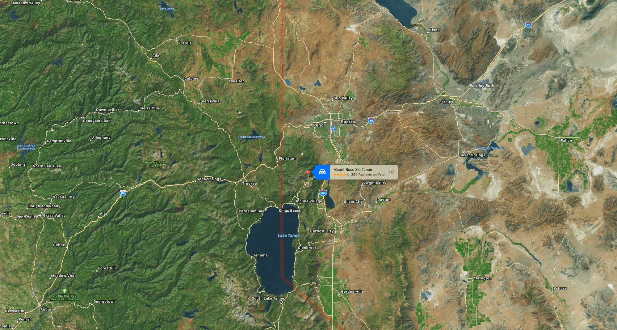
Mount Rose Ski Tahoe is the closest ski resort to Reno, Nevada. The resort is located about 30 miles south of Reno, in the Carson Range. Mt. Rose has the highest base elevation of a Tahoe-region ski resort at about 8,260 ft and the summit is 9,700 ft. The resort area is 1,200 acres and is located in Toiyabe National Forest.
- Draft Approval Last Year: US Forest Service Approves Plan for New Chairlifts and New Terrain at Mt. Rose Ski Tahoe, NV
Despite the name, the resort is actually on the slopes of Slide Mountain rather than Mount Rose, which is on the other side of Nevada State Route 431.
The resort first opened in 1953, starting with the “Reno Ski Bowl” located on the east face of Slide Mountain. Later renamed to the “Slide Mountain Ski Area”, it operated side-by-side with the “Mount Rose Ski Area”, which opened in 1964 on the north side of Slide Mountain. The two areas merged in 1987.
December 2004 saw the opening of The Chutes at Mount Rose. The Chutes offer some of the steepest, consistent terrain in all of Tahoe.
In 2018 the Buser family (majority shareholders since 1972) decided to keep the resort, after having it on the market.
I enjoyed reading this and thank you for sharing. Mt. Rose is going to be awesome with the new expansion but hopefully it doesn’t get more crowded than it already is.