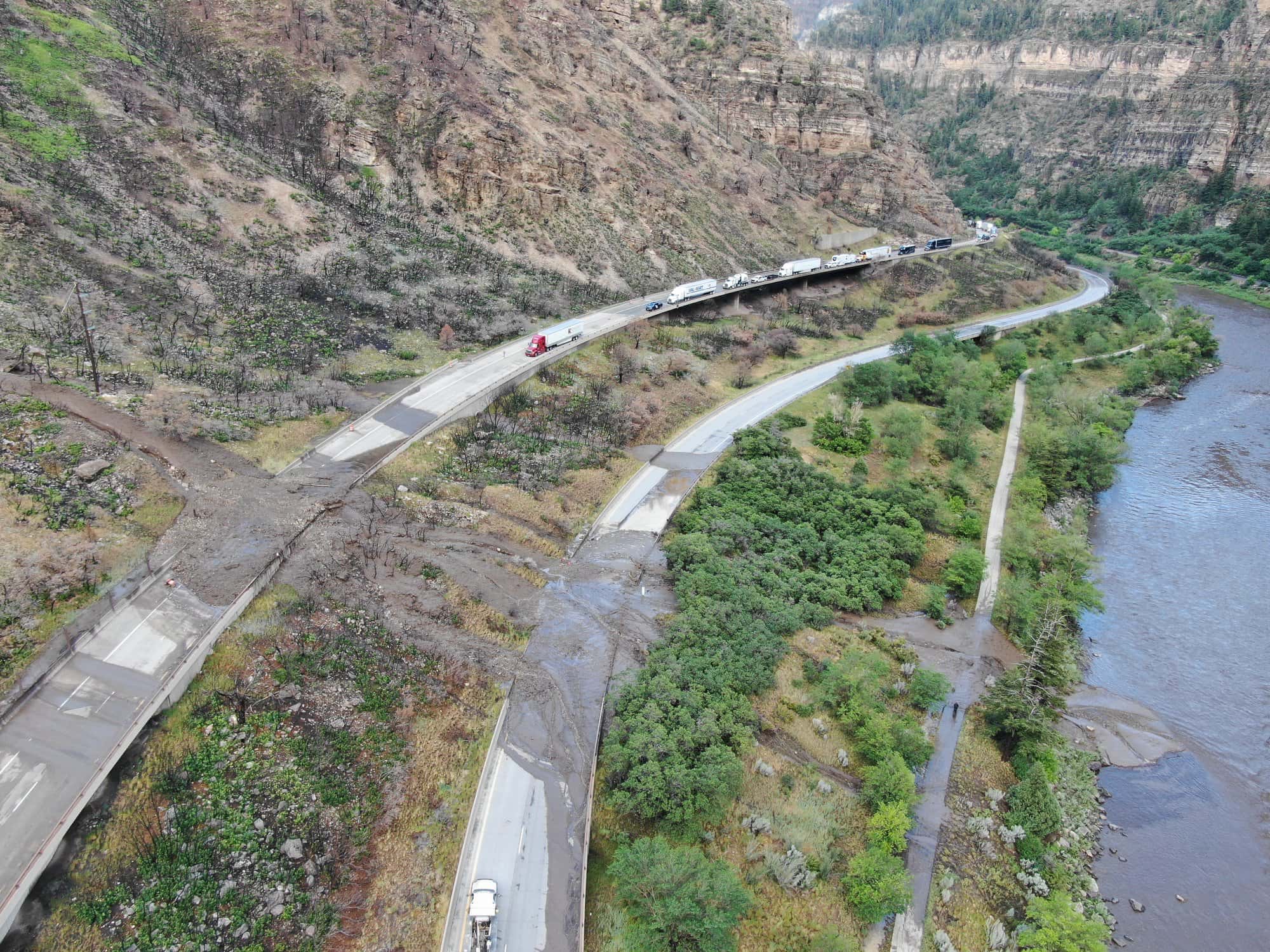
The infamous I-70, right through the heart of many of Colorado’s ski areas, closed twice over the weekend due to flood warnings and significant mudslides.
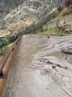
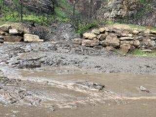
The road through Glenwood Springs was under a ‘hard closure’ through at least Sunday night due to a mudslide eighty feet wide and five feet deep in places.
UPDATE – 10 p.m. (Last update for 6/27) – CDOT has made the decision to keep I-70 Glenwood Canyon closed overnight. CDOT crews will continue clearing mudflow debris tonight, and will reassess the debris and closure in the morning. The closure points continue to be between Exit 87 (West Rifle) and Exit 133 (Dotsero).
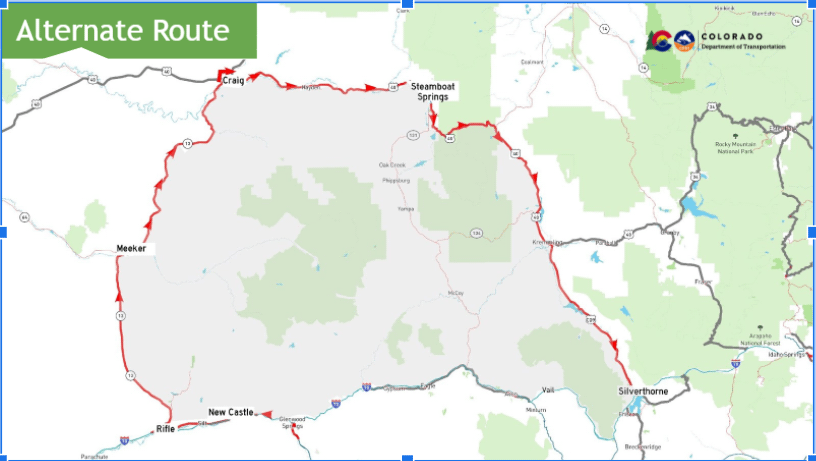
CDOT continues to ask that motorists use the northern alternate route whenever possible (see map below). The team for the US 50 Little Blue Creek Canyon project will not begin regular closure operations until 1:30 p.m. tomorrow, Monday, June 28, allowing motorists to access the southern alternate route. The project is located between Montrose and Gunnison on US Highway 50.
We appreciate your patience as CDOT works as safely and quickly as possible to clear I-70 in Glenwood Canyon of the mudflow debris. Photo courtesy Glenwood Springs Fire Department. We will not be monitoring comments overnight, please see cotrip.org for road conditions.
UPDATE 8:45 p.m. Both directions of I-70 remain closed at this time. The debris field is approximately 80 feet wide and up to five feet deep. Crews are working cleanup efforts, but there is no estimated time for reopening. Please check COtrip.org for up-to-date closure information.
UPDATE 5:30 p.m. Eastbound closure point is now Rifle (MP 87). Motorists are recommended to take the northern detour route. Debris area is estimated to be larger than yesterday’s slide.
I-70 CLOSED between Exit 133 (Dotsero) and Exit 116 (CO 82, Glenwood Springs) due to another mudslide in the area.
Crews are currently working to assess the scene and move closure point back to MP 109. There is no estimated time of reopening. Check COtrip.org for updated closure and condition information.
On Saturday a similar mudslide that was seventy feet wide and five deep also closed the road for a number of hours while crews cleared the debris.
The slides were along the Grizzly Creek Fire burn scar.