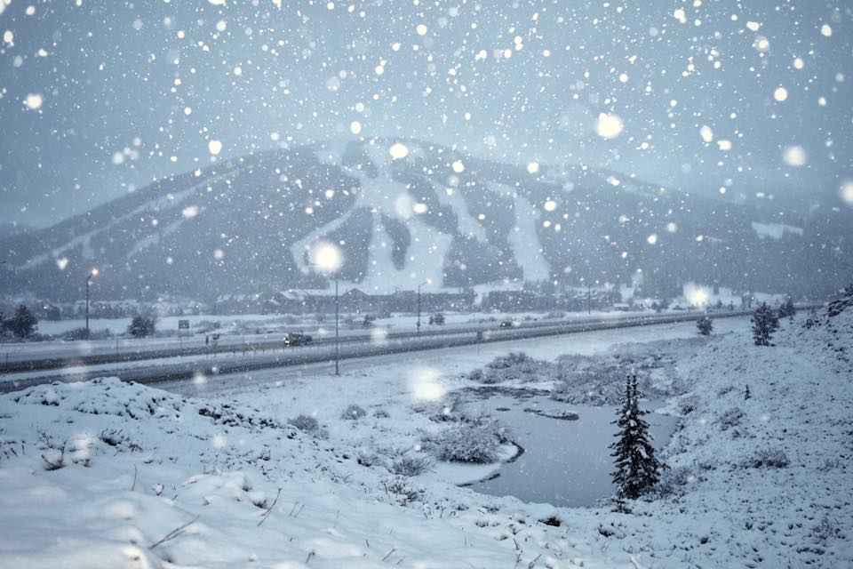
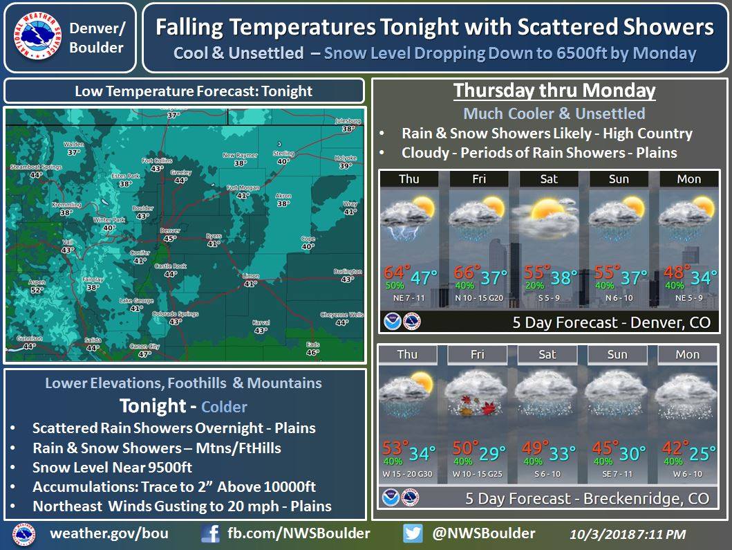
The National Weather Service is calling for a cold and unsettled weather pattern in Colorado. There’s multiple rounds of snow on tap tonight through early next week. Specifically tonight, Friday – Friday Night, and Sunday – early next week. There’s even a chance that snow could fall along the Urban Corridor early next week.
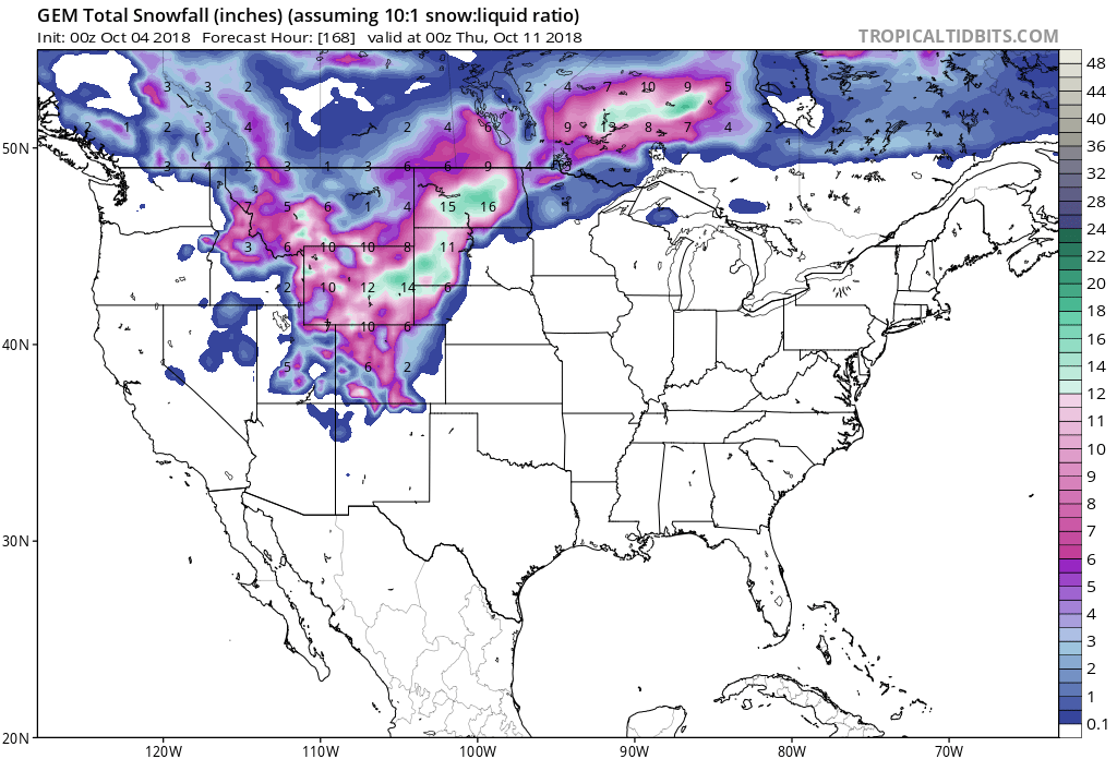
Snow levels are expected to start out around 10,000ft tonight and hovering between there and 9,000ft into the weekend, before dropping down to 6,500ft by Monday.
Additional Storm Info:
Colorado: Multiple Rounds Of Snow On Tap Tonight – Early Next Week
* A strong slow moving system over the Great Basin and
  Central Rockies is expected to bring a period or two
  of rain and mountain snow Sunday and into early next week.
  This system could end up colder with the snow level falling
  into the foothills and a slight chance its cold enough
  for light snow along Urban Corridor.
- NOAA, Today
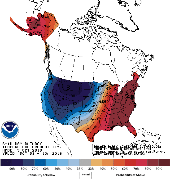
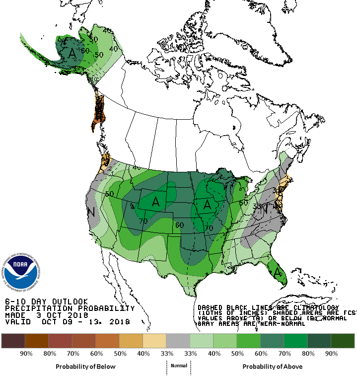
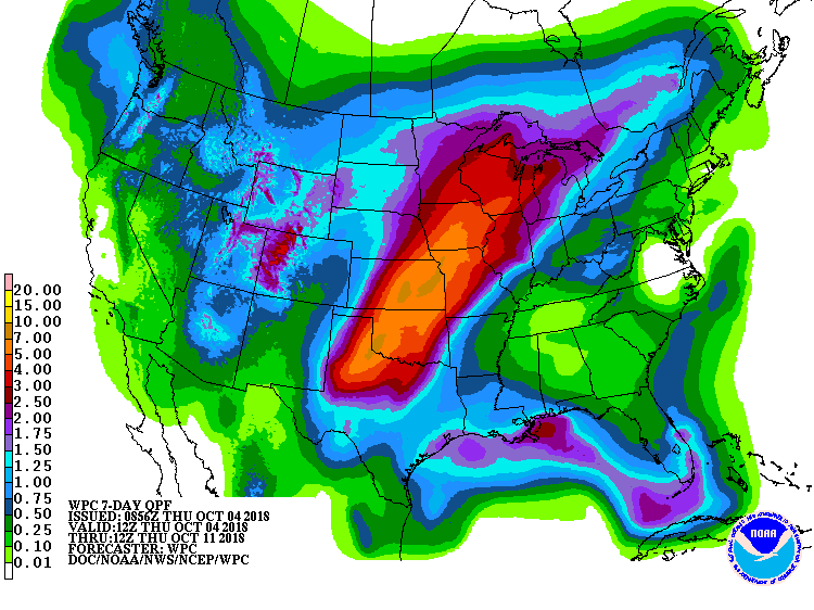
The 6-10 day outlook calls for above average precipitation and below average temperatures in Colorado.
Colorado Hazardous Weather Outlook:
This hazardous weather outlook is for northeast and north central
Colorado.

.DAY ONE...Today and Tonight

It will be much cooler today with a showers and a slight chance of
thunderstorms in the mountains. Areas of fog may reduce visibilities
in the foothills this morning to less than a mile at times. Across
the northeast plains, scattered rain showers and isolated thunderstorms
will decrease this morning, but a another round of thunderstorms
is expected to move off the foothills and across the northeast
plains this afternoon. A strong southwesterly flow aloft will be
over the region today. An upper level trough embedded in the flow
aloft will move across the region this afternoon then exits the
state this evening.

.DAYS TWO THROUGH SEVEN...Friday through Wednesday

An upper level system and cold front will bring a good chance for
rain and mountain snow Friday and Friday night. The snow level
falls to 9000 to 10000 feet MSL Friday night where up to 3 inches
snow will be possible.

A strong slow moving system over the Great Basin and Central
Rockies is expected to bring a period or two of rain and mountain
snow Sunday and into early next week. This system could end up
colder with the snow level falling into the foothills and a slight
chance its cold enough for light snow along Urban Corridor.