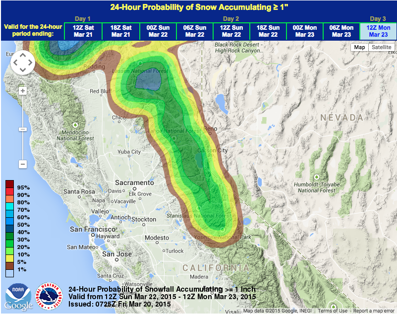
There is snow forecast for Lake Tahoe this weekend. We know that sounds weird to put “snow” and “tahoe” in the same sentence without the word “no”, but we’re going for it.
All the sources we could find are saying about 6″ of snow on the highest Tahoe peaks on Sunday and Monday and about 2″ down low.
Here is what Open Snow is saying:
We could see 3-6 inches of snow on the mountains above 7000 feet, with slightly higher amounts possible West of the lake along the crest. – opensnow.com
Here is what Powder Chasers is saying:
The central and northern Sierra is going to reap moderate rewards Sunday night and Monday with a return of snowfall (4-8), strong SW winds (60-80 MPH ridge top) and snow levels in the 6500 to 7500 foot level. – powderchasers.com
Here is what NOAA is saying:
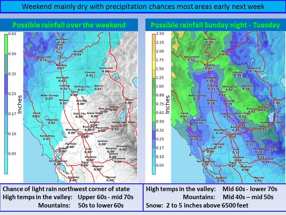
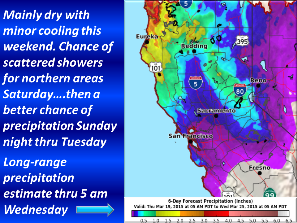
THE COLD FRONT PASSAGE MONDAY WILL LOWER SNOW LEVELS PERHAPS AS
LOW AS 4,500-5,000 FEET NORTH OF I-80 AND 5,000-7,500 FEET SOUTH OF
I-80. THE BEST CHANCES FOR RAIN AND SNOW ARE FROM THE WESTERN TAHOE
BASIN NORTH THROUGH PLUMAS AND LASSEN COUNTIES. SNOW TOTALS DO NOT
LOOK SUBSTANTIAL BUT IN THE VICINITY OF HALF A FOOT IN THE
MOUNTAINS. SOME SNOWFALL COULD STICK TO ROADWAYS MONDAY MORNING
POTENTIALLY IMPACTING COMMUTERS. HOWEVER, WITH SPRING SUN ANGLES ANY
SNOW THAT DOES STICK IS LIKELY TO MELT OF ROADWAYS BY MONDAY
AFTERNOON.