NOAA: 2-8″ of Snow Forecast in Washington’s Mountains Friday-Sunday

WeatherBrains | | Post Tag for WeatherWeather
image: noaa, seattle wa, 9/25/19

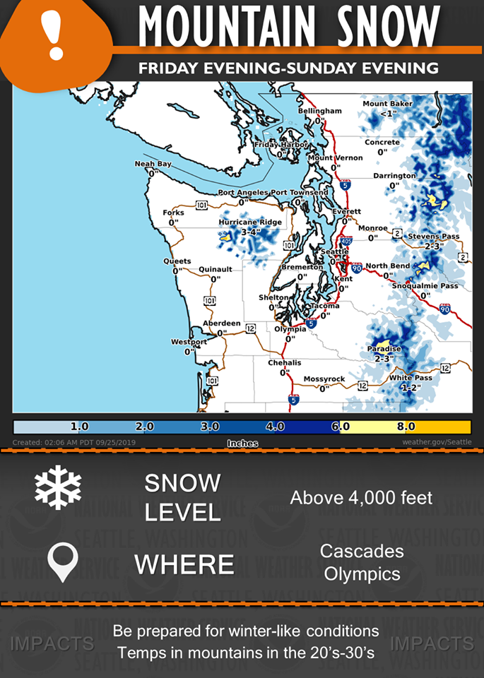
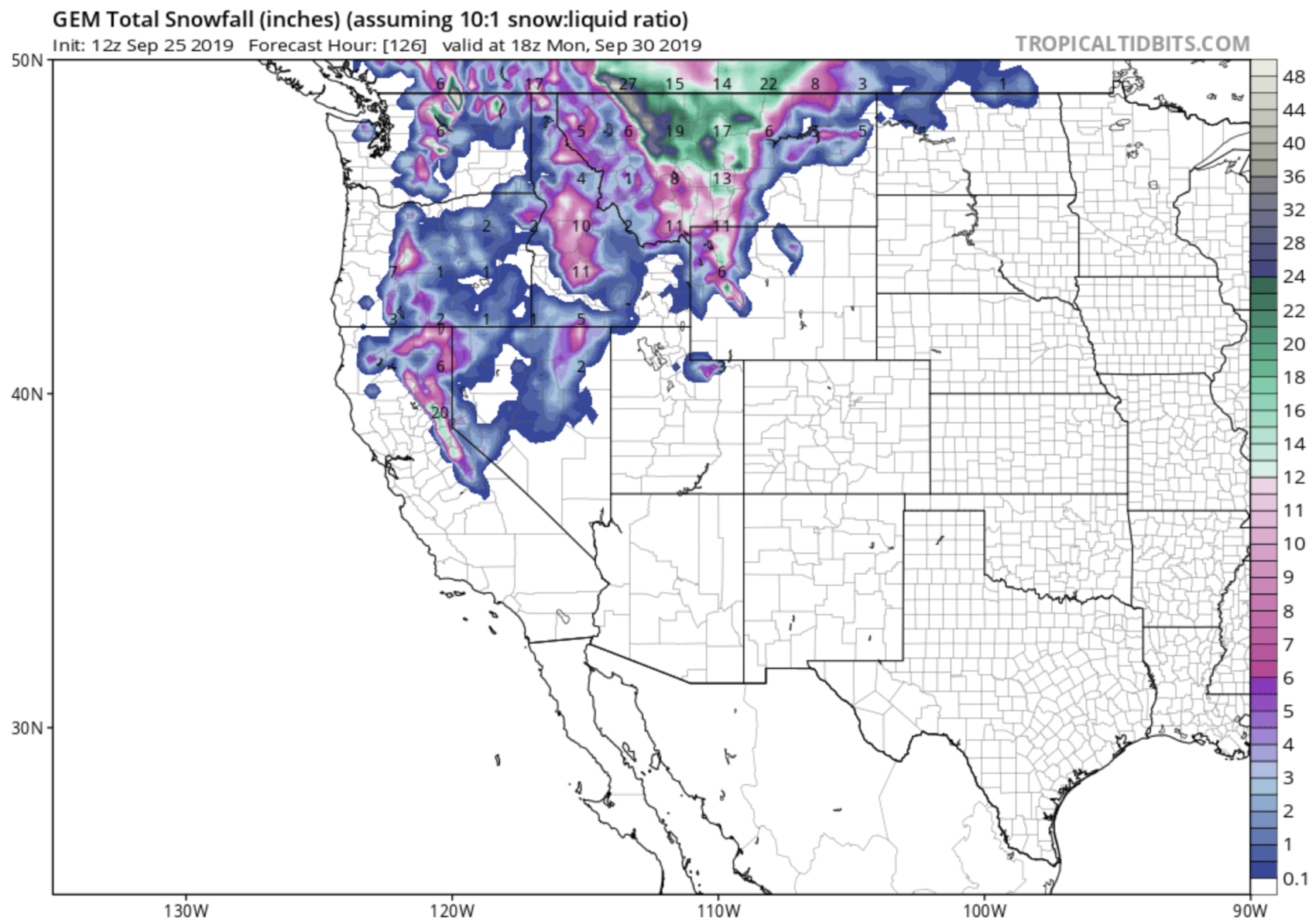
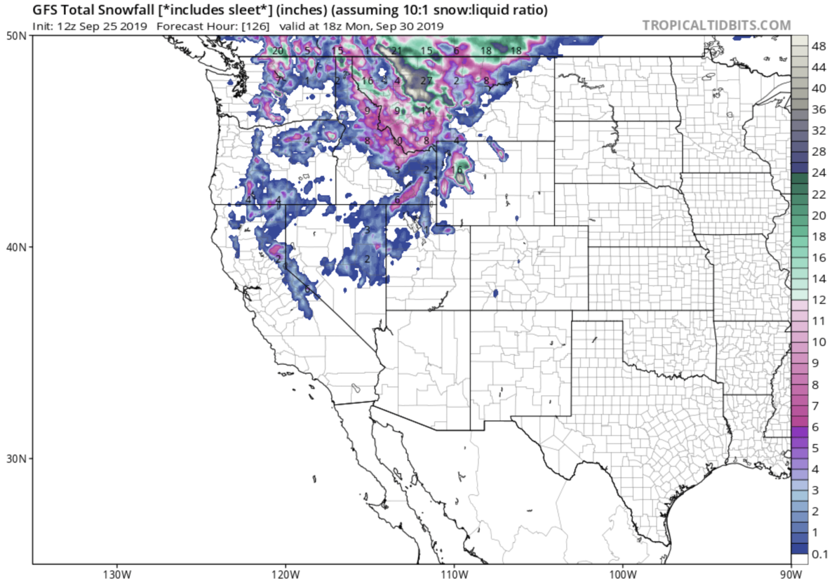
NOAA is calling for 2-8″ of snow to fall in the Cascade Mountain of Washington State Friday – Sunday this week.

Snow levels are forecast to drop as low as 4,000 feet over the weekend which will mean snow for Crystal Mountain, Stevens Pass, & Mt. Baker ski resorts.

Snow levels will lower to 4,000-5,000 feet by Friday with cooler air across the Pacific Northwest. Generally 2-8″ across the higher elevations above 4,000 feet through the weekend!” – NOAA, Seattle WA, 9/25/19

Both the GEM & GFS weather model agree on this Washington Snowfall through Monday.

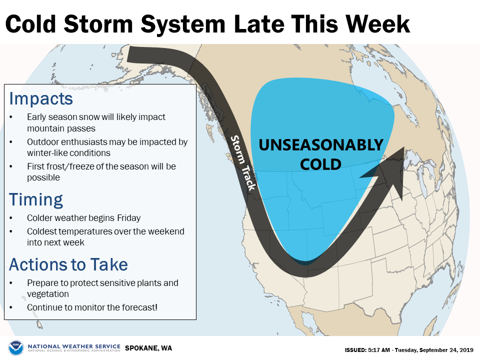
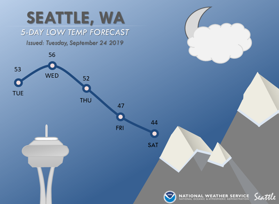
We’re not sure if Washington has seen snow yet this season, so this may be their 1st snowfall of the year.

GEM 4-DAY WEATHER MODEL:

GEM 4-Day snowfall forecast showing decent amount of snow in Washington State. image: tropicaltidbits.com

GFS 4-DAY WEATHER MODEL:

GFS 4-Day snowfall forecast agrees with GEM showing decent amount of snow in Washington State. image: tropicaltidbits.com

MORE WEATHER INFO:

image: noaa, spokane wa, 9/24/19
image: noaa, seattle wa, 9/25/19
“A colder weather system will move into eastern WA by Friday and bring an increasing chance for light snow to the higher elevations of the Cascades, northern Mountain, and the northern ID Panhandle by Fri night into Sat morning.” – noaa, spokane wa, 9/25/19

Related Articles

Got an opinion? Let us know...