The National Weather Service has issued a Winter Storm Watch for California.
It’s in effect from 8:00pm Tuesday night – 11:00am Thursday morning.
Heavy snow and high winds are expected to impact the area throughout that time.
California:
- 2+ FEET of Snow Above 7,000ft Tuesday – Thursday
- 80mph Wind Gusts Across Sierra Ridges
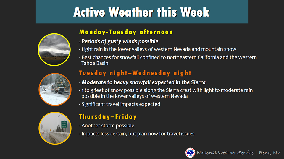
“A series of storms will move through northern California and Nevada Monday through Thursday bringing periods of rain and snow along with gusty winds. Sunday will be the best day to travel and/or prepare for the active week ahead. The greatest concern is the stronger storm Tuesday night into Wednesday night with widespread travel impacts likely in the Sierra and northeast California due to snow.”
– NOAA Reno, NV
Make sure to get your hands on an Ikon Pass, so you don’t miss out on any powder days like this next season.
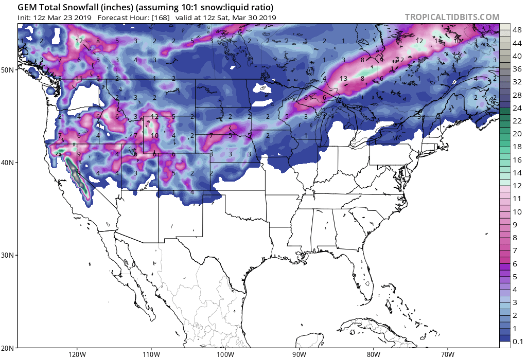

Snow levels will start out around 6,000ft on Tuesday, before dropping down to 4,000ft by Thursday.
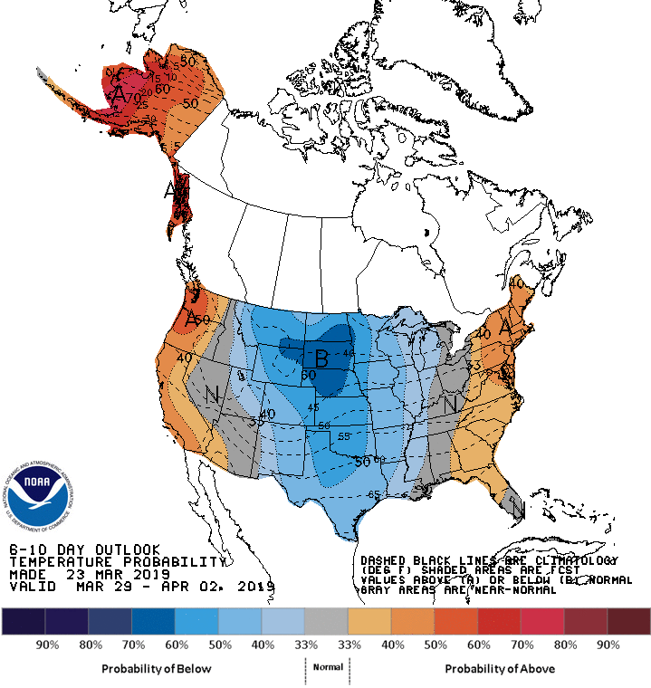
The 6-10 day outlook calls for average precipitation and above average temperatures in California.
Additional Storm Info:
California: 2+ FEET of Snow Above 7,000ft Tuesday – Thursday
* Heavy snow possible. Total snow accumulations of 8 to 16
  inches below 7000 feet, up to 2 feet above 7000 feet with
  localized amounts up to 3 feet along the crest possible.
- NOAA Reno, NV

Winter Storm Watch:
URGENT - WINTER WEATHER MESSAGE
National Weather Service Reno NV
245 PM PDT Sat Mar 23 2019

Greater Lake Tahoe Area-
Including the cities of South Lake Tahoe, Truckee, Stateline,
and Incline Village

...WINTER STORM WATCH IN EFFECT FROM TUESDAY EVENING THROUGH
THURSDAY MORNING...

* WHAT...Heavy snow possible. Total snow accumulations of 8 to 16
  inches below 7000 feet, up to 2 feet above 7000 feet with
  localized amounts up to 3 feet along the crest possible. Winds
  could gust as high as 80 mph across Sierra ridges and up to 40
  mph in valley locations.

* WHERE...Greater Lake Tahoe Area.

* WHEN...From Tuesday evening through Thursday morning.

* ADDITIONAL DETAILS...Travel could be very difficult to
  impossible. The hazardous conditions could impact the morning
  or evening commute. Very strong winds could cause extensive
  tree damage.