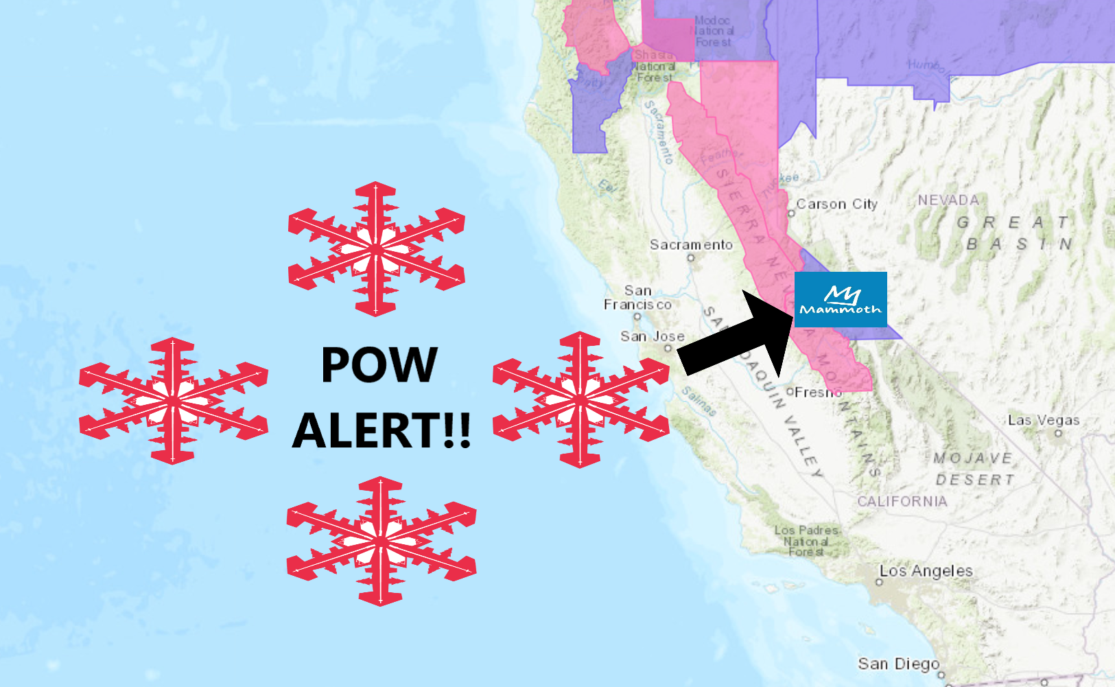
The National Weather Service has issued a Winter Weather Advisory for Mammoth Mountain, CA. It’s in effect from 10:00pm this evening through 4:00am Thursday morning.
High winds and heavy snowfall are forecasted to impact the area throughout that time.
Storm Summary:
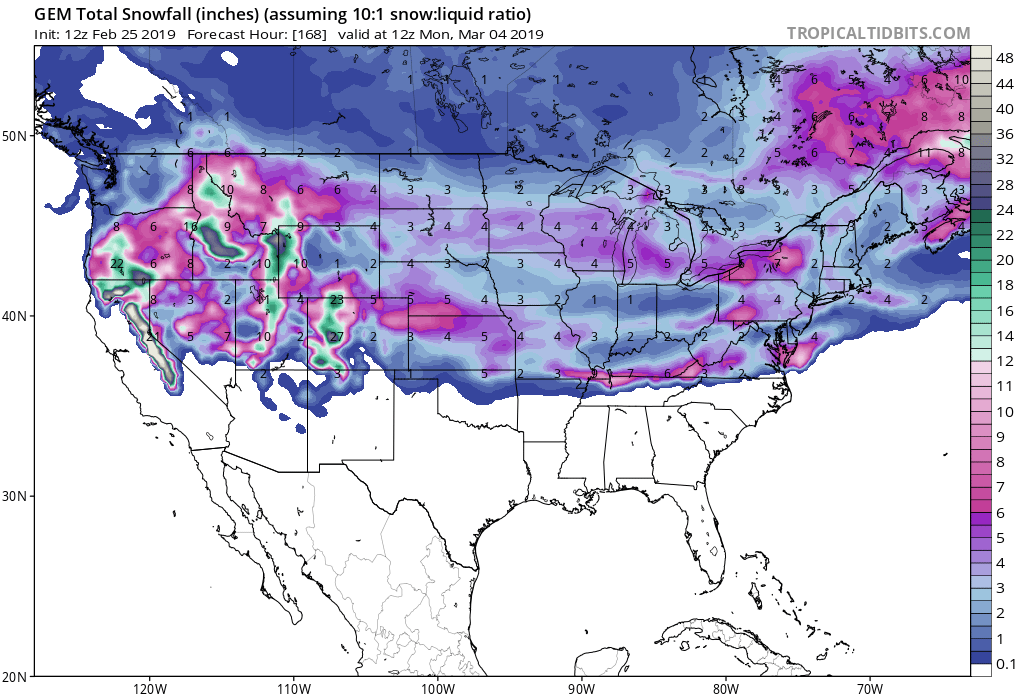
- 24-48″ of Snow In The Next 3 Days
- 100+mph Wind Gusts Over Sierra Ridges
- Possible White-Out Conditions
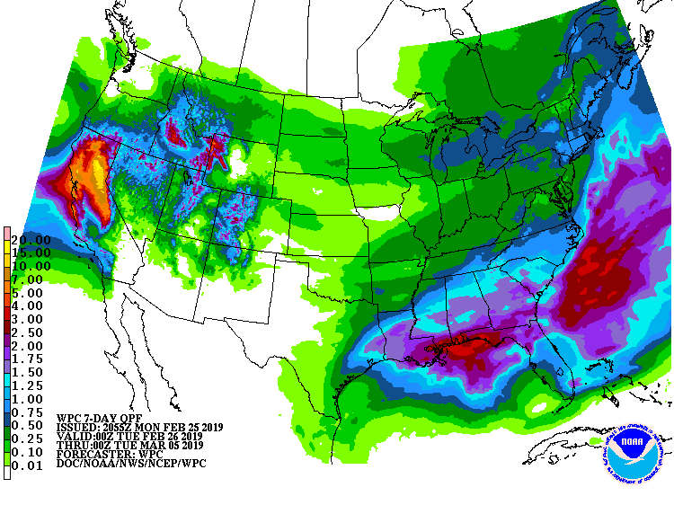
“Any precipitation will likely remain north of Fresno County this evening through Tuesday. This precipitation will spread southward Tuesday night and Wednesday. Snow levels will start at around 5,000 feet this evening, before rising to about 7,000 feet by Wednesday morning.”
– NOAA Hanford, CA
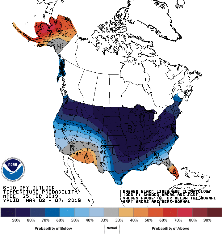
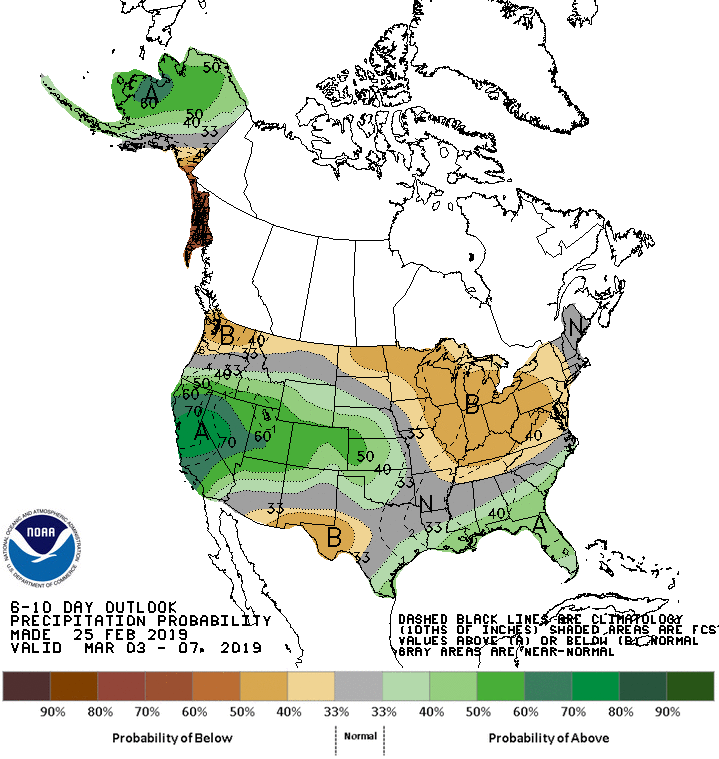
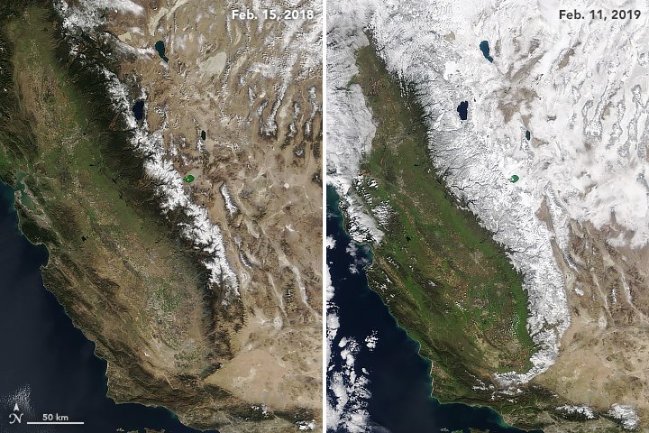
As you can tell by the images below, the California snowpack is set up significantly better right now than it was at the same time in 2019.
Mammoth Mountain is reaping the benefits of that with the DEEPEST snowfall total and the DEEPEST snowpack.
Snow levels are forecasted to start out around 5,000ft tonight, before rising to 7,000ft by Wednesday morning.
The 6-10 day outlook calls for below average temperatures and above average precipitation in California.
Additional Storm Info:

Mammoth Mountain: 24-48″ of Snow In The Next 3 Days
* Snow expected. 3-Day total snow accumulations of up to
  12 inches, except 2 to 4 feet above 7000 feet expected.
- NOAA Reno, NV
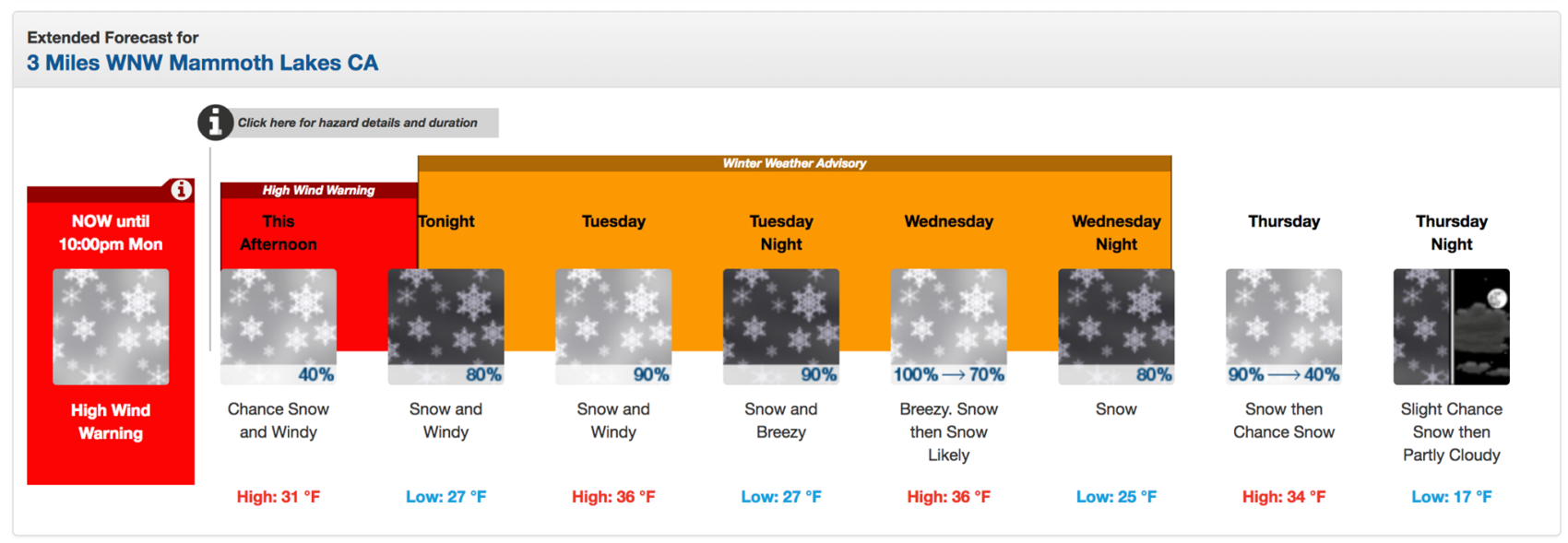
Winter Weather Advisory:
URGENT - WINTER WEATHER MESSAGE
National Weather Service Reno NV
247 PM PST Mon Feb 25 2019

Mono County-
Including the cities of Bridgeport, Coleville, and Mammoth Lakes

...WINTER WEATHER ADVISORY NOW IN EFFECT FROM 10 PM THIS EVENING
TO 4 AM PST THURSDAY...

* CHANGES...Moved the advisory back to 10 PM. High wind warning in
  effect until 10 PM.

* WHAT...Snow expected. 3-Day total snow accumulations of up to
  12 inches, except 2 to 4 feet above 7000 feet expected. Winds
  gusting as high as 70 mph with gusts over 100 mph for the
  Sierra ridges. Periods of white-out conditions are possible.

* WHERE...Mono County.

* WHEN...From 10 PM Monday to 4 AM PST Thursday.

* ADDITIONAL DETAILS...Travel could be very difficult to
  impossible. The hazardous conditions could impact the morning
  and evening commutes. Very strong winds could cause extensive
  tree damage.