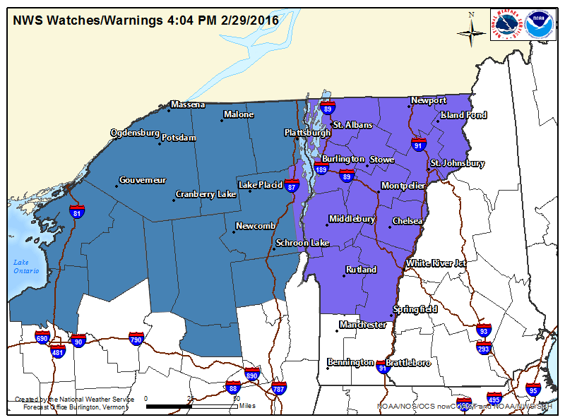
NOAA has issued Winter Storm Watches and Winter Weather Advisories across northern New York, Vermont, and New Hampshire today.
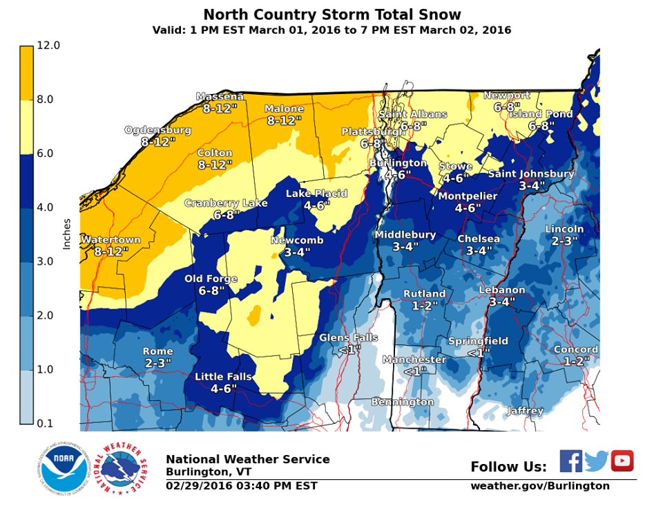
3-6″ of snow is forecast along with temperatures as low as -25ºF. This could be a good thing, or it could cause the gnarliest ‘dust on crust’ conditions imaginable since it’s hot and wet in Vermont today.
* ACCUMULATIONS...SNOW ACCUMULATION OF 3 TO 6 INCHES OF HEAVY
  DENSE SNOW...ALONG WITH SLEET AND UP TO A TENTH OF AN INCH OF
  ICE.

* MAXIMUM SNOWFALL RATE...UP TO 1 INCH PER HOUR...MAINLY EARLY
  WEDNESDAY MORNING.
* TEMPERATURES...LOWS 1 BELOW TO 25 ABOVE ZERO. HIGHS IN THE MID 30S. - NOAA Burlington, VT today
It’s been a rough year for the East Coast this year. Every inch of snow helps.
Mad River Glen, VT has been closed during the week, but just opened back up for Mondays and Tuesday.
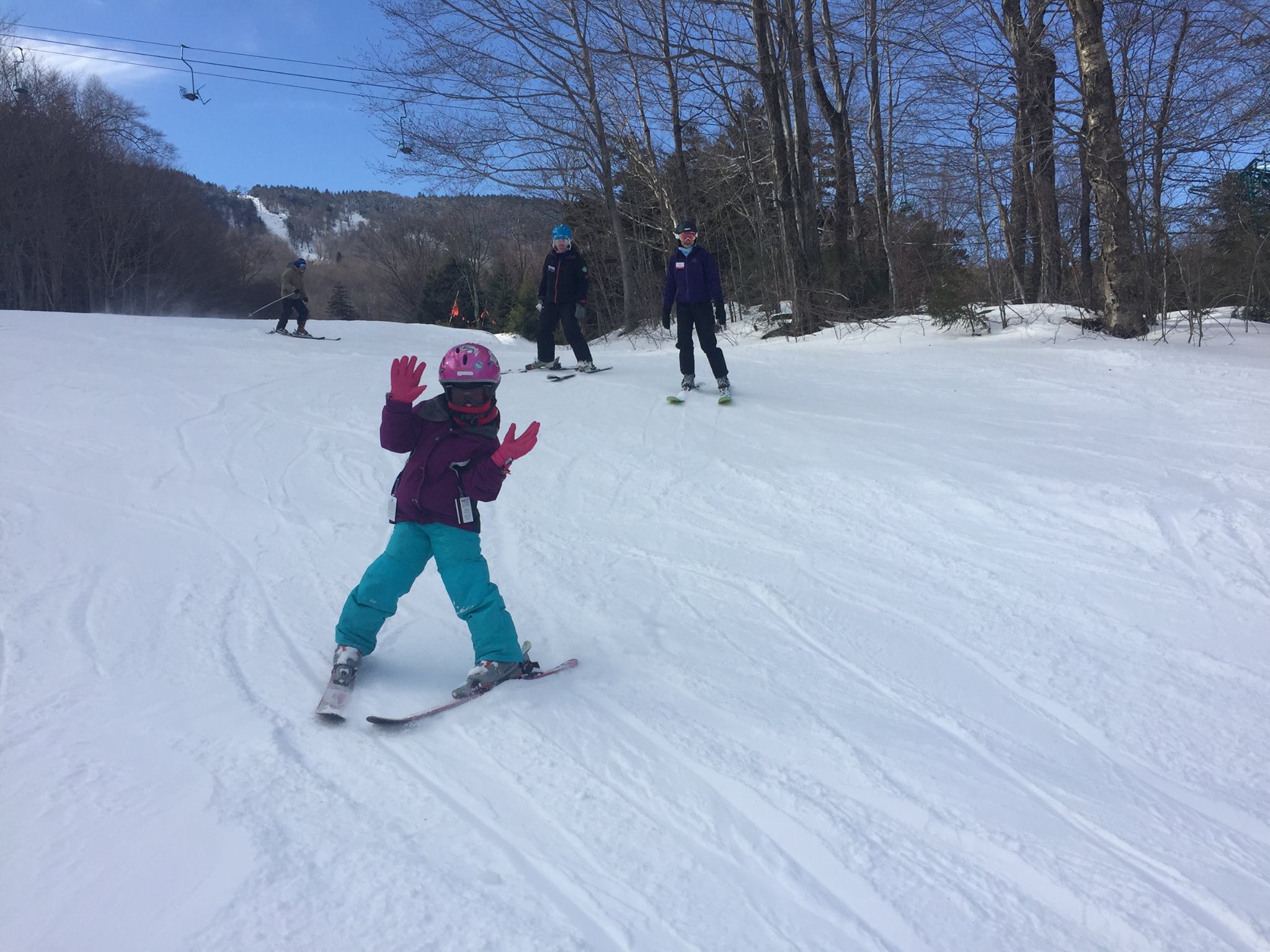
Check out their report from today:
“Today’s balmy and wet conditions rendered us some surprisingly decent, soft turns up on the hill today. Despite some morning rain the “snow pack” is miraculously hanging in there but it is getting increasingly thin. On Tuesday for Town Meeting Day (all kids ski free – BTW) we PLAN on enjoying skiing on nearly all of our legendary main mountain trails serviced by 3 of our 5 lifts. That being said temperatures are supposed to plummet overnight and that may leave us in a precarious position in terms of being able to open up the main mountain on Tuesday. We certainly feel like we will be able to keep the Practice Slope lift running for the race scheduled. The issue right now is that if skiing surfaces do “solidify” with colder temps then we will need to do some grooming and the fact of the matter is that we are running out of snow for the cats to work with. We strongly encourage you to check for updates in the morning to see what we will be able to have open for skiing. Want to see how it looks right now on General Stark Mountain? ” – Mad River Glen, VT today
WINTER WEATHER ADVISORY for VERMONT:
URGENT - WINTER WEATHER MESSAGE
NATIONAL WEATHER SERVICE BURLINGTON VT
308 PM EST MON FEB 29 2016
EASTERN ESSEX-GRAND ISLE-WESTERN FRANKLIN-ORLEANS-ESSEX-
WESTERN CHITTENDEN-LAMOILLE-CALEDONIA-WASHINGTON-WESTERN ADDISON-
ORANGE-WESTERN RUTLAND-WINDSOR-EASTERN FRANKLIN-
EASTERN CHITTENDEN-EASTERN ADDISON-EASTERN RUTLAND-
INCLUDING THE CITIES OF...PORT HENRY...TICONDEROGA...ALBURGH...
SOUTH HERO...ST. ALBANS...NEWPORT...ISLAND POND...BURLINGTON...
JOHNSON...STOWE...ST. JOHNSBURY...MONTPELIER...MIDDLEBURY...
VERGENNES...BRADFORD...RANDOLPH...RUTLAND...SPRINGFIELD...
WHITE RIVER JUNCTION...ENOSBURG FALLS...RICHFORD...UNDERHILL...
BRISTOL...RIPTON...EAST WALLINGFORD...KILLINGTON
...WINTER WEATHER ADVISORY IN EFFECT FROM 1 AM WEDNESDAY TO 1 AM
EST THURSDAY...
THE NATIONAL WEATHER SERVICE IN BURLINGTON HAS ISSUED A WINTER
WEATHER ADVISORY FOR WINTRY MIXED PRECIPITATION...WHICH IS IN
EFFECT FROM 1 AM WEDNESDAY TO 1 AM EST THURSDAY.
* LOCATIONS...ALL OF NORTHERN...CENTRAL AND SOUTH CENTRAL
VERMONT...AND THE SOUTHERN CHAMPLAIN VALLEY OF NEW YORK.
* HAZARD TYPES...SNOW...SLEET...AND FREEZING RAIN.
* ACCUMULATIONS...SNOW ACCUMULATION OF 3 TO 6 INCHES OF HEAVY
DENSE SNOW...ALONG WITH SLEET AND UP TO A TENTH OF AN INCH OF
ICE.
* MAXIMUM SNOWFALL RATE...UP TO 1 INCH PER HOUR...MAINLY EARLY
WEDNESDAY MORNING.
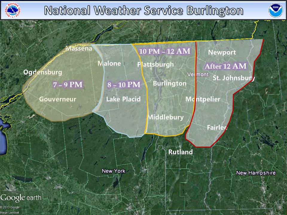
* TIMING...SNOW WILL SPREAD ACROSS THE REGION TUESDAY EVENING AND
TRANSITION TO A WINTRY MIX OF SNOW...SLEET...AND FREEZING RAIN
EARLY WEDNESDAY. SOME AREAS MAY ALSO SEE RAIN MIX IN BEFORE
TRANSITIONING BACK TO SNOW DURING THE DAY WEDNESDAY. SNOW
SHOWERS WILL TAPER OFF WEDNESDAY EVENING.
* IMPACTS...HAZARDOUS TRAVEL CONDITIONS WILL RESULT FROM ICY AND
SLIPPERY ROAD SURFACES DUE TO MODERATE TO HEAVY SNOWFALL AND
WINTRY MIXED PRECIPITATION.
* WINDS...WEST 5 TO 15 MPH WITH GUSTS UP TO 30 MPH.
* TEMPERATURES...LOWS 1 BELOW TO 25 ABOVE ZERO. HIGHS IN THE MID
30S.
* VISIBILITIES...DOWN TO LESS THAN ONE MILE AT TIMES.