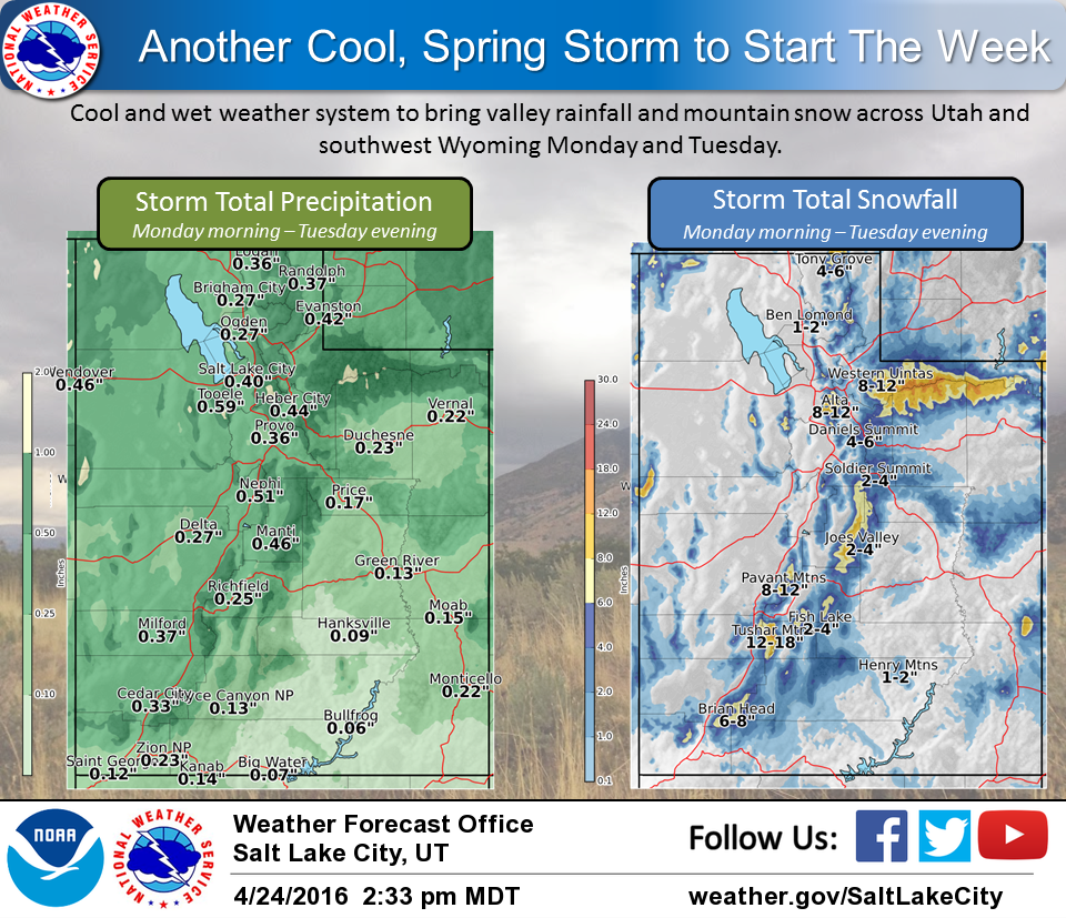
NOAA has isseud a Hazardous Weather Outlook for Utah and they’re calling for 8-12″ of snow Monday and Tuesday for Snowbird ski resort.
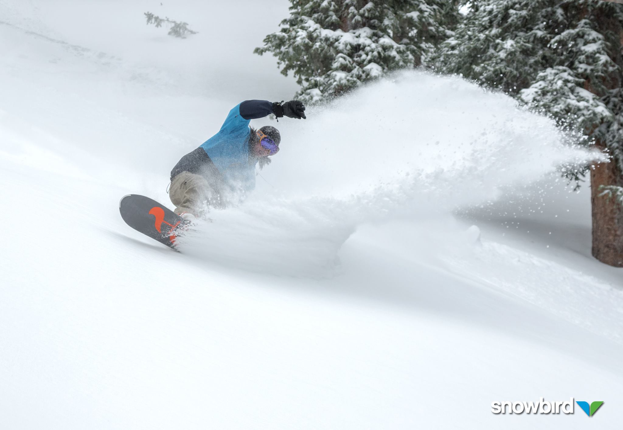
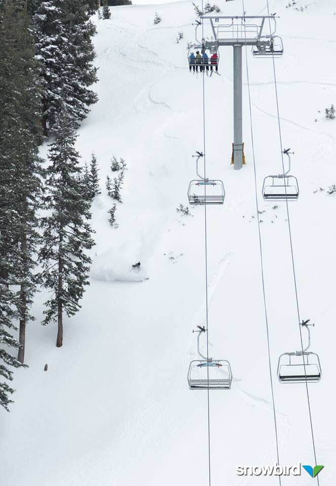
Snowbird is the only ski resort left open in Utah and they just saw 13″ of new snow in the past 48 hours.
“While we see some rest today from the rain, expecting another cool, wet spring system to move through and bring more valley rain and mountain snow Monday through Tuesday evening. I’m sure our yards and plants can use the moisture!” – NOAA SLC, UT today
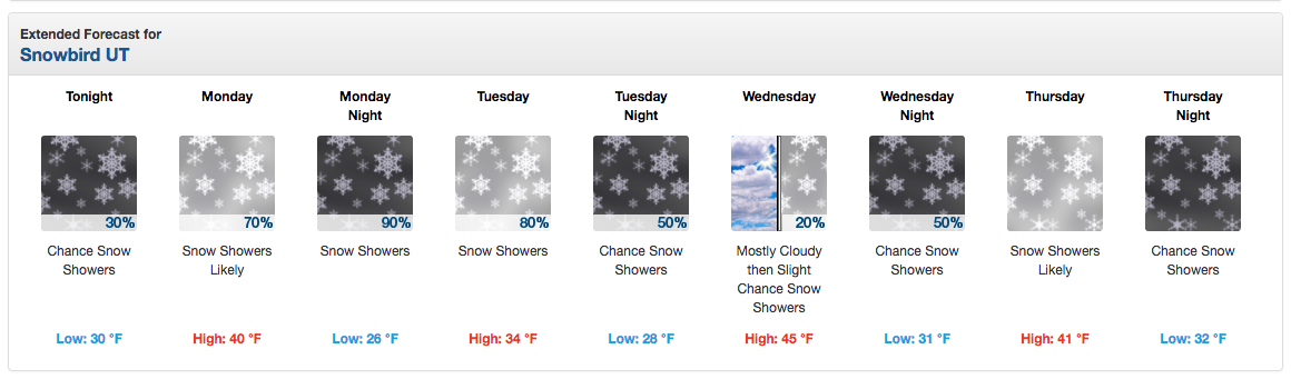
NOAA is calling for storms all week in Utah through the entire week:
YET ANOTHER STORM SYSTEM WILL IMPACT THE AREA TOWARDS THE END OF
THE WEEK. - NOAA SLC, UT today
As of right now, Snowbird is the only ski resort open in Utah. Snowbird’s scheduled closing day is May 30th.
HAZARDOUS WEATHER OUTLOOK:
HAZARDOUS WEATHER OUTLOOK
NATIONAL WEATHER SERVICE SALT LAKE CITY UT
336 PM MDT SUN APR 24 2016

CACHE VALLEY/UTAH PORTION-NORTHERN WASATCH FRONT-
SALT LAKE AND TOOELE VALLEYS-SOUTHERN WASATCH FRONT-
GREAT SALT LAKE DESERT AND MOUNTAINS-WASATCH MOUNTAIN VALLEYS-
WASATCH MOUNTAINS I-80 NORTH-WASATCH MOUNTAINS SOUTH OF I-80-
WESTERN UINTA MOUNTAINS-WASATCH PLATEAU/BOOK CLIFFS-
WESTERN UINTA BASIN-CASTLE COUNTRY-SAN RAFAEL SWELL-
SANPETE/SEVIER VALLEYS-WEST CENTRAL UTAH-SOUTHWEST UTAH-
UTAHS DIXIE AND ZION NATIONAL PARK-SOUTH CENTRAL UTAH-
GLEN CANYON RECREATION AREA/LAKE POWELL-CENTRAL MOUNTAINS-
SOUTHERN MOUNTAINS-SOUTHWEST WYOMING-

THIS HAZARDOUS WEATHER OUTLOOK IS FOR PORTIONS OF CENTRAL UTAH...
NORTHERN UTAH...SOUTHERN UTAH AND SOUTHWEST WYOMING.

.DAY ONE...THIS AFTERNOON AND TONIGHT

MOISTURE WILL INCREASE TONIGHT WITH A SMALL CHANCE FOR VALLEY RAIN
AND MOUNTAIN SNOW SHOWERS.

.DAYS TWO THROUGH SEVEN...MONDAY THROUGH SATURDAY

A COOL PACIFIC STORM SYSTEM WILL SPREAD VALLEY RAIN AND MOUNTAIN
SNOW ACROSS THE OUTLOOK AREA MONDAY THROUGH MONDAY NIGHT BEFORE
TAPERING OFF TUESDAY. ACCUMULATING SNOW IS EXPECTED ACROSS THE
HIGHER TERRAIN OF NORTHERN AND CENTRAL UTAH. SNOW COULD MIX IN
WITH THE RAIN AT TIMES IN THE WESTERN VALLEYS LATE MONDAY NIGHT
AND EARLY TUESDAY. ANY ACCUMULATION WILL BE MINIMAL AT BEST AND
NOT ON PAVEMENT SURFACES.

YET ANOTHER STORM SYSTEM WILL IMPACT THE AREA TOWARDS THE END OF
THE WEEK.
One thought on “NOAA: 8-12″ of Snow for Snowbird, UT Monday/Tuesday”