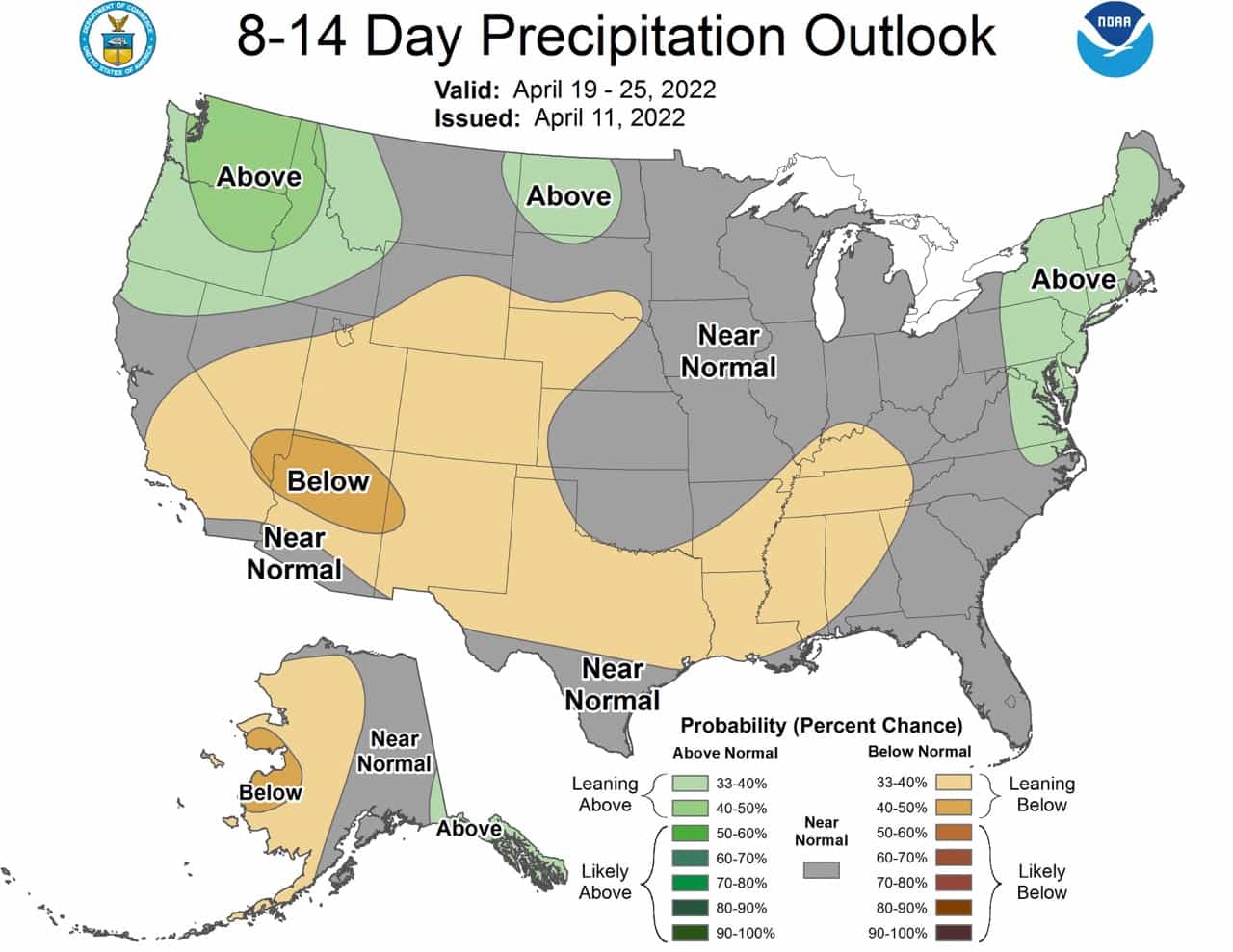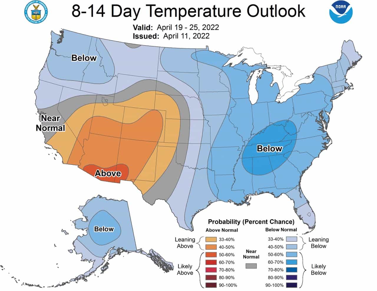
The NOAA yesterday released its 8-14 day outlook for the second half of April. Many ski resorts will be already closed, or closing soon, but if you’re still chasing powder it looks like the PNW is the place to be. Or even the northeast. Expect colder and wetter conditions there than normal. The majority of the CONUS will see average to below-average precipitation.
Full discussion from the NOAA below:
Near to above normal temperatures are likely for much of the southwestern CONUS and parts of the central and southern High Plains. Below normal temperatures are favored over most of the remainder of the CONUS, associated with troughs over the Pacific Northwest and the eastern CONUS, and consistent with dynamical forecast tools. Elevated probabilities of below normal temperatures are forecast for Alaska, supported by the dynamical model temperature tools.
Above normal precipitation is favored for parts of the northeastern CONUS, due to a predicted trough over the eastern CONUS. Near to below-normal precipitation is favored over much of the southwestern CONUS extending eastward into parts of the central High Plains, Southern Plains, Lower Mississippi Valley and Tennessee Valley, consistent with the precipitation dynamical model tools. Above normal precipitation is favored across southeastern Mainland Alaska and the Alaska Panhandle, while near to below normal precipitation is likely for the remainder of Alaska, supported by the precipitation dynamical forecast tools.