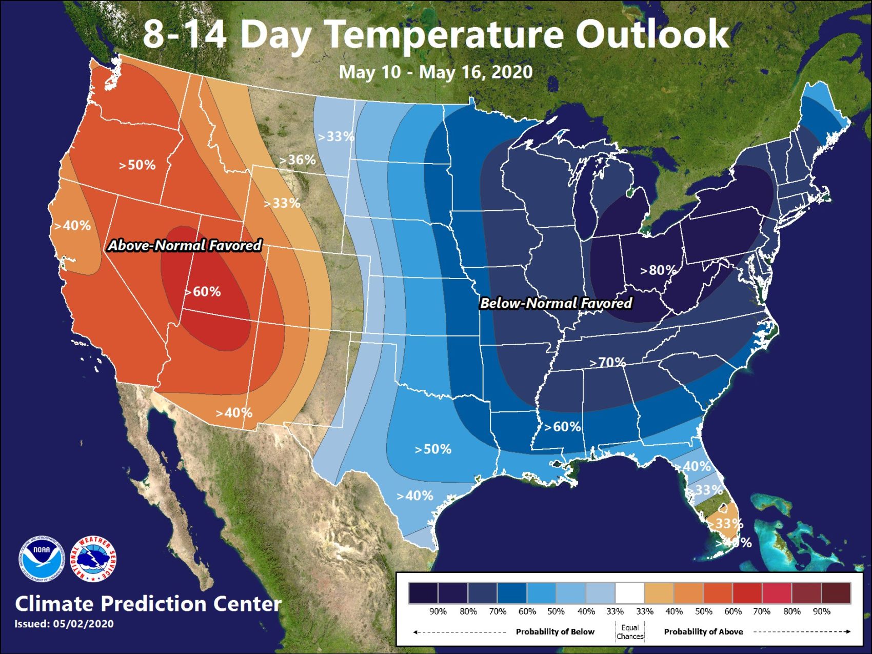
The NOAA released its outlook for mid-May over the weekend. Looks like most of the west can expect above-normal temperatures to continue, while the north-east can look forward to cooler temperatures.
- Related: Summer 2020 Weather Outlook
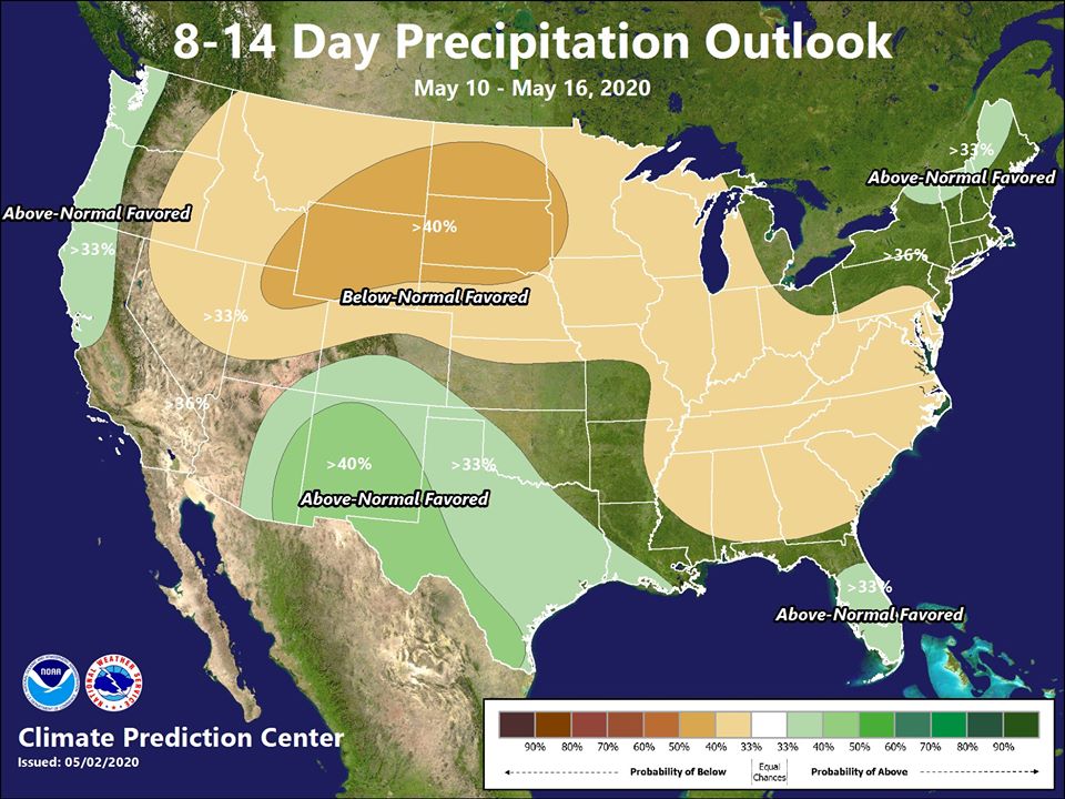
In terms of precipitation, as well as being warm, the west-coast will also be wetter than normal. The northeast can also expect a wet pattern too. The majority of the country can expect below-normal precipitation.
Here’s the full NOAA discussion below:
8-14 DAY OUTLOOK FOR MAY 12 - 18 2020

During the 8-14 day period, models continue to be in general agreement on the
prediction of moderately amplified mean flow pattern at high latitudes. Mean
troughs are favored for the Aleutians and northeastern North America, while a
mean ridge is expected over western Canada and Alaska. Predicted 500-hPa height
anomalies are weak over most of the CONUS outside of the northeastern CONUS.
The ECMWF ensemble mean was weighted most in the manual blend of 500-hPa height
forecasts, due to recent model skill.

Probabilities of above normal temperatures are enhanced for most of the western
CONUS, the Southern Plains, and the southern Florida Peninsula, under weak
positive or negative 500-hPa height anomalies, supported by the operational
Autoblend and ERF Consolidation tools. Probabilities of below normal
temperatures are elevated over the northeastern CONUS, and parts of the
Northern Plains and Central Plains, under the predicted trough. Near normal
temperatures are favored for parts of the Lower Mississippi Valley, and the
Southeast, where calibrated temperature forecasts from the GEFS and ECMWF
ensembles disagree. Above normal temperatures are likely for Alaska, under
anomalous southerly flow and positive 500-hPa height anomalies.

Above normal precipitation is likely for much of the West Coast of the CONUS
due to the enhanced Pacific flow. Return flow favors a wet pattern for much of
the Southern Plains and east-central CONUS. Increased chances of below normal
precipitation are likely over North Dakota, parts of northwestern Minnesota,
southeastern Nevada, southwestern Utah, and northwestern Arizona, consistent
with the GEFS and ECMWF reforecast tools. Near to below normal precipitation is
favored for Alaska due to anomalous ridging across much of the Alaska Mainland.

The official 8-14 day 500-hPa height blend consists of: 30% of Today's 6z GFS
Ensemble Mean centered on Day 11, 50% of Today's 0z European Ensemble Mean
centered on Day 11, and 20% of Today's 0z Canadian Ensemble Mean centered on
Day 11
FORECAST CONFIDENCE FOR THE 8-14 DAY PERIOD: About average, 3 out of 5, due to
fair agreement among model circulation forecasts, offset by some disagreement
among surface tools and increasing ensemble spread.